Where can you see the NYC skyline on a budget?

NEW YORK (PIX11) – The weather is finally getting nicer in New York City, which means you may be more motivated to go outside and take in the views.
One of the most popular views in New York City, arguably, is of the skyline. And you’re in luck: There are many places around the Big Apple where you can see the skyline — either for free or cheap.
Solar Eclipse Express to take people from NYC to Niagara Falls
Here are some places you can view the NYC skyline without emptying your pockets:
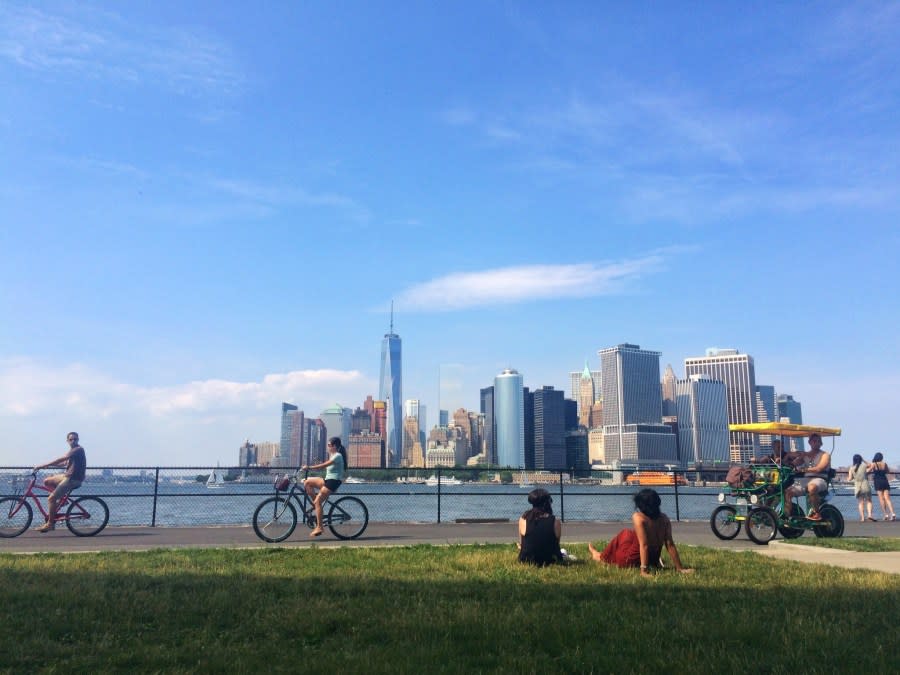
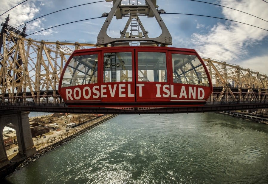
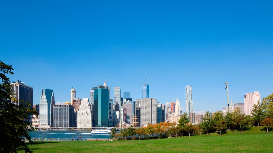
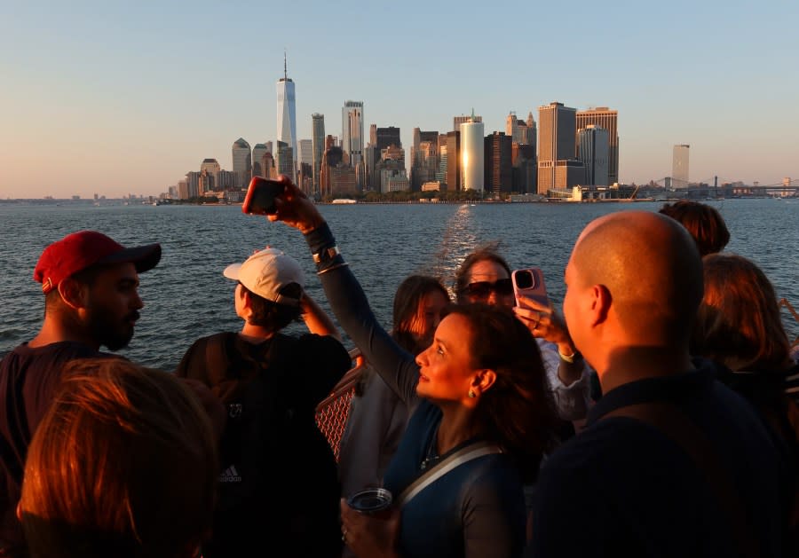
A couple takes a photograph on the Brooklyn Bridge, December 1, 2017 in New York City. (Photo by Drew Angerer/Getty Images) A landscape view of the Manhattan Bridge and downtown skyline from the East River, May 18, 2023 in New York City, New York. (Photo by Andrew Lichtenstein/Corbis via Getty Images) People walking on the High Line in Manhattan. (Photo by: Sergi Reboredo/VW Pics/Universal Images Group via Getty Images) People enjoying a summer day on Governors Island looking out at the Manhattan skyline. (Credit: Stacey Bramhall / Getty Images) A Roosevelt Island Tram goes past the Queensboro Bridge in Manhattan, New York, USA. (Credit: Chris J Ratcliffe / Getty Images) The view of the Lower Manhattan skyline and East River seen from Brooklyn Bridge Park. (Photo by: Eye Ubiquitous/Universal Images Group via Getty Images) People lay on lounge chairs at Domino Park in the Brooklyn Borough of New York, U.S., on Friday, May 15, 2020. (Credit: Nina Westervelt/Bloomberg via Getty Images) People gather at the Marsha P. Johnson State Park on the Williamsburg East River waterfront on September 04, 2021 in the Brooklyn borough of New York City. (Photo by John Lamparski/Getty Images) A view of Manhattan from the Brooklyn Heights Promenade in Brooklyn, NY on the 19th of April, 2016. (Credit: Alessandro Vecchi/picture alliance via Getty Images) People walk at Gantry Plaza State Park in Queens, New York, on July 19, 2022, as a heat wave continues in Europe and North America. (Photo by YUKI IWAMURA/AFP via Getty Images) A general view of the Queensboro Bridge during the Salute to Hip Hop featuring N.O.R.E and Funkmaster Flex at the Queensbridge Park on July 21, 2011 in the Queens borough of New York City. (Photo by Dario Cantatore/Getty Images) People ride the Staten Island Ferry as the sun sets on August 19, 2023, in New York City. (Photo by Gary Hershorn/Getty Images)
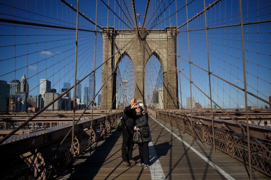


Brooklyn, Manhattan Bridges
The Brooklyn Bridge was the first bridge to connect Manhattan and Brooklyn across the East River after it was completed in 1883, according to New York City officials. You can use the Brooklyn Bridge pedestrian walkway, located at the intersection of Tillary Street and Boerum Place, or the staircase at the underpass on Washington Street and Prospect Street to access it.
The Manhattan Bridge, the youngest of three Department of Transportation East River suspension bridges, was completed in 1909, according to New York City officials. Around 2,700 pedestrians and 6,200 cyclists travel on the bridge each day. The entrance for the pedestrian walkway is located at Bowery between Canal and Bayard streets in Lower Manhattan, according to NYC Tourism + Conventions.
The High Line
The High Line was once an abandoned elevated rail line, according to NYC Tourism + Conventions. It reopened as a park in 2009. The walkway runs from Gansevoort Street all the way to West 30th Street.
Governors Island
Governors Island, a former military outpost, is a 7-minute ferry ride from Manhattan. It features plenty of outdoor space and is used as a venue for concerts, art installations and more. Tickets to ride the ferry cost $4 a person, but there are exceptions for certain people that will allow them to ride for free.
Roosevelt Island Tramway
The Roosevelt Island Tramway first opened in 1976, according to NYC Tourism + Conventions. It takes riders from Manhattan to the island every 7 to 15 minutes. You can get on the tramway on Second Avenue between 59th and 60th streets. The cost of riding the tramway is $2.75 each way. Riders can also tap and pay with OMNY.
Brooklyn Bridge Park
Brooklyn Bridge Park is right under the Brooklyn Bridge in the neighborhood of DUMBO, making it a perfect photo spot for the skyline. It’s located off of Furman Street on Bridge Park Drive.
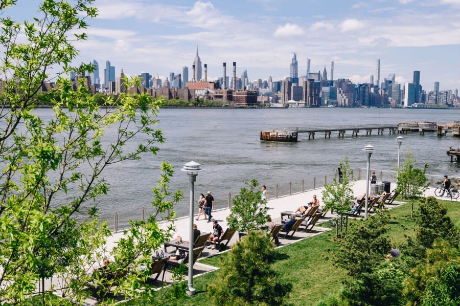
Domino Park
Domino Park, located in Williamsburg, is part of the redevelopment of the Domino Sugar Refinery site, according to NYC Tourism + Conventions. It can be found off River Street.
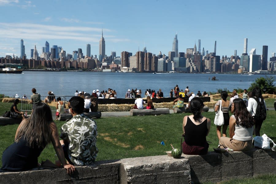
Marsha P. Johnson State Park
Marsha P. Johnson State Park, also known as East River State Park, is also located in Williamsburg — off Kent Avenue.
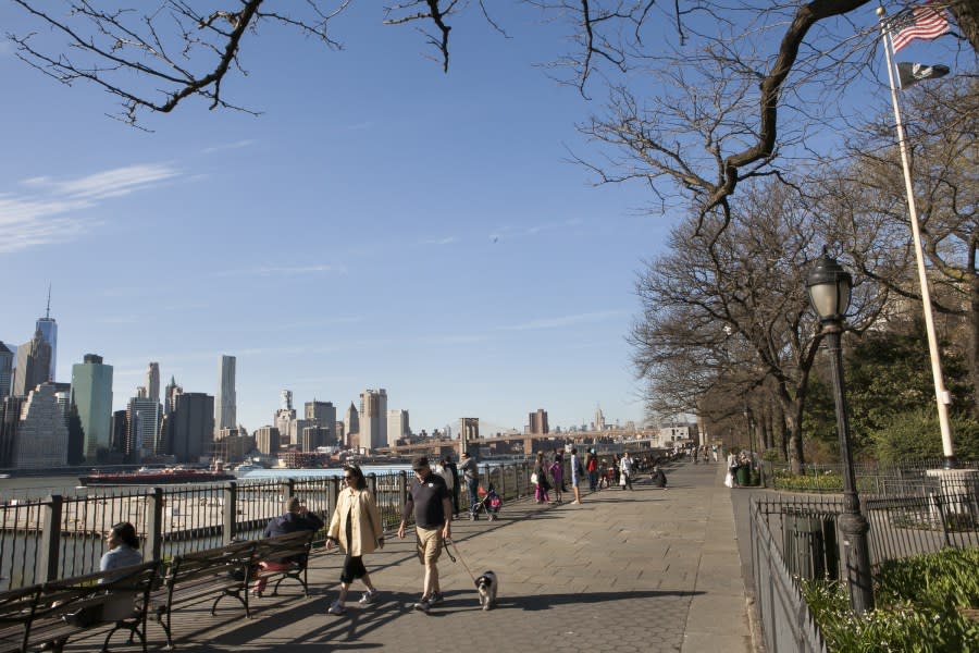
Brooklyn Heights Promenade
Located off the Brooklyn-Queens Expressway in Brooklyn Heights sits the Brooklyn Heights Promenade, a pedestrian walkway with views of not just the skyline – but of townhouses and mansions in the area, according to NYC Tourism + Conventions.
Gantry Plaza State Park
Gantry State Park in Long Island City was once an abandoned industrial waterfront, according to NYC Tourism + Conventions. It’s the location of a great backdrop – a large black sign with lettering that reads “LONG ISLAND.” It can be found off of 47th Road.
Queensbridge Park
Queensbridge Park, also located in Long Island City, is right next to the Ed Koch Queensboro Bridge. You can get a view of not just the skyline, but of Roosevelt Island. It can be found in the area of Vernon Boulevard and 41st Avenue.
Staten Island Ferry
Almost 70,000 people daily ride the State Island Ferry from the neighborhood of St. George to Manhattan. It’s free to ride and runs every 15 to 20 minutes during rush hour. On weekends, the ferry runs every half hour.
Erin Pflaumer is a digital content producer from Long Island who has covered both local and national news since 2018. She joined PIX11 in 2023. See more of her work here.
For the latest news, weather, sports, and streaming video, head to PIX11.

