Where is the Delaware River deepest? New map poster shows 113-foot answer
Where is the deepest part of the 330-mile Delaware River? Where it is also widest, where the river meets the Delaware Bay? Try Narrowsburg, New York. A new map has been published showing the mysterious contours of what is called the “Big Eddy Narrows.”
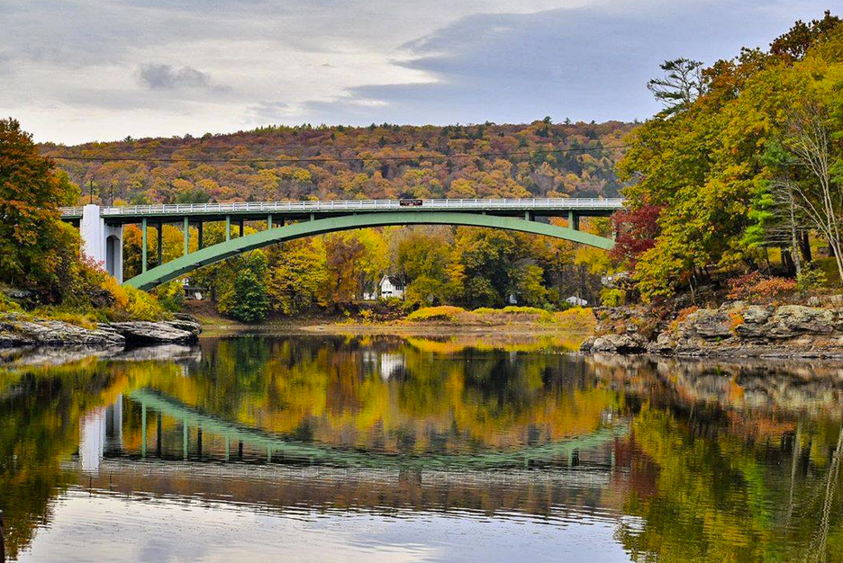
The river, the longest free-flowing river east of the Mississippi, is 113 feet deep at River Mile 290, counting from Delaware Bay, and visible from the bridge connecting Pennsylvania and New York.
The Delaware River’s average depth is only four to five feet, although holes of 12 to 18 feet are not unusual.
A diver with a local search and rescue team said no light penetrates the bottom at all.
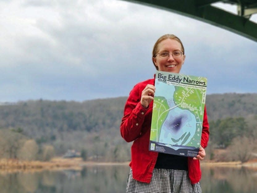
Made a map poster
The map is available as an 11-by-17-inch poster that its creator has donated to benefit the non-profit Upper Delaware Council (UDC), announced UDC Executive Director Laurie Ramie.
The map was developed by Lisa Glover of Honesdale, who became enthralled with this unique, local claim to fame of the Delaware River and contacted the UDC.
Although one might muse that the hamlet of Narrowsburg should have been named Deepestburg, its name is derived from its other distinction of being the main stem’s narrowest part. The river courses through a rock canyon before the bridge, where it is only 200 feet wide.
Where to see it
The Big Eddy Observation Deck on Main Street in Narrowsburg has an interpretative sign telling these distinctive topographic features. Here the public also finds a good place to watch for bald eagles as rowboats, canoes, kayaks, and rafts go by.
Perhaps very few people paddling by or on shore looking at this scenic part of the river are aware of the fantastic underwater depth.
This very deep part of the Delaware also is easily seen from the Darbytown Access on the Pennsylvania side.
The interpretative sign at the deck offers two theories of how the 113-foot hole was created. The first is that a long-drowned "plunge pool" was created from a glacial waterfall. The other theory is that a pothole was formed by tumbling rocks scoured out through erosion.
A whirlpool is often visible at the Big Eddy, where the deepest point is located just downstream from the narrows.
Log rafts spun like tops
The deeps at Narrowsburg have been known for a very long time, impacting 19th century log rafters. The Wayne County Herald's Feb. 20, 1873, edition reported that J.I. Appleby and J.E. Miller, of Narrowsburg, out of curiosity took soundings of the river from a boat. They concluded the river was 101 feet. "Rafts in coming down the Delaware are frequently drawn into this eddy and sometimes detained for days," the article reads. "Whenever the wind is blowing with any force, rafts are sure to be drawn into this eddy where they have to remain until the wind calms."
The Herald republished an unattributed column from The Middletown Mercury on Jan. 20, 1881, stating that log rafts caught in the Big Eddy "may spin around like a top for an hour." Rafts so caught could create a river traffic jam of a hundred rafts. "I have seen 500 rafts in here at one time, some of them on top of each other, and some turned up on edge, and others bottom side up," the columnist penned.
Extensive research
The UDC press release states that Glover read articles from the UDC’s “The Upper Delaware” newsletter which led her to interviews with National Park Service divers who had measured the hole. Glover also found various illustrations.
She spoke of her desire for an accurately detailed map of the river bottom with the hope of potentially solving the mystery. Although topographic maps exist showing the elevation of landforms above “sea level,” bathymetric maps show depths of landforms below water.
Glover, in her research, discovered that the U.S. Geological Survey (USGS) had published a LiDAR scan of the Delaware River in 2020 and reached research scientist John Young, who provided a digital map focused on the Big Eddy section, the press release states.
Obtaining a map
From her research, Glover designed a topobathymetric color map with 10-foot contour lines and to-scale cross sections of The Narrows and The Deeps, printed 50 copies, and offered a stack to the UDC to share with the public as a fundraiser.
The Big Eddy Narrows poster is available for a $20 donation to the UDC.
Contact Administrative Support Stephanie Driscoll at stephanie@upperdelawarecouncil.org or 845-252-3022, or stop by the UDC’s office at 211 Bridge St. in Narrowsburg (next to the firehouse) on weekdays for pick-up.
Payment must be by check or cash. Add $3 for mail orders.
Glover is affiliated with Highlights for Children, the Stourbridge Project, the Wayne County Arts Alliance and the Center on Rural Innovation, for which she is their Placemaking Fellow.
She holds a bachelor's degree in architecture and a master of engineering degree from Lehigh University and likes to use a paddle board. Her website is lisathemaker.com.
Peter Becker has worked at the Tri-County Independent or its predecessor publications since 1994. Reach him at pbecker@tricountyindependent.com or 570-253-3055 ext. 1588.
This article originally appeared on Tri-County Independent: New map depicts Delaware River’s deepest point at Narrowsburg, NY

