In Warren, a dam comes down to restore a river. How that helps wildlife and reduces flooding
WARREN – And just like that, the lower dam on the Kickemuit River was gone.
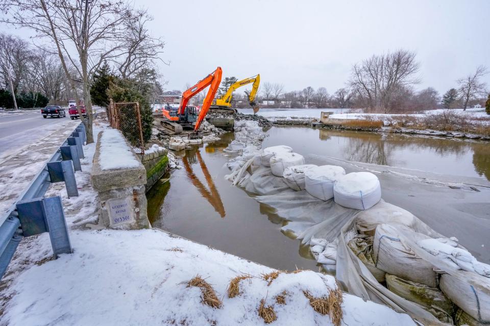
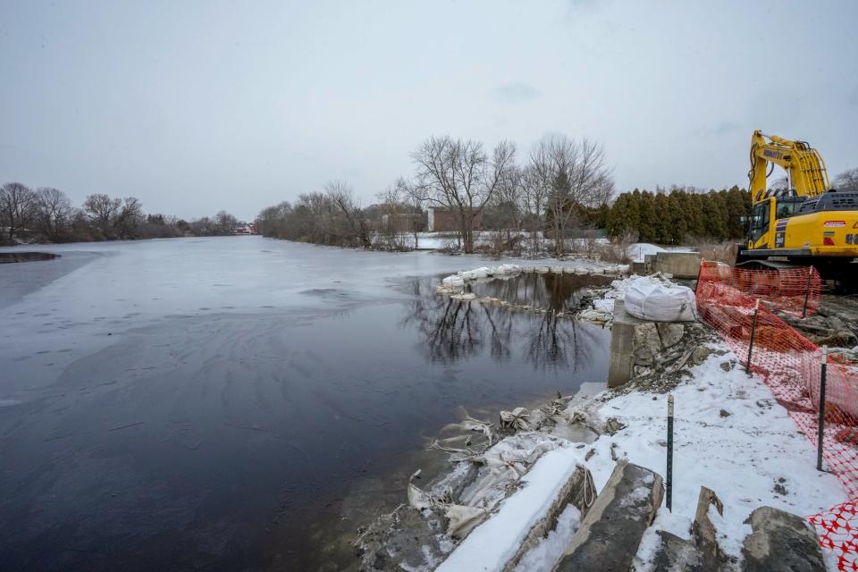
After years of planning and months of staging, the 250-foot-wide dam near Child Street went down in just a few days, marking the biggest step yet in the restoration of the 8-mile-long river that runs from headwaters in Rehoboth, Massachusetts, to Mount Hope Bay in Bristol.
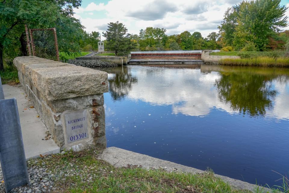
The concrete barrier had stood across the Kickemuit since 1883, when it was built to create a reservoir for the storage of drinking water for residents of Warren, Bristol and, later, Barrington.
Bristol County residents have long since ended their reliance on the murky waters held behind the lower dam and a second barricade, built higher up the river, close to the Massachusetts state line, after Hurricane Carol in 1954.
The dams had become a maintenance burden for the Bristol County Water Authority, which since 1998 has been getting its water from the Scituate Reservoir and is hooking up to the Pawtucket system for backup supplies. State authorities found the dams to be critically vulnerable to flooding and other impacts of climate change.
So, with guidance from Save The Bay and support from a slew of federal and state agencies, an effort began nearly a decade ago to raze the dams and bring the river back to its natural state.
Restoration is part of a statewide program
Removing the dams will mean a narrower river channel flanked by mudflats and marshes, cleaner waters, and, hopefully, more wildlife.
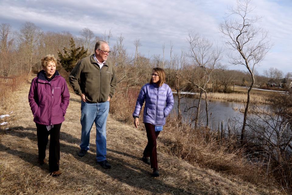
“We’re restoring the Kickemuit to the tidal system it historically was,” said Wenley Ferguson, director of habitat restoration for Save The Bay.
The work comes amid a larger campaign to tear down some of the hundreds of dams that were built across Rhode Island’s rivers to power mills and store water. Many no longer serve any purpose and have fallen into disrepair, so in places like the Wood-Pawcatuck River and the Ten Mile River, they’re being demolished to create spawning habitat for fish and improve the natural flow of water.
On the Kickemuit, the earthen embankment that makes up the upper dam was breached first, but only a portion was taken out. Work was suspended over the winter so as not to disturb turtles and amphibians that hibernate around it. The rest of the berm won’t be removed until the spring.
Flooding delayed removal of the lower dam
The lower dam took more time.
It historically marked the dividing line between the Kickemuit’s saltwater and freshwater portions, but the barrier was overtopped time and again by storm surges and higher-than-normal tides exacerbated by rising sea levels. The waters were so brackish that the upper river was full of blue crabs.
This flooding was part of the reason it took longer than expected to demolish the dam. A crew with Taunton, Massachusetts-based Luciano’s Excavation started prep work in the river in late October.
First they removed 12,000 cubic yards of riverbed sediments contaminated with copper sulfate, a compound used to kill algae that clogged the stagnant waters above the dam. The plan was to take out the barrier itself by mid-December.
But in order to get their equipment on site, the workers had to de-water the channel. That proved to be a challenge. First, there were the incoming tidal waters that were so high they poured over the super-sacks of sand piled up to block off the dam.
“It was like a waterfall,” Ferguson said.
And then there was the series of heavy downpours over the last month that brought runoff washing in from the watershed above the dam.
It wasn’t until early last week that the water had drained enough that an excavator could start tearing into the structure. By Friday, not much of the dam was left.
The project also aims to reduce flooding
All told, it cost about $5 million to take out the dams. The work was funded by the state Department of Environmental Management, the National Fish and Wildlife Foundation, the U.S. Environmental Protection Agency, Restore America’s Estuaries and others.
Climate change was one factor in the efforts. The infrastructure along the Kickemuit was seen as vulnerable to extreme storms and surges. By removing the structures, the Water Authority is opening up more areas to hold floodwaters.
Engineering studies project that demolishing the two dams would reduce the frequency of flooding above the lower dam. While flooding could go up slightly in places in some scenarios, it would go down during a 100-year storm, the baseline event used to measure flood risk.
“This is a poster-child climate-resilience project,” said Stephen Coutu, executive director of the water authority.
While some neighbors objected to the dam removals, raising concerns that saltwater could contaminate their wells, studies commissioned by the water authority found that wells wouldn't be affected.
![The Kickemuit River, dotted with sailboats, flows south and empties into Mount Hope Bay. [John Kostrzewa/Special to the Providence Journal, file]](https://s.yimg.com/ny/api/res/1.2/nsCsiRGaF0ae9jbiknIkVA--/YXBwaWQ9aGlnaGxhbmRlcjt3PTk2MDtoPTcyMA--/https://media.zenfs.com/en/the-providence-journal/3207191899d1c5c42149f876c63483d1)
Potential habitat for oysters and diamondback terrapins
What the river will look like over time is still a bit of a mystery. Ferguson expects marsh grasses and other plants to grow along the riverbanks and fill in the area around the channel.
As for the waters in the river, they will undoubtedly be healthier than in the past, when they were plagued by high nutrient levels that fueled algae growth and low oxygen levels.
It’s unlikely river herring will spawn in the Kickemuit, but its waters could become habitat for wild oysters, diamondback terrapins and all sorts of shorebirds, according to backers of the project.
“When you restore that true estuarine geography, you’re supporting all these species that could make it home,” said Thomas Ardito, director of the Southeast New England Watershed Grants Program at Restore America’s Estuaries.
This article originally appeared on The Providence Journal: Kickemuit River dams taken out to restore river, reduce flooding

