Utah snow came in like a lion this March

All of Utah’s watershed basins are in the triple digits, which means there is above average water up in the mountains that supplies not only thirsty Wasatch Front residents but much of the state.
A strong Pacific storm clobbered California’s Sierra mountains which haunted the region over the weekend with 190 mph winds at high mountain peaks, more than 10 feet of snow, blizzard conditions, road closures and too many traffic pileups to count, according to CBS News.
In a cruel paradox, the high winds coupled with the intense amount of snow caused ski resorts at Lake Tahoe and elsewhere to close their operations.
In other portions of the West, including Utah, the wrath of the storm had some similar results, with ski resort closures, blizzard conditions, high winds and low visibility contributing to some operational disruptions at the Salt Lake International Airport, road closures and white-knuckle driving for those travelers who didn’t hunker down at home.
Although not nearly as impactful, the storm lingered into Sunday overnight and into Utah Monday in some portions of the state, and the snowfall coupled with below freezing temperatures created skating rink like conditions for those on the road or even navigating their own terrain.
According to the CDC, about one million people are injured as a result of falls or slips each year and 17,000 of those are fatalities. Ice and snow play a big factor, so as winter continues to pound away, be careful.
The Mayo Clinic put out a list of tips, including walking slowly, knowing the terrain, wearing proper foot gear and to not brace your fall with your hands — due to the risk of more injuries.
All that snow and ice, the associated risks and traffic mayhem all comes with some extremely good news for Utah and its watershed basins. The Weber Basin/Ogden is sitting at 127% of normal for its water content, or snowpack this winter so far, Jordan River-Utah Lake edges them out with 129% of normal, and even southwest Utah is squeaking by at 103%.
Even before the major storm that swept in this weekend, Deer Valley reported it had broke its all time February record for snowfall, logging 125.5 inches.
Today @Deer_Valley reported that they've broken the February snowfall record with 125.5 inches! This is their wettest February on record. 🙌🤩That's great news for our state's water resources. #UtahSnow pic.twitter.com/CqVECoql6B
— Utah Division of Water Resources (@utahwaterres) February 28, 2024
Alta had a big month too, reporting its snowfall for February was the third best in history.
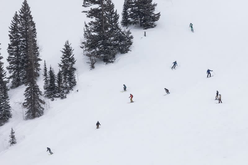
Hayden Mahan of the National Weather Service in Salt Lake City said Monday that the weekend storm was generous in its distribution of both valley and mountain snow, with the exception of southern Utah.
Most mountainous areas received a couple of feet of new snow and the valley locations in many areas reported picking up several inches, including places like Price.
“It was a really interesting storm. In most locations we saw accumulating snow. A lot of times we’ll have these winter storms where certain areas we’ll see quite a bit of snow and then other areas will basically see nothing as they get shadowed by the mountains.”
Mahan said the storm settled over central Utah and stayed there, taking its time. Normally, the storms sweep in and last for awhile, but in central Utah it lingered — showing promising results for an area that has been hard hit by drought.
The storm is part of an unsettled pattern that will continue to dominate Utah over the next week, although not with the drastic repercussions, he added.
“So we are going to see colder than normal temperatures, but nothing like we saw over the weekend,” he said. “So there’s a high probability of seeing snow, but whatever you see is probably going to be a pretty low amount”
Mahan added that the storm dropped high temperatures between 10 and 15 degrees below normal for this time of year, while nightly lows have been five to 10 degrees below normal.
The March tempest is testament to how Utah weather rolls. It’s hard to know what’s next.

