Triangle area will get heavy rain and possible severe storms this week. Here’s the timeline
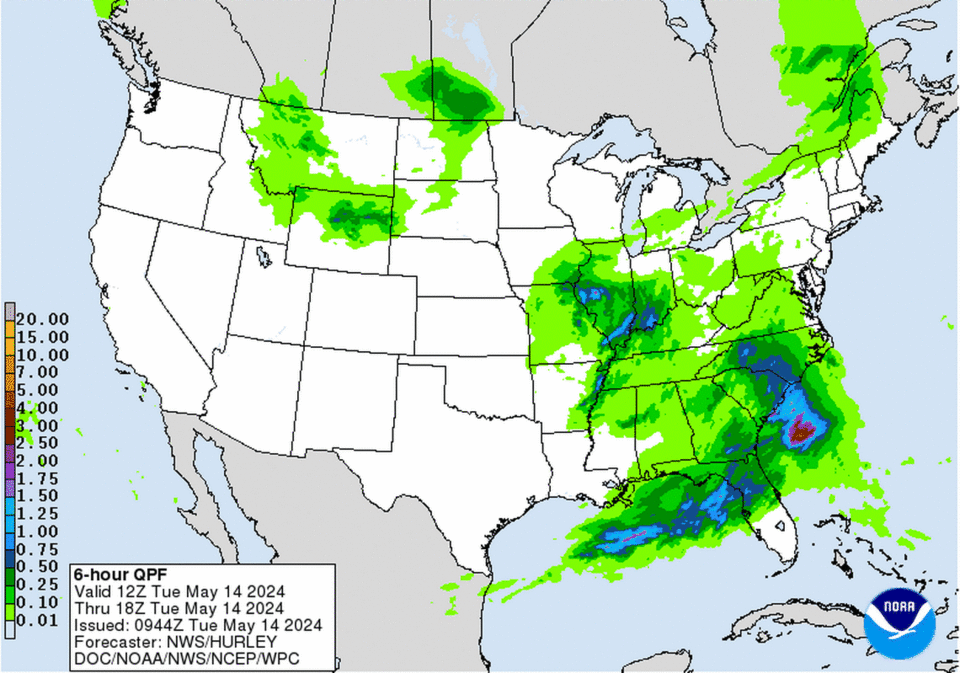
Showers and storms, some of which could be severe, could drop up to an inch of rain in parts of central and southern North Carolina Tuesday and Wednesday, the National Weather Service says.
The greatest risk of severe weather will be Tuesday afternoon and evening and again Wednesday afternoon and evening. Damaging wind and large hail are possible both days, forecasters say.
The Weather Service has issued a hazardous weather alert for Moore, Cumberland, Hoke, Scotland, Stanly, Montgomery, Anson, Richmond and Sampson counties for Tuesday afternoon through Wednesday afternoon.
Most of the state is likely to get at least some rain Tuesday or Wednesday.
What’s the forecast for the Triangle?
Raleigh, Durham and Chapel Hill could see up to three-quarters of an inch of rain during the day Tuesday, with another quarter of an inch possible Tuesday night, forecasters say. Higher amounts are possible where thunderstorms occur.
Winds across the area will be from 8 mph to 15 mph Tuesday with gusts up to 23 mph during the day Tuesday, according to the forecast.
Showers are possible throughout the day Wednesday as well, but rainfall amounts are expected to be lower compared to Tuesday, less than half an inch total except in areas of thunderstorms.
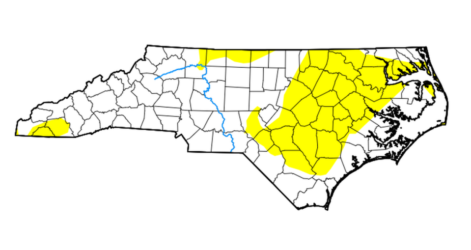
Do we need the rain?
The most recent drought map shows more than 35% of the state is abnormally dry. Most of the counties that need rain will likely get it this week, according to forecasts.
911 caller reports alien spaceship in Durham. ‘Most likely cicadas,’ police say
No drone of cicadas where you live? Here is where Brood XIX is emerging in NC

