Treacherous travel likely as widespread winter storm blankets the Prairies
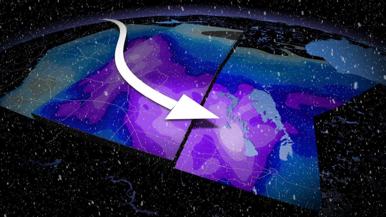
The first weekend of March has been a writeoff for a good chunk of the Prairies as a sprawling, powerful winter storm spreads heavy snow and intense wind gusts across the region.
Widespread winter storm, snowfall and blizzard warnings cover the region as snow and strong winds make their way farther east on Sunday.
MUST SEE: Expect a turbulent March across Canada as the seasons duke it out
People are urged to consider postponing non-essential travel until conditions improve. Road closures have been reported near Kindersley and North Battleford, Sask. As well, the Maidstone to Maymont corridor of the Yellowhead Highway is closed.
The hardest-hit locales are likely to see 40+ cm of snow by the time all is said and done.
Snow and winds intensify and spread east
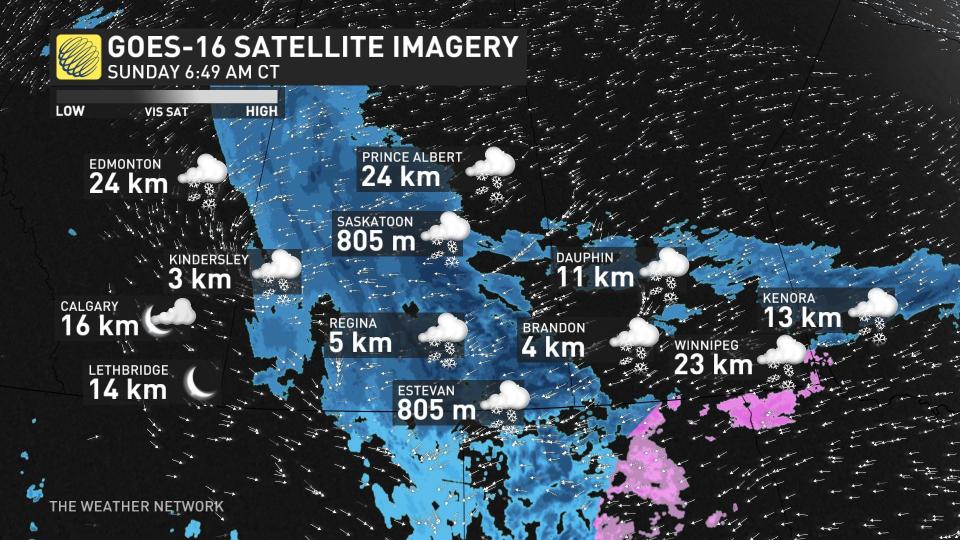
A potent low-pressure system that came to fruition stateside pushed snow into parts of southern Alberta and Saskatchewan through the day Saturday. Heavy snow and gusty winds led to near-blizzard conditions in Saskatoon at times on Saturday afternoon.
Not taking long for conditions to deteriorate here in Western #Saskatchewan #skstorm as the snow moves in pic.twitter.com/Kp7zEeQt7h
Not taking long for conditions to deteriorate here in Western Jenny Hagan LostInSk on Twitter: "Not taking long for conditions to deteriorate here in Western #Saskatchewan #skstorm as the snow moves in pic.twitter.com/Kp7zEeQt7h / Twitter" Jenny Hagan LostInSk on Twitter: "Not taking long for conditions to deteriorate here in Western #Saskatchewan #skstorm as the snow moves in pic.twitter.com/Kp7zEeQt7h / Twitter" as the snow moves in Jenny Hagan LostInSk on Twitter: "Not taking long for conditions to deteriorate here in Western #Saskatchewan #skstorm as the snow moves in pic.twitter.com/Kp7zEeQt7h / Twitter"
— Jenny Hagan LostInSk (@LostInSk) Jenny Hagan LostInSk on Twitter: "Not taking long for conditions to deteriorate here in Western #Saskatchewan #skstorm as the snow moves in pic.twitter.com/Kp7zEeQt7h / Twitter"
Snowfall totals are starting to pour in. As of Sunday morning local time, Calgary, Alta., has documented 18 cm and Kindersley, Sask., has reported 12 cm.
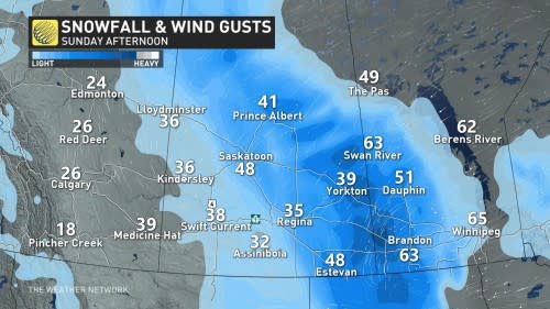
The heaviest and most dangerous band of snow is now centred across Saskatchewan on Sunday, dropping visibility to near zero. By the afternoon, heavy snow pushes across southwestern Manitoba. Meanwhile, the only remaining snow across Alberta is in northeastern sections.
Very heavy snowfall rates of up to 4 cm per hour are possible around southern Saskatchewan and southwestern Manitoba Sunday afternoon.
Blowing snow a significant concern for travel, road closures may increase
Cold temperatures will make it a fluffy, dry snow, which accumulates in a hurry and easily blows around in gusty winds.
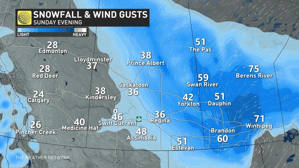
Gusty winds of 50-70 km/h will accompany the heavy snowfall across the region, leading to extended periods of severely reduced visibility. However, some areas are seeing gusts exceeding 70 km/h.
Blizzard conditions will continue through Sunday and end Monday morning.
Complete whiteouts are likely at times. Travel will be difficult if not impossible on all roads across the region during heavy snow and high winds.
Expect tough if not impossible travel during the height of the storm into Sunday, especially along most of the Yellowhead Highway east of Edmonton.
As previously mentioned, road closures have been reported near Kindersley and North Battleford, Sask. As well, the Maidstone to Maymont corridor of the Yellowhead Highway is closed.
Additional road closures are likely in the hardest-hit areas due to rapidly accumulating snow and poor visibility.
Snowfall totals of 40+ cm are possible
Since the snowfall is anticipated to be light and fluffy, accumulations will likely exceed forecast amounts in some areas. However, there is some uncertainty in exact snowfall totals on the Prairies, with a challenge arising to get reliable measurements due to the blowing snow and drifts.

RELATED: Avalanche warning issued as snow piles up in the Rockies
Forecasters expect the heaviest snowfall totals to target central and southern Saskatchewan, and west-central and southwestern Manitoba, where 20-40+ cm of snow is possible by the time precipitation wraps up on Monday.
A widespread swath of snowfall topping 30 cm is expected elsewhere in the provinces, as well as northeastern Alberta.
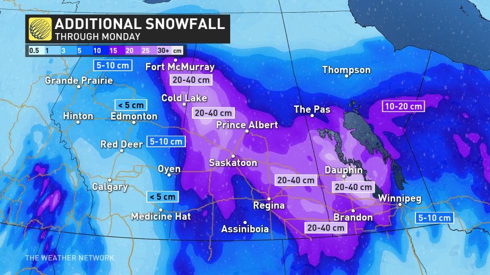
Folks around Regina in the south could see 15-30 cm of snow by Monday.
The greatest uncertainty surrounding this storm is the potential for a sharp cutoff in snowfall totals around Winnipeg, but 10 cm is still expected in the city. That is due to the centre of low tracking across the Red River Valley, and as it does so, is pulling in warmer air with it and creating a wintry mess.
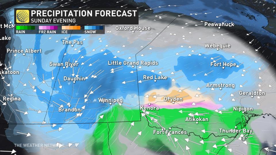
Precipitation changed to freezing rain in Winnipeg along the warm front, and will continue as a wintry mix on Sunday before changing back to snowfall. Ice accumulation is not forecast to be significant.
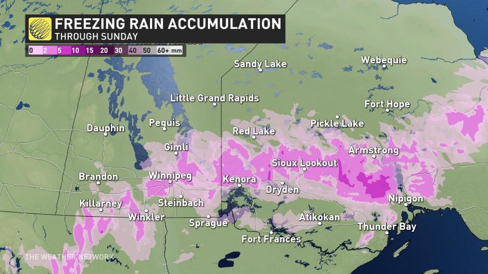
This intrusion of warm air into southern Manitoba could force a changeover to ice pellets in and around Winnipeg, which would significantly cut down snow accumulations here. Warmer temperatures will also make for wetter snow in Manitoba as opposed to the light and fluffy powder expected to the west.
By Monday morning, the system will have dissipated and snowfall will lift north, but lingering wind means a continuation of blowing snowfall.
Stay with The Weather Network for all the latest on this snowstorm across the Prairies.

