The total solar eclipse is seen in Madras, Oregon. (Photo: Aubrey Gemignani/NASA)
Unless you’ve been living in a fallout bunker (and who would blame you), everyone should know Monday is the day people around the U.S. have been excited about for the past few months.
Photographers across the country captured the phenomenon in various stages with cameras fitted with special filters, along with images of crowds taking in the spectacle.
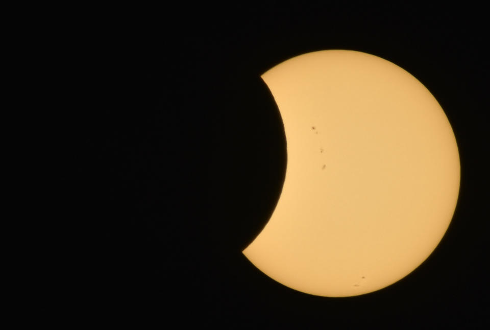
The Moon is seen as it starts passing in front of the Sun during the solar eclipse August 21, 2017 from Ross Lake, North Cascades National Park, Washington.
A cheerleader uses solar viewing glasses before welcoming guests to the football stadium to watch the total solar eclipse at Southern Illinois University in Carbondale, Illinois.
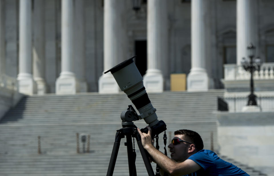
A news photographer adjusts his telephoto lens equipped with a filter in front of the U.S. Capitol on Monday, Aug. 21, 2017, in preparation for today's solar eclipse.
A composite image, made from seven frames, shows the International Space Station, with a crew of six onboard, as it transits the Sun at roughly five miles per second during the solar eclipse.
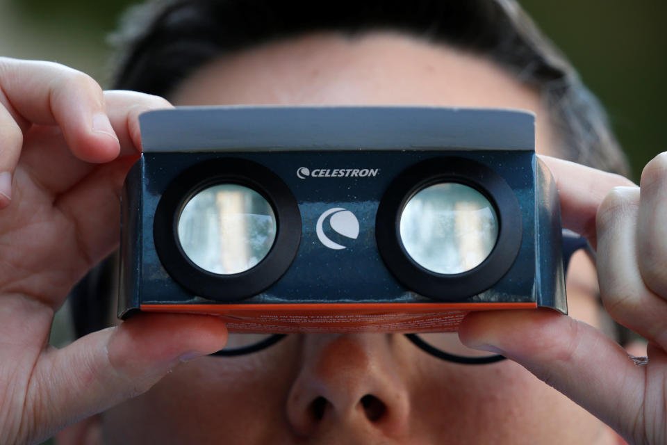
A man looks through his solar viewing glasses in New York City.
Depoe Bay, Oregon
Ross Lake, North Cascades National Park, Washington.
Madras, Oregon.
People watch the Solar Eclipse in Depoe Bay, Oregon.
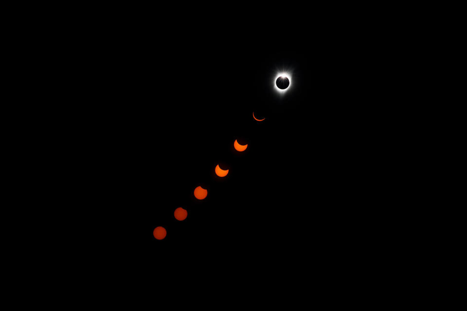
The 'diamond ring effect' is seen during a total solar is seen from the Lowell Observatory Solar Eclipse Experience in Madras, Oregon.
Depoe Bay, Oregon
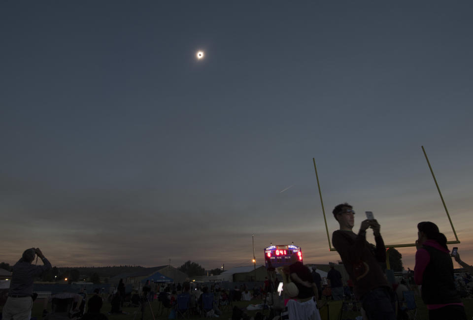
A total solar eclipse is seen from the Lowell Observatory Solar Eclipse Experience in Madras, Oregon.
Totality in Depoe Bay, Oregon.
A Mexican boy looks through a telescope at the beginning of the solar eclipse, at the esplanade of the Museum of Natural History in Mexico City.
Mexico City, Mexico.
The "Bailey's Beads" effect is seen as the moon makes its final move over the sun over Madras, Oregon.
Members of the media watch the solar eclipse at the White House.
Attorney General Jeff Sessions, left, and Commerce Secretary Wilbur Ross watch from the White House.
President Donald Trump watches from the Truman Balcony.
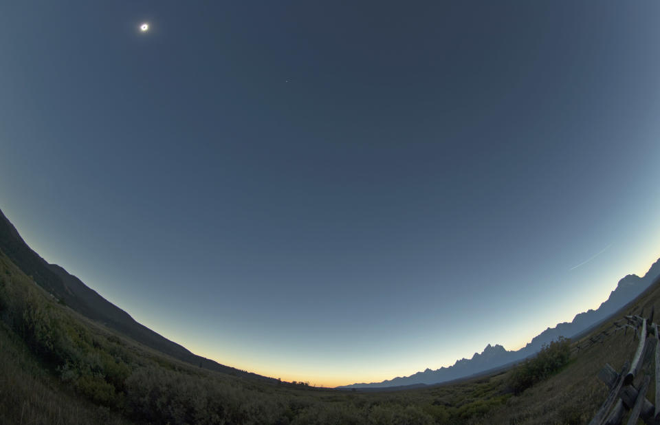
The sun is is in full eclipse over Grand Teton National Park outside Jackson, Wyoming.
In-camera multiple exposure of the solar eclipse as seen in Salem, Oregon.
Charleston, South Carolina.
Alliance, Nebraska.
A man takes a look at the solar eclipse at Liberty State Island in New York.
Enthusiasts Tanner Person and Josh Blink, both from Vacaville, California, atop Carroll Rim Trail at Painted Hills, a unit of the John Day Fossil Beds National Monument, near Mitchell, Oregon.
Also on HuffPost
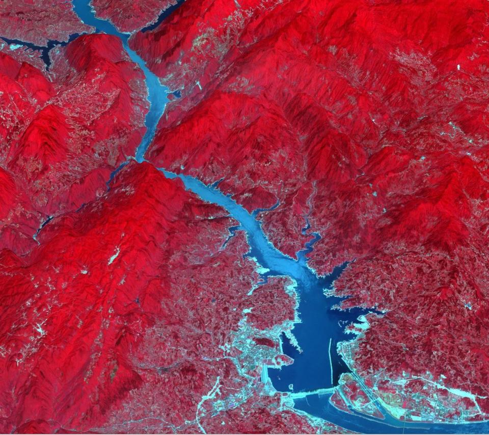
The Three Gorges Dam spans the Yangtze River in east-central China. It's the world's largest power station in terms of installed capacity, with its vast reservoir stretching for 410 miles.
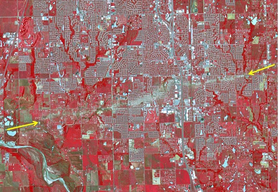
The Newcastle-Moore EF-5 tornado ripped through central Oklahoma on May 20, 2013, killing 24 people and leaving behind more than $2 billion in damage. On June 2, 2013, the Advanced Spaceborne Thermal Emission and Reflection Radiometer instrument on NASA's Terra spacecraft captured this image showing the scar left on the landscape by the tornado's deadly track. In this false-color image, vegetation is red, water is dark blue, roads and buildings are gray and white, and bare fields are tan. The tornado track crosses the image from left to right as indicated by the arrows. The image covers an area of 6 by 8.6 miles, and is located at 35.3 degrees north latitude, 97.5 degrees west longitude.
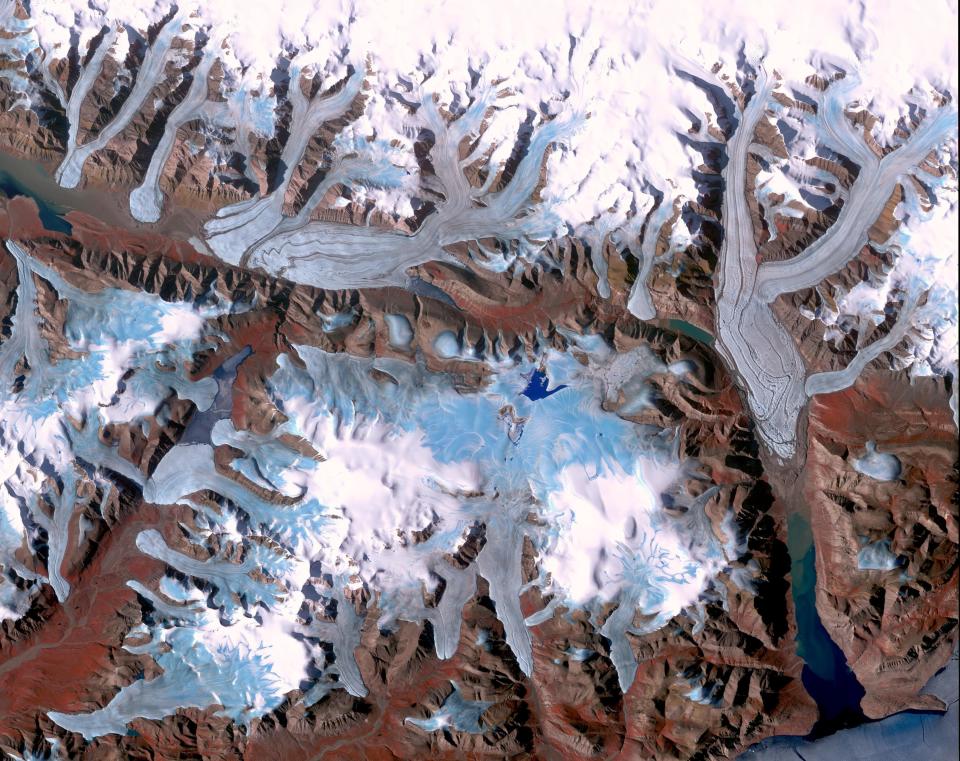
Ellesmere Island is part of the Qikiqtaaluk Region of the Canadian territory of Nunavut with the most northerly point of land in Canada. Inhabited since about 2000 BC, its current population is less than 200. Large portions of Ellesmere Island are covered with glaciers and ice, as seen in this image of a portion of the north-central part of the island.
In the middle of the Arabian desert, the city Green Oasis Wadi Al Dawasir is being developed as a new urban center for the Wadi Al Dawasir region of Saudi Arabia. Huge solar fields supply the entire city and the surrounding region with energy. Hundreds of circular agricultural fields are fed by center pivot irrigation apparatus, drawing water from subterranean aquifers.
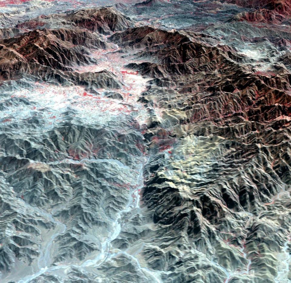
The Khyber Pass is a mountain pass that links Afghanistan and Pakistan. Throughout its history it has been an important trade route between Central Asia and South Asia, and is a strategic military location. It is the route used by Alexander the Great, Cyrus the Great, Genghis Khan, Babur the Tiger, Chandragupta Maurya, Darius I and countless other would-be conquerors. The Afghan Shinwari clan, who live in the Pass, regarded the Pass as their own preserve and have levied a toll on travelers for safe conduct. The perspective view looks from Afghanistan, eastward into Pakistan.
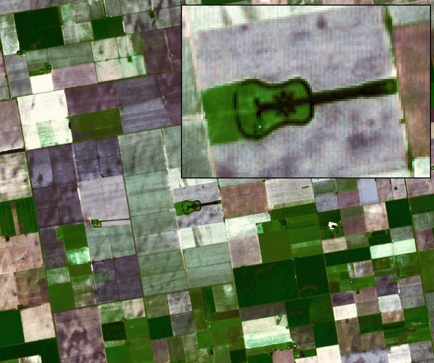
Located in the fertile agricultural region of Argentina's Pampas is a guitar-shaped forest made up of cypress and eucalyptus trees. An Argentinian farmer planted the forest in memory of his departed wife.
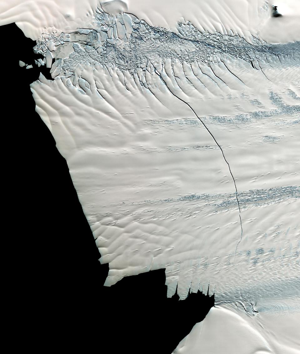
In mid-October 2011, NASA scientists working in Antarctica discovered a massive crack across the Pine Island Glacier, a major ice stream that drains the West Antarctic Ice Sheet. Extending for 19 miles, the crack was 260 feet wide and 195 feet deep. Eventually, the crack will extend all the way across the glacier, and calve a giant iceberg that will cover about 350 square miles. This image from the ASTER instrument on NAS's Terra spacecraft was acquired Nov. 13, 2011 and covers an area of 27 by 32 miles , and is located near 74.9 degrees south latitude, 101.1 degrees west longitude.
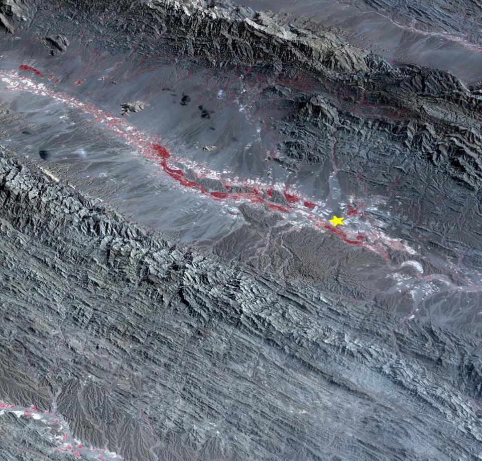
On September 24 at 6.29 a.m. ET, a magnitude 7.7 earthquake struck in south-central Pakistan at a relatively shallow depth of 12 miles. The earthquake occurred as the result of oblique strike-slip motion, consistent with rupture within the Eurasian tectonic plate. Tremors were felt as far away as New Delhi as well as Karachi in Pakistan. Even though the immediate area to the epicenter is sparsely populated, the majority of houses are of mud brick construction and damage is expected to be extensive. The perspective view, looking to the east, shows the location of the epicenter in Pakistan's Makran fold belt.
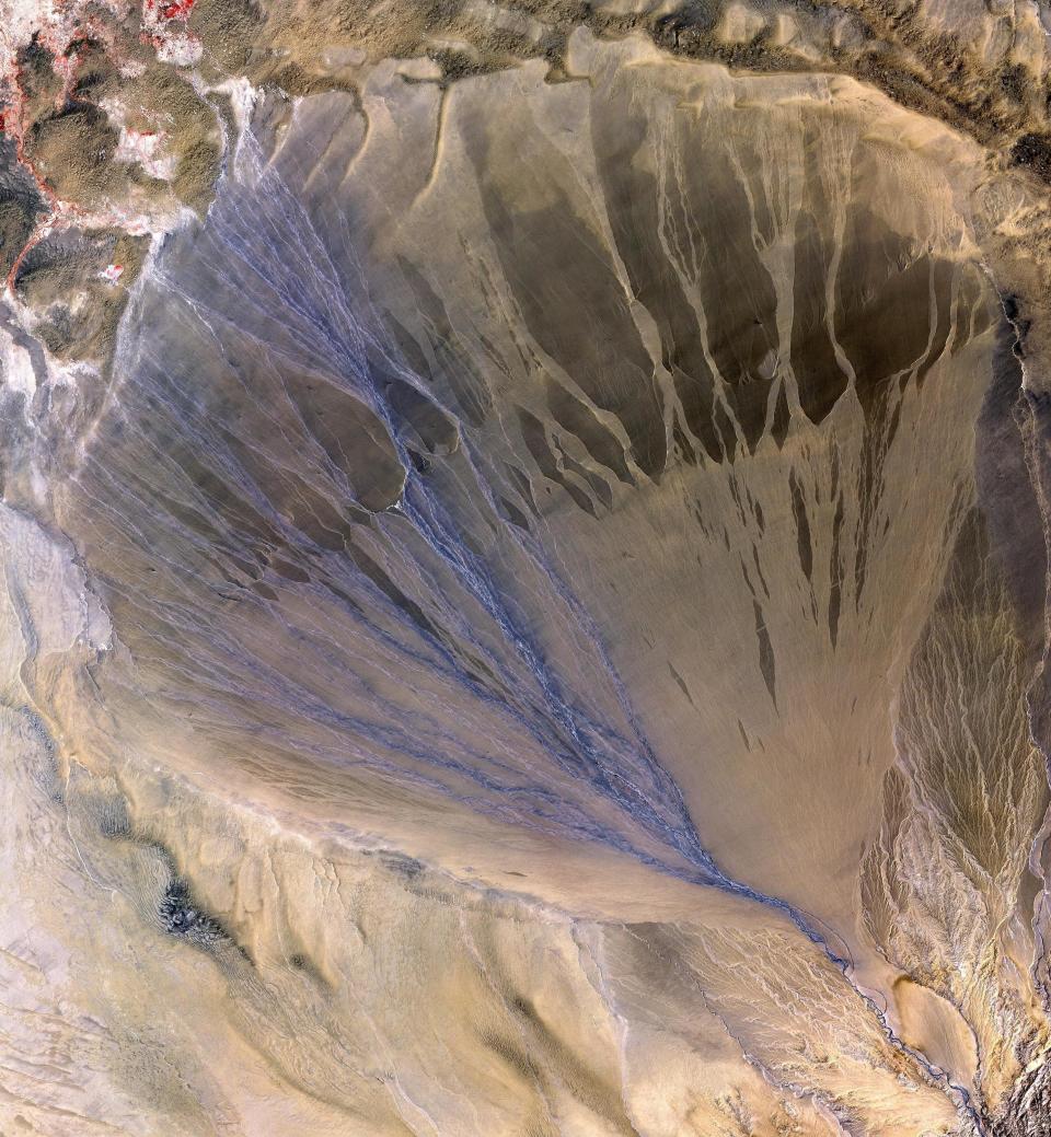
A vast alluvial fan blossoms across the desolate landscape between the Kunlun and Altun mountain ranges that form the southern border of the Taklimakan Desert in China’s XinJiang Province. The left side is the active part of the fan, and appears blue from water currently flowing in the many small streams.
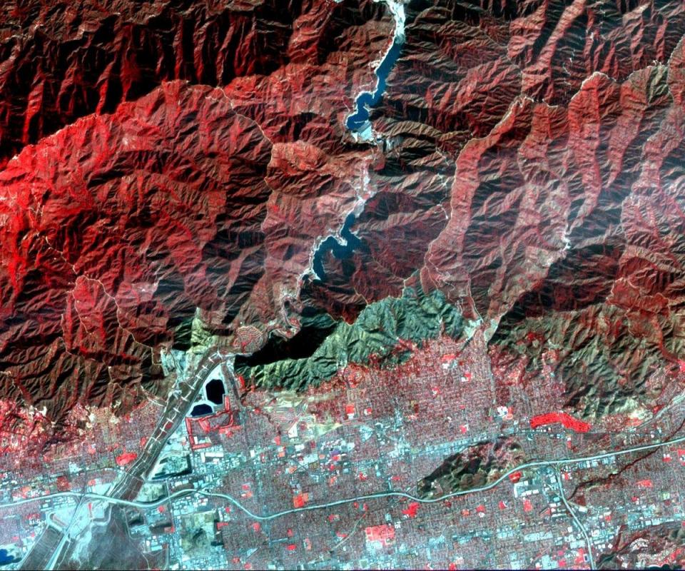
On Jan. 16, 2014, a wildfire broke out in the mountains above the Los Angeles suburbs of Glendora and Azusa. The fire consumed almost 2,000 acres and destroyed several homes, after starting from an illegal campfire. This image, acquired Jan. 23, 2014 from the ASTER instrument on NASA's Terra spacecraft, depicts vegetation in shades of red. The burned area is seen as the blue-gray area at the base of the mountains.
Poyang Lake was once China's largest freshwater lake. It has largely evaporated because of drought and a nearby dam on the Yangtzee River.
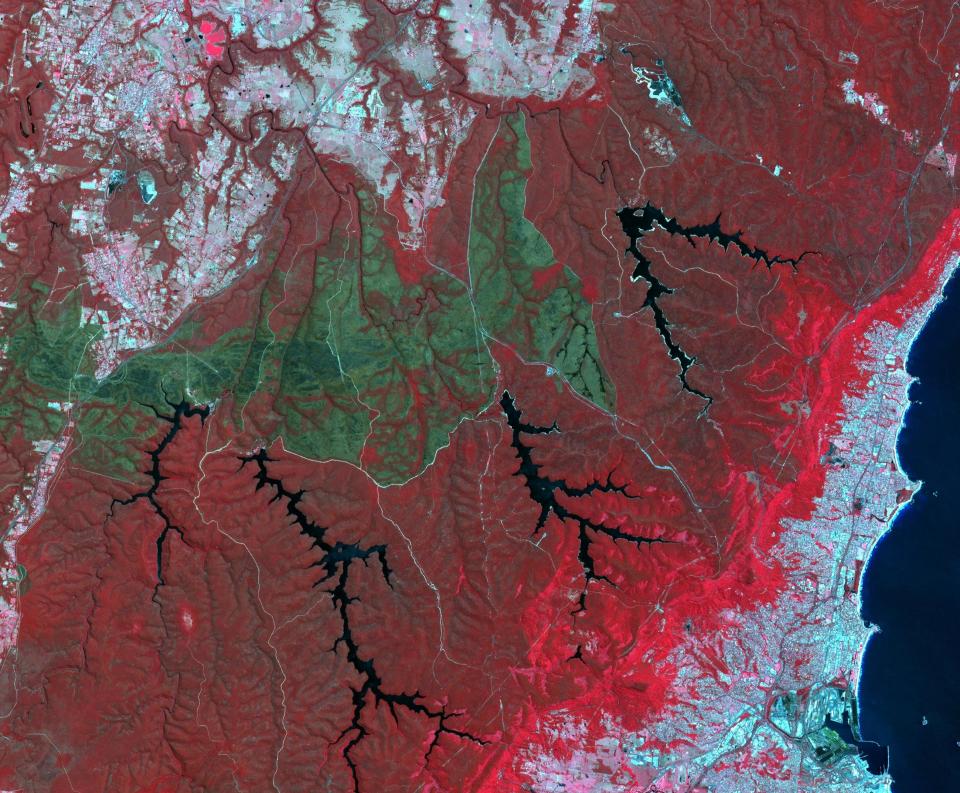
October 2013 brought the worst fires seen in the Australian state of New South Wales in many decades. More than 100 wildfires burned. One of the largest was the Hall Road fire, southwest of Sydney, west of the town of Wollongong. The fire scar is seen in this satellite image acquired Nov. 14, 2013, by the ASTER instrument on NASA's Terra spacecraft. Vegetation is displayed in shades of red, burned areas are dark gray, water is black and blue, and urban areas are blue-gray.
Affluent Americans may want to double-check how much of their bank deposits are protected by government-backed insurance. The rules governing trust accounts just changed.
Former NBA guard Darius Morris has died at the age of 33. He played for five teams during his four NBA seasons. Morris played college basketball at Michigan.
Jason Fitz and Frank Schwab join forces to recap the draft in the best way they know how: letter grades! Fitz and Frank discuss all 32 teams division by division as they give a snapshot of how fans should be feeling heading into the 2024 season. The duo have key debates on the Dallas Cowboys, New York Giants, New Orleans Saints, Los Angeles Rams, New England Patriots, Las Vegas Raiders and more.