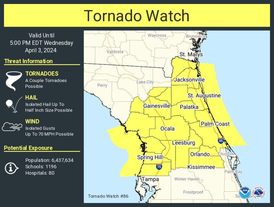
Tornado watch for Volusia-Flagler until 5 p.m. Wednesday. Expect 1-inch hail, heavy rain.
A tornado watch has been issued for Volusia and Flagler counties through 5 p.m. Wednesday, part of a broader watch area that covers 20 counties throughout a large swath of Florida from Jacksonville through Orlando and into Spring Hill on Florida's west coast.
A couple of tornadoes are possible, along with isolated hail up to half-inch size, according to the advisory from the National Weather Service in Melbourne. Wind gusts up to 70 mph also are possible.
A band of strong to severe storms are forecast to move into Lake and Volusia counties early this afternoon and continue to shift east-southeast at 35 to 50 mph through the Interstate 4 corridor into mid to late afternoon, according to the NWS.
At 2 p.m., the National Weather Service in Jacksonville issued a Special Weather Statement advising of winds of 55 mph and the possibility of pea-sized hail in an area that included Palm Coast, Palatka and Ocala.
That statement was slated to expire at 2:45 p.m. , but was extended until 3:15 p.m. for areas that included Palm Coast, Flagler Beach and Bunnell.
Residents were advised to seek shelter in a sturdy structure.
Just after 2 p.m., the National Weather Service in Melbourne issued a Special Weather Statement advising of winds of 40 mph in an area that included Deltona as well as portions of Orlando and Lake County.
That statement expired at 2:45 p.m., but was extended until 4:15 p.m. for areas that included Deltona and Daytona Beach. Residents were advised to seek shelter in a sturdy structure.
Just after 4 p.m., the tornado watch was lifted in Flagler County, but continued until 5 p.m. in Volusia, according to the NWS.
Primary storm threats throughout the day include strong to locally damaging wind gusts up to 50 to 70 mph, hail up to 1 inch in diameter, heavy rainfall, and frequent lightning strikes. However, a tornado or two is also possible, especially as this line of storms moves into Lake and Volusia counties and through the I-4 corridor.
This line of showers and storms should then begin to gradually weaken as it progresses farther southward across east Central Florida through late day into early this evening, the advisory states. However, a few stronger storms will still be possible.
Difference between a watch and warning? Palm Coast tornado: What we know and what's the difference between a warning and a watch
Winds will continue to increase into the afternoon from the southwest at 20 to 30 mph with frequent gusts up to 40 mph. For this reason, a Wind Advisory is in effect through 8 p.m. across all of east Central Florida, including Volusia and Flagler counties.
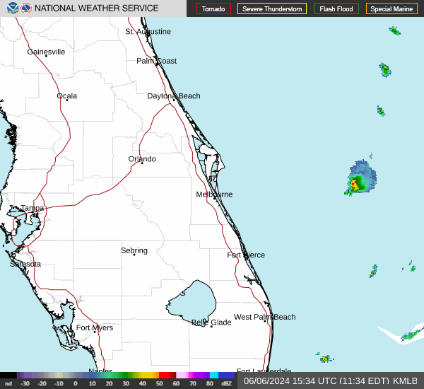
Daytona Beach radar
Volusia County officials take precautions as storms approach
Ahead of the potential storms, Volusia County officials were closely monitoring conditions expected to impact the county on Wednesday.
In preparation for this storm, the county removed low-lying trash receptacles and dog bag dispensers along the beach by the end of day on Tuesday. Additionally, vehicle access ramp toll booths may be moved for safety purposes, the county advised.
Staff will continuously inspect walkovers and ramps for erosion, and access points may close temporarily.
Anyone planning to visit the beach during this time should take appropriate measures to stay safe, the county stated in a news release.
Officials recommend staying out of the water as conditions continue to deteriorate; however, if the decision is made to enter the water, a person should do so in front of a staffed lifeguard tower and remain in waist-deep water to firmly grasp the bottom.
Beachgoers are encouraged to download the Volusia Beaches mobile app for real-time information on staffed lifeguard tower locations, beach access, weather conditions, and other essential updates.
Additionally, it is recommended to adhere to posted warnings and flags, carefully monitor children and inexperienced swimmers, and follow lifeguard instructions.
The entire county, including inland communities, may also experience significant rainfall throughout the event, the news release stated.
Residents should prepare their property, including cleaning out gutters, and exercising extreme caution if roadways become covered in water.
As always, Volusia County officials encourage residents and visitors to be prepared and take action to know what to do before, during, and after a storm. To learn more about Volusia County Emergency Management, residents can download the VCEM mobile app. To sign up for Alert Volusia notification, visit volusia.org/emergency.
This article originally appeared on The Daytona Beach News-Journal: Tornado watch in effect until 5 p.m. Wednesday in Volusia, Flagler

