Topeka is part of an area expected to see an 'enhanced' chance for severe storms Tuesday evening
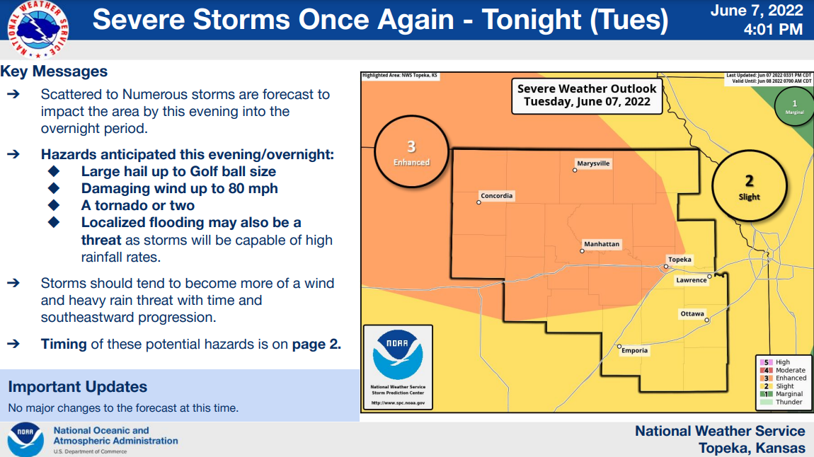
Topeka is part of an area the National Weather Service says will see an "enhanced" chance for severe storms, most likely between 11 p.m. Tuesday and 1 a.m. Wednesday.
That area also includes Manhattan, Concordia and Marysville, according to a graphic the weather service's Topeka office placed on its website at 4:01 p.m. Tuesday.
"Scattered to numerous storms are forecast to impact the area by this evening into the overnight period," the graphic said.
It indicated anticipated hazards include a tornado or two; large hail, up to golf ball size; winds of up to 80 mph; and localized flooding resulting from the storms, which are expected to bring heavy rain.
"Storms should tend to become more of a wind and heavy rain threat with time and southeastward progression," the graphic said.
It indicated a slight chance for severe weather was forecast for an area that includes Emporia, Lawrence and Ottawa.
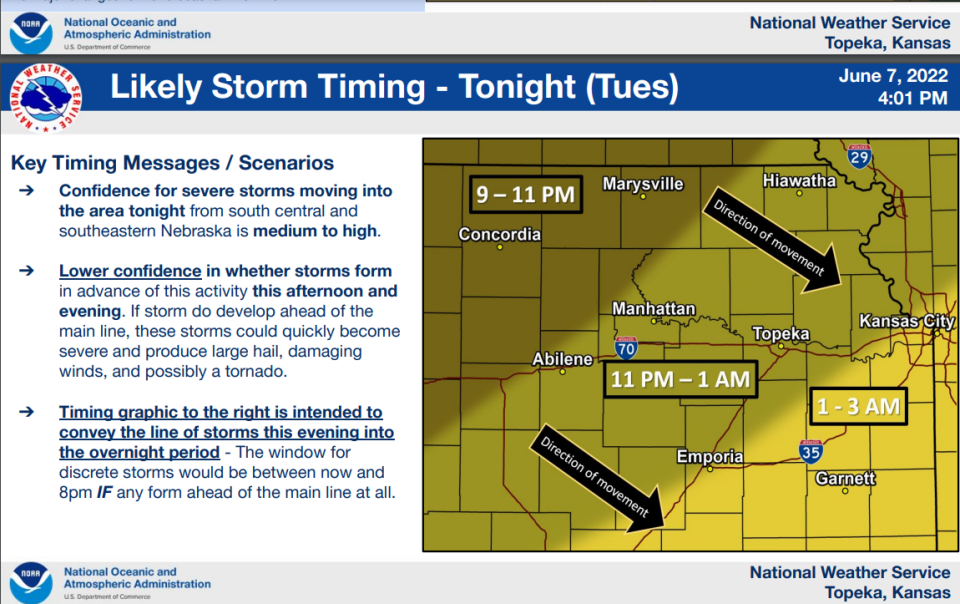
"Confidence for severe storms moving into the area tonight from south-central and southeastern Nebraska is medium to high," said a separate graphic posted at 4:01 p.m. Tuesday on the website of the weather service's Topeka office.
That graphic indicated severe storms were expected to move southeast between 9 and 11 p.m. through an area that includes Marysville and Concordia; between 11 p.m. Tuesday and 1 a.m. Wednesday through an area that includes Topeka, Manhattan, Abilene and Hiawatha; and between 1 and 3 a.m. Wednesday through an area that includes Emporia and Garnett.
Tim Hrenchir can be reached at threnchir@gannett.com or 785-213-5934.
This article originally appeared on Topeka Capital-Journal: Topeka area to see 'enhanced' chance for severe storms late Tuesday

