Three chances for St. Louis area storms through Tuesday night
ST. LOUIS — There are three chances for storms to pop up in the St. Louis area through Tuesday night.
Round 1
The first chance for isolated to scattered storms will be over extreme eastern Missouri and southern Illinois between 2 p.m. and 8 p.m. Monday. This includes metropolitan St. Louis. There is a level 1 out 5 risk of some severe wind gusts and hail with these storms, if they develop. The greatest potential appears to be along I-70 from St. Louis into Illinois. Although, there is a chance for storms anywhere in the highlighted region.
Round 2
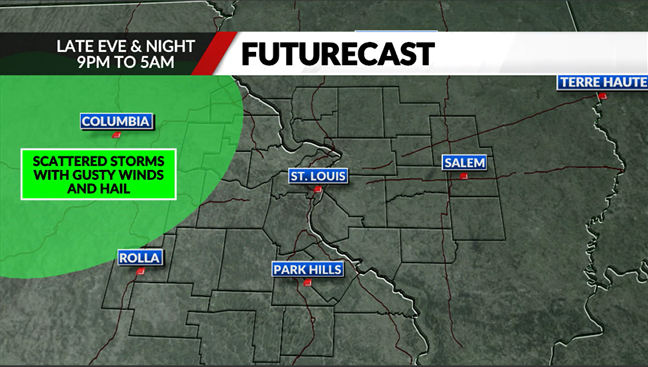
The second chance for storms will be overnight and focused over western and central Missouri. These storms could produce locally heavy rain, flash flooding and some pockets of gusty winds and hail. While the main threat from these storms is likely to stay west of the St. Louis area, they may drift into Pike, Montgomery and Gasconade counties after midnight. There is a level 1 out of 5 risk for severe storms in those counties on Tuesday night.
Round 3
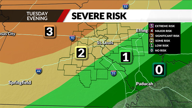
The third chance for storms will come Tuesday evening into Tuesday night with an advancing cold front. There is a level 3 out of 5 risk for severe storms over our far northwesternmost counties, with a level 2 risk extending into metropolitan St. Louis.
The most likely timing for storms on Tuesday will be from 7 p.m. to midnight. All modes of severe weather will be possible with winds, hail, and even an isolated tornado threat.
Copyright 2024 Nexstar Media, Inc. All rights reserved. This material may not be published, broadcast, rewritten, or redistributed.
For the latest news, weather, sports, and streaming video, head to FOX 2.


