Flood forecasts for coastal South Carolina are scaled back


By Harriet McLeod and Gene Cherry
CHARLESTON, S.C./RALEIGH, N.C. (Reuters) - Emergency management officials on Wednesday scaled back their flooding forecasts for coastal South Carolina but urged residents not to be complacent as the rivers swollen by Hurricane Florence wreak havoc on the state.
Florence, which came ashore on Sept. 14 as a Category 1 hurricane and killed 46 people in three states, has long since dissipated, but the torrential rainfall it generated is flooding riverside communities in a line to the ocean.
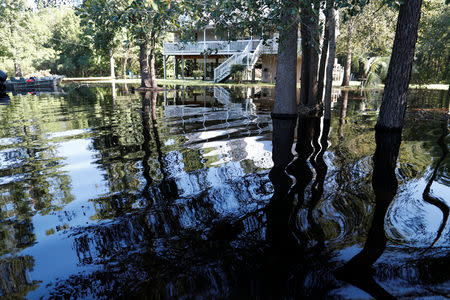
In the coastal city of Georgetown, about 30 miles south of Myrtle Beach, at the confluence of the Waccamaw, Great Pee Dee and Sampit rivers, officials now expect flood waters of two to four feet, down from earlier forecast at five to 10 feet.
"We’re encouraging people not to let their guard down though, because just as quickly as forecasts change in our favor, they can change against us,” Jackie Broach-Akers, spokeswoman for the Georgetown County Emergency Management Operations Center, said by telephone.
Despite bright sunshine on Wednesday, Broach-Akers said officials were urging 6,000 to 8,000 residents to leave their homes, with rivers expected to crest in Georgetown on Friday morning and remain above flood stage for four or five days.
"It makes it harder to believe that something bad is right around the corner," she said.
South Carolina Governor Henry McMaster said the river flooding caused by Florence, which dropped nearly 20 inches (50 cm) of rain in some places in the state, is something his state has not had to cope with before.
"This is unprecedented and we are still in full battle mode," McMaster said at a press briefing on Wednesday at Emergency Management Division headquarters in Columbia, the state capital.
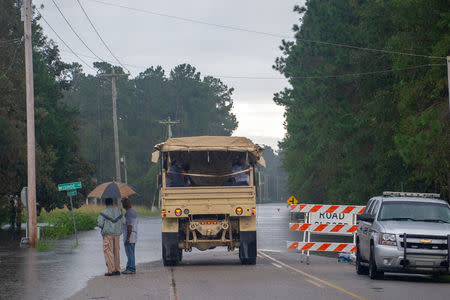
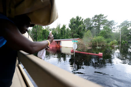
Flooding has already destroyed 46 homes in the state, significantly damaged more than 1,000 and forced 11,000 people to flee their homes, including 3,000 in Georgetown, EMD Director Kim Stenson told reporters.
DODGING A THREAT
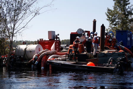
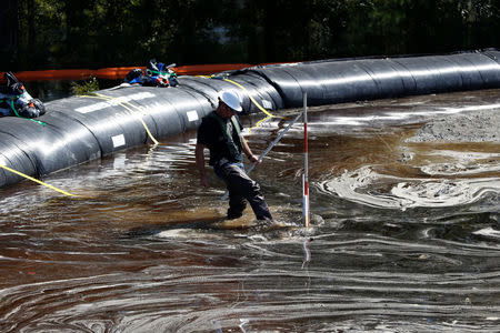
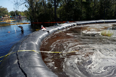
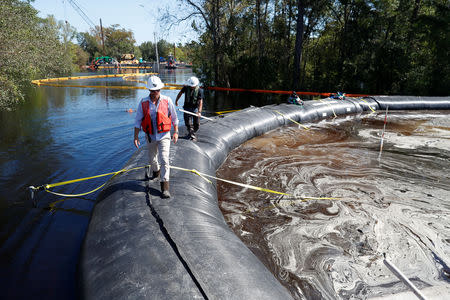
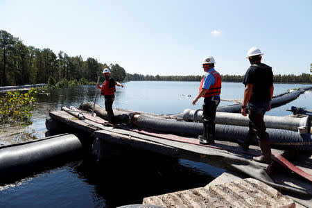
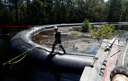
In Conway County, where the Waccamaw was already well above flood stage, South Carolina's state-owned electric and water utility, said it dodged a threat that flooding would inundate a pond that holds more than 200,000 tons of toxic coal ash.
“The river’s rise has slowed and we think it’s cresting today,” utility spokeswoman Mollie Gore said by telephone from the site, where 115 workers had shored up the dam around the pond. “We still have a foot between the top of the river and the top of the dam.”
Santee Cooper said it has removed more than 1 million tons of coal ash, which can contaminate water and harm fish and wildlife, from the site in the past few years.
The Waccamaw was expected to crest by late Thursday at 21.2 to 26.4. feet in the upriver communities of Conway and Bucksport, the National Weather Service Southeast River Forecast Center in Atlanta said.
“This is going to be a very long flooding event," said John Atwell, a weather service hydrologist.
Some one to two inches of rain moving into the central and western parts of the state in a next day or two will prolong the flooding, said meteorologist Rich Otto of the weather service's Weather Prediction Center in College Park, Maryland.
“Any additional rainfall is just going to filter into those rivers,” Otto said.
Crews worked to erect temporary dams on either side of U.S. Highway 17, the main coastal route through the area, and National Guard engineers were installing a floating bridge at Georgetown in case the highway is washed out at the river.
Insured losses from Hurricane Florence will range from $2.8 billion to $5 billion, according to RMS, a risk modeling and analytics firm.
(Additional reporting by Peter Szekely in New York, Makini Brice in Washington, Bernie Woodall in Fort Lauderdale, Florida, Writing by Peter Szekely; editing by Bill Trott, Leslie Adler and Cynthia Osterman)
