Tornadoes skip through West Texas, Oklahoma as 1,400-mile line of storm slams nation's mid-section
At least three tornadoes touched down in West Texas and Oklahoma Saturday, damaging a high school southwest of Fort Worth as a slow-moving, 1,400-mile line of severe weather pounded Tornado Alley along a northeast trajectory.
At one point Saturday afternoon, the line of severe storms stretched from Sonora, Texas, in deep West Texas, to Green Bay Wisconsin, pounding a string of cities including Fort Worth, Oklahoma City, Kansas City and Des Moines.
The first twister damaged a baseball stadium just outside the town of Ballinger, about 200 miles southwest of Fort Worth, demolishing one home and injuring at least one person, according to the National Weather Service Storm Prediction Center.
It also touched down in the town of Baillinger, damaging a country club and high school. It continued to snap trees and power lines as it skipped through the county.
A tornado also hit Silver Valley, Texas, where it downed trees and damaged a church roof. A third twister struck Comanche, Oklahoma, 90 miles south of Oklahoma City, damaging homes and ripping up trees.
The line of storms was poised to rake Fort Worth and Dallas as it snaked its way northeast across Tornado Alley.
"The potential for significant severe wind gusts will exist as storms merge into a fast-moving line," the SPC warned.
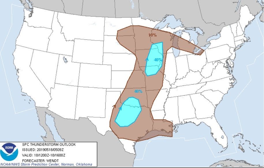
Saturday was expected to be one of the worst periods for the Texas-Oklahoma area from a multi-day storm threat forecast for Tornado Alley, which spans from Texas to South Dakota. The storm was forecast to slam the area again Monday and Tuesday.
The SPC posted over 30 preliminary tornado reports in Nebraska and Kansas on Friday as the violent weather took hold.
The fierce weather is being triggered by a high-energy system sweeping in from the Pacific and clashing with warm, humid Gulf Coast air.
AccuWeather meteorologists warn of the likelihood of hailstones so large they could cause serious injury, kill livestock and inflict substantial property damage.
Around 6:45 p.m. ET on Friday, a tornado touched down near McCook, Nebraska, AccuWeather reported. The National Oceanic and Atmospheric Administration Storm Prediction Center reported tree and power line damage along with minor damage to a farm, the Weather Service reported.
As the storm tracked northeast, it spun up rare twin tornadoes near Farnam, Nebraska, around 8:26 p.m. ET. Storm center said the twisters knocked down tress and power lines, forcing police to close one roadway.
AccuWeather Extreme Meteorologist Reed Timmer was reporting from Nebraska for the AccuWeather Network and intercepted a tornado on foot near McCook, Nebraska, losing his hat in the process.
The threat area is almost a textbook description of traditional Tornado Alley.
The SPC highlighted a risk area for severe weather through Tuesday at least.
Earlier this week, the threat area was on the map for 8 straight days.
This article originally appeared on USA TODAY: Tornadoes skip through West Texas, Oklahoma as 1,400-mile line of storm slams nation's mid-section

