Temperature whiplash as Utah cools down following midweek warm up
SALT LAKE CITY (ABC4) – Happy Thursday, Utah! We are experiencing a mild case of temperature whiplash, jumping from the 60s to the 70s yesterday and back to the low 60s again today.
The bottom line? Waves of unsettled weather will impact portions of the state into the holiday weekend.
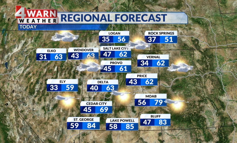
The temperature swing will be more pronounced in northern and central Utah, but some areas in the south could see a minor dip. Thursday’s highs return to the 50s and low 60s for the north and 60s for central Utah. Meanwhile, warm spots will hold onto the mid-80s with breezy winds statewide.
The cold front that brought the cooler air mass today will be responsible for some brief isolated showers on the northernmost areas of the state in the morning, but that will continue clearing into the afternoon, leaving the region with partly cloudy to mostly sunny skies.
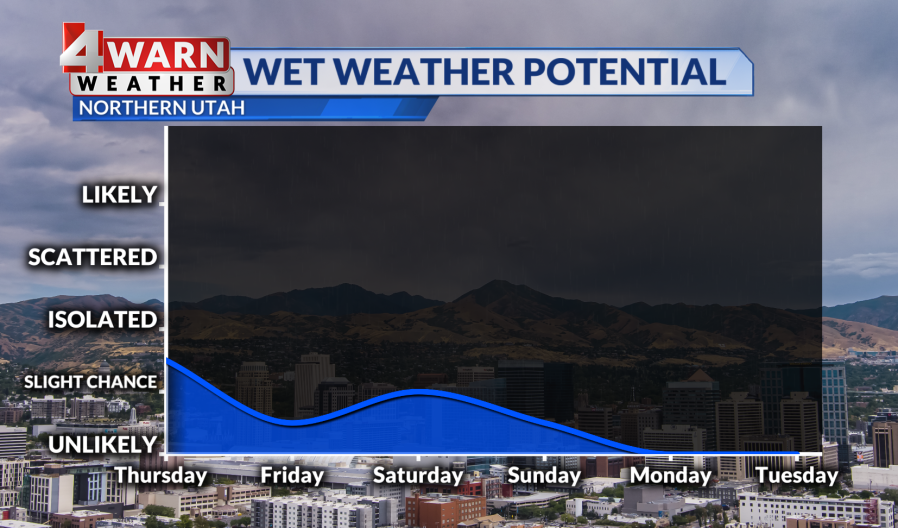
Temperatures are quick to rebound tomorrow, warming up by 5-10 degrees and reaching seasonal norms on Friday. However, we could also have more active weather over the next few days. We see an uptick in wet weather as we get into Friday afternoon. Isolated showers will impact central Utah first before expanding to northern Utah.
Saturday will bring an even higher chance of wet weather, and we may hear thunder rumble through some valleys and mountains as a trough of low-pressure swings through. This will impact the Memorial Day Weekend with a slight chance of showers hanging on Sunday, clear skies and warming temperatures anticipated for Memorial Day next week.
We’ll continue to keep you up-to-date on the latest developments on our 4Warn Weather forecast both on-air and online, we are Good4Utah!
Copyright 2024 Nexstar Media, Inc. All rights reserved. This material may not be published, broadcast, rewritten, or redistributed.
For the latest news, weather, sports, and streaming video, head to ABC4 Utah.

