Super-straight jet stream will cause localized weather chaos worldwide

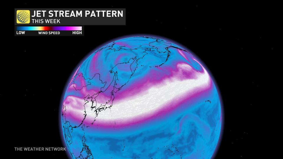
Our current jet stream configuration is so straight you could trace it with a ruler.
I'm sure you've heard of the jet stream, the narrow bands of stronger winds that circulate high above the ground.
SEE ALSO: Will winter stage a comeback this month? Find out in our official January Outlook
There's usually not a singular jet stream but several that dip and rise, producing multiple changes in latitude and altitude. This feature becomes more pronounced in winter as temperature gradients grow. The wonky winter jet stream is a classic prerequisite for active weather and was the primary driver of the historic December storm across North America.
But what happens when you completely straighten out this robust air current?
Most of the continent is facing an absence of active weather and strong storms. Instead, there’s a prolific influx of mild air, compliments of the jet stream.
If you’re on the receiving end of the monster jet stream, a minority will experience extreme weather. The ruler-straight jet stream can be traced back toward southeast Asia, famous for humidity and excess moisture. When this atmospheric river interacts with the mountainous terrain across California, it’s a recipe for disaster.
After years of drought conditions across California, we are transitioning from one extreme to the next, but there will be tremendous benefit to zapped reservoirs.
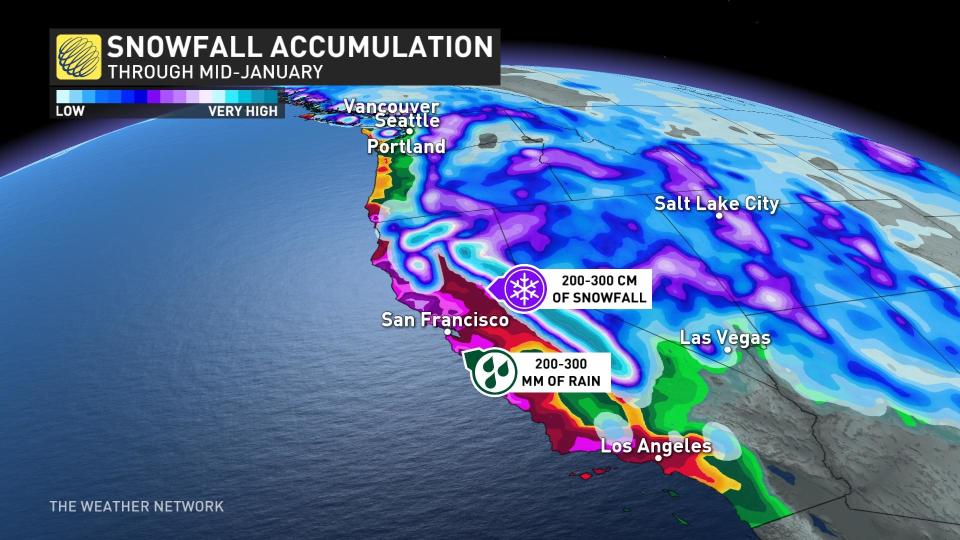
Long term, there’s the possibility of measuring snowfall in metres in the Sierra mountains. Widespread flooding, landslides, and power outages are also all likely.
Such a powerful jet stream typically carves a path farther north, propelling powerful Aleutian lows. A low will rapidly deepen through Wednesday, meeting the criteria for bombogenesis -- a pressure drop over 24 millibars in 24 hours.
Consequently, this low will be a massive wave generator, pushing wave heights above 7 metres along the coast of the Pacific Northwest and California.
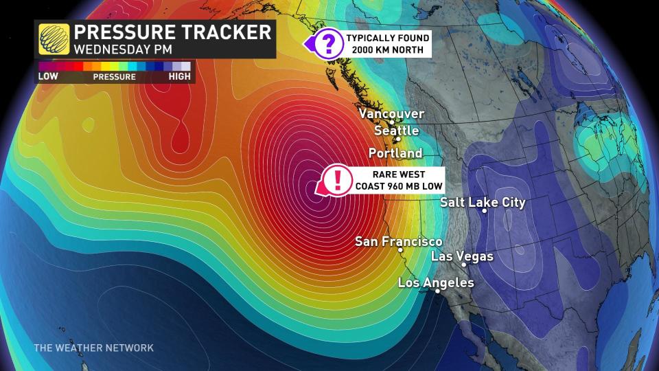
By the time the low reaches northern Vancouver Island late Thursday, it will be substantially weaker, with gusts up to 80-90 km/h along exposed coastal sections. Although it’s not a significant windstorm across the South Coast, wave-watching conditions for Tofino will be superb through Friday.

