Stunning NASA Photos Show California's Devastating Wildfires From Space
Satellite photos captured by NASA show how large California’s wildfires have become as they continue to burn vast areas of the state.
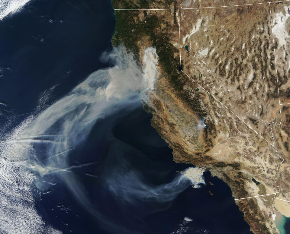
In the photos below, taken from NASA’s Terra satellite on Friday, massive plumes of smoke can be seen drifting over the Pacific Ocean from fires in Northern and Southern California.
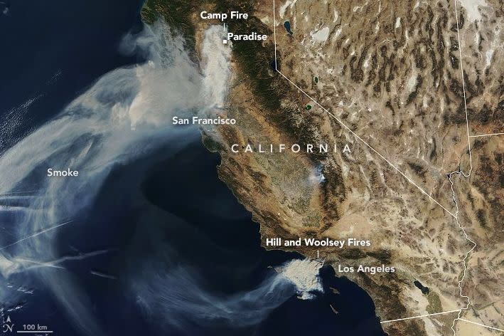
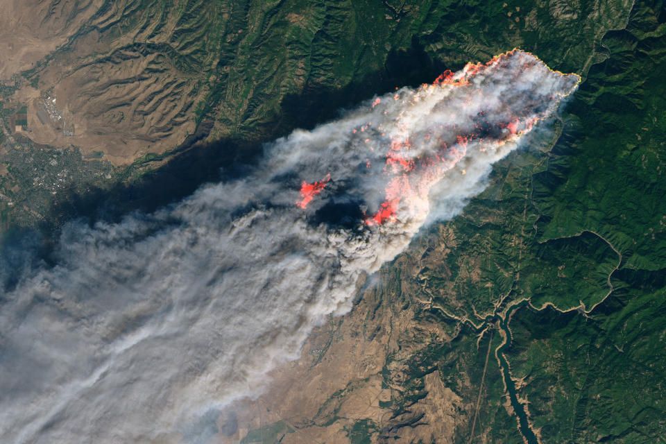
One fast-moving wildfire, known as the Camp fire, likely wiped out the entire town of Paradise, where 27,000 people were forced to evacuate. As of Friday evening, the wind-fueled fire was only 5 percent contained after burning up to 70,000 acres and destroying 6,453 homes. At least nine people have died, with at least five bodies found trapped in vehicles.
A fire official told The Associated Press on Friday that Paradise, 90 miles north of Sacramento, was “pretty much” destroyed.
In Southern California, brush fires are nearing a community in mourning over a deadly mass shooting late Wednesday at Borderline Bar & Grill in Thousand Oaks. The Woolsey fire, south of Simi Valley, spread to 35,000 acres and is making its way toward the coastal city of Malibu, where a mandatory evacuation was ordered.
An estimated 75,000 homes were also evacuated along the borders of Ventura and Los Angeles counties, according to AP.
At least 75 percent of Thousand Oaks residents were also evacuated.
See NASA’s satellite images below.
Related Coverage
Video Of California Wildfires Is A Driving Tour Through Hell
Two Fast-Moving Fires Rip Through Los Angeles, Ventura Counties
California Wildfires Kill 11 People Trapped In Vehicles And Homes
James Woods Reaches Across Politics To Aid Alyssa Milano In California Wildfire
Here’s How Governor-Elect Gavin Newsom Plans To Fight California’s Wildfire Crisis
Love HuffPost? Become a founding member of HuffPost Plus today.
This article originally appeared on HuffPost.

