Strong storms could continue Thursday night, as heat and humidity return Friday
- Oops!Something went wrong.Please try again later.
(PINPOINT WEATHER) — Strong to severe storms returned to parts of the area Thursday during a hot — and more humid — late afternoon.
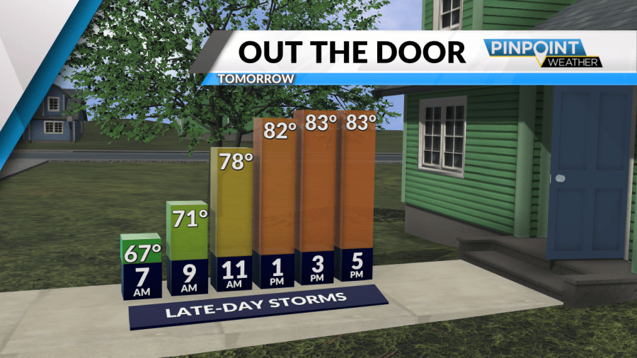
Some heavy showers or storms could linger later than usual into the night, up until midnight or so. By Friday morning, showers and storms are done, but patchy fog is possible as you head out the door.
Click here to see our latest Pinpoint Weather forecast! 🌤️🌦️
Friday will feature more of the same: Dry in the morning and early afternoon, with more spotty, possibly severe storms, developing by late afternoon and evening. Stay weather aware!
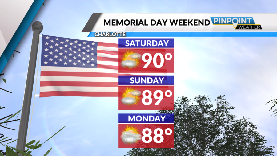
As for the Memorial Day and Coca-Cola 600 weekend, don’t cancel any outside plans! It’ll be hot and humid, that’s for sure, with highs in the upper 80s to around 90.
But although it likely won’t stay completely dry everywhere, we’re not talking any washouts. Just be aware that you may have to take cover briefly for a downpour or storm!
Tonight: Lingering showers/storms early, then some patchy fog. Low 66.
Friday: Partly cloudy. PM showers and storms develop. High 85.
Copyright 2024 Nexstar Media, Inc. All rights reserved. This material may not be published, broadcast, rewritten, or redistributed.
For the latest news, weather, sports, and streaming video, head to Queen City News.

