
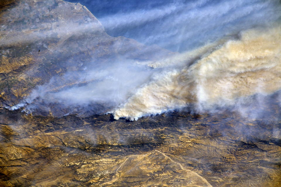
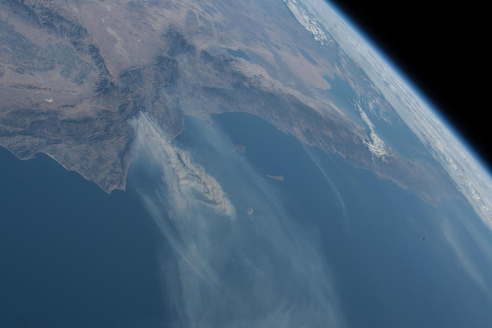
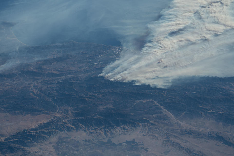
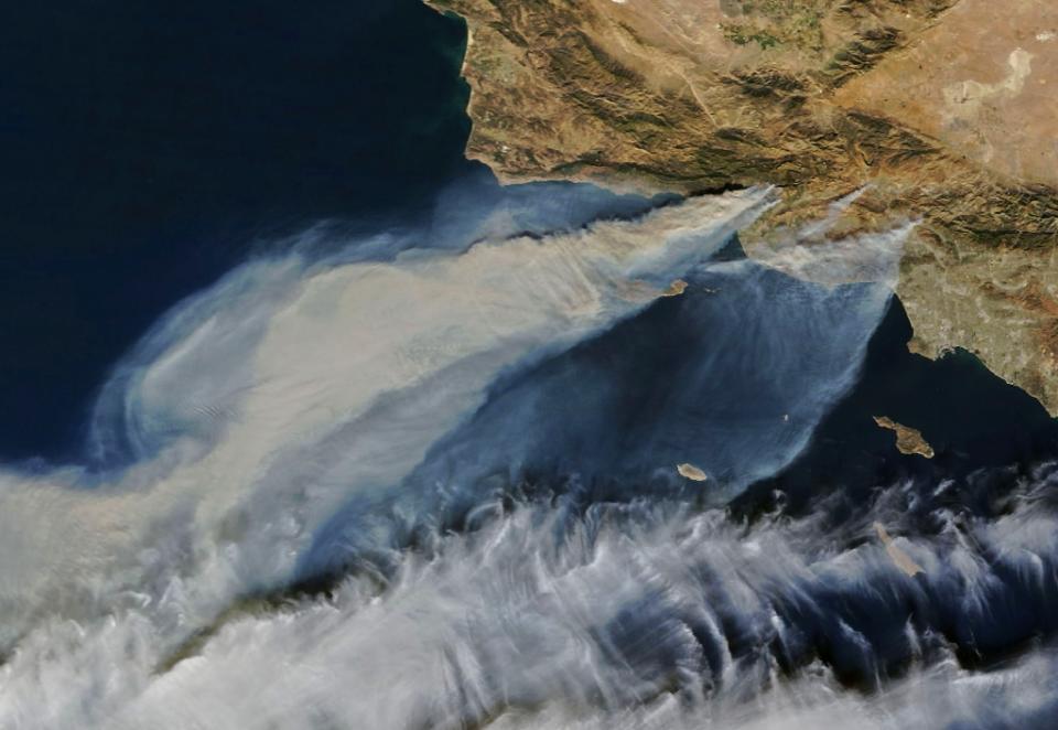
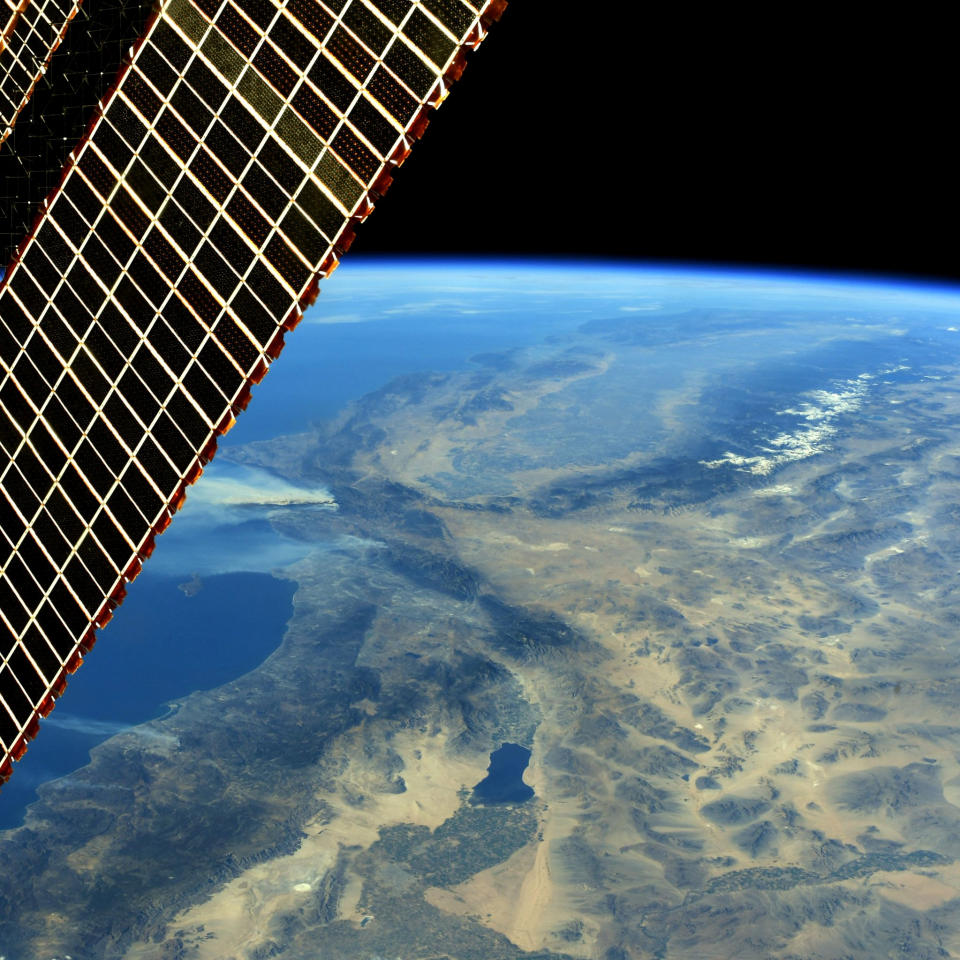
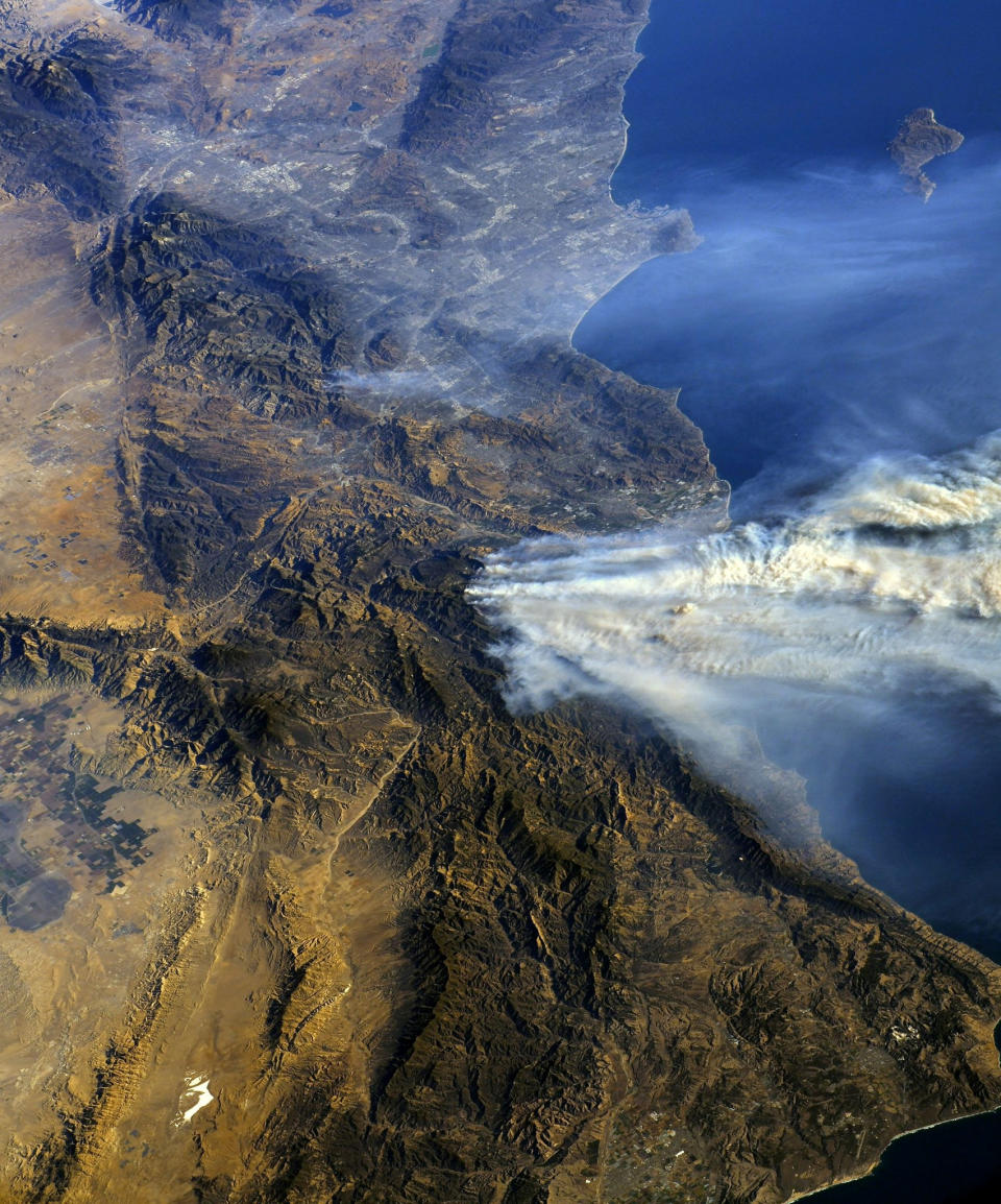
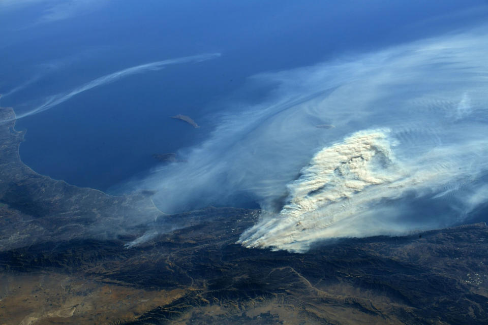
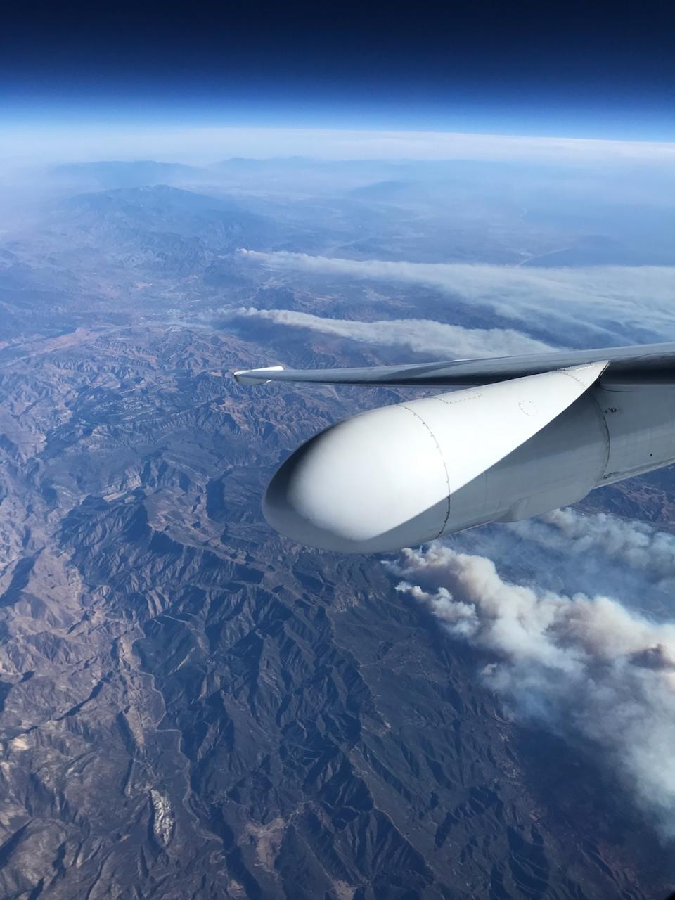
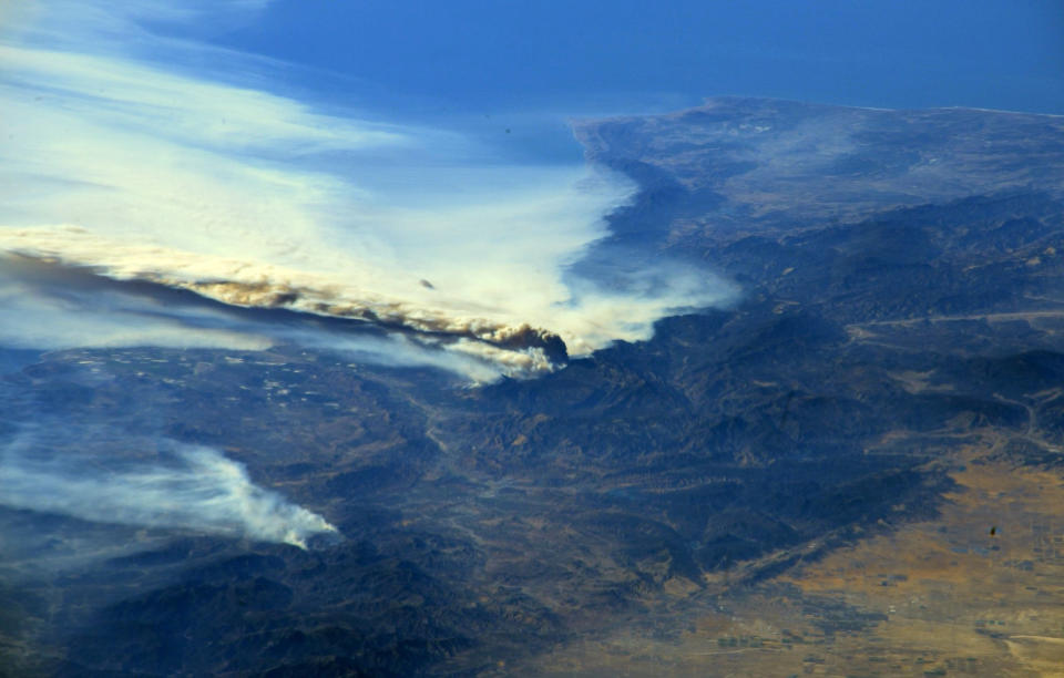
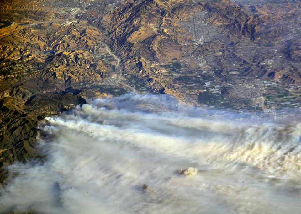
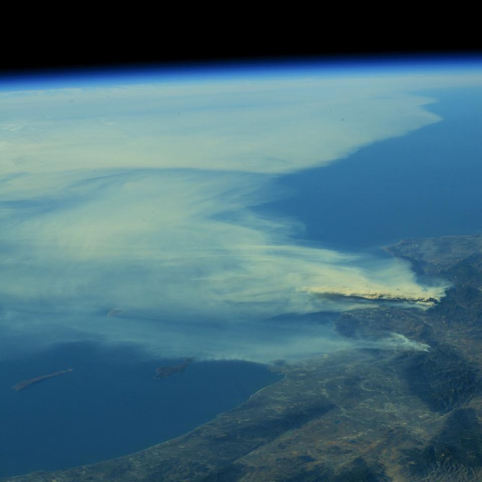
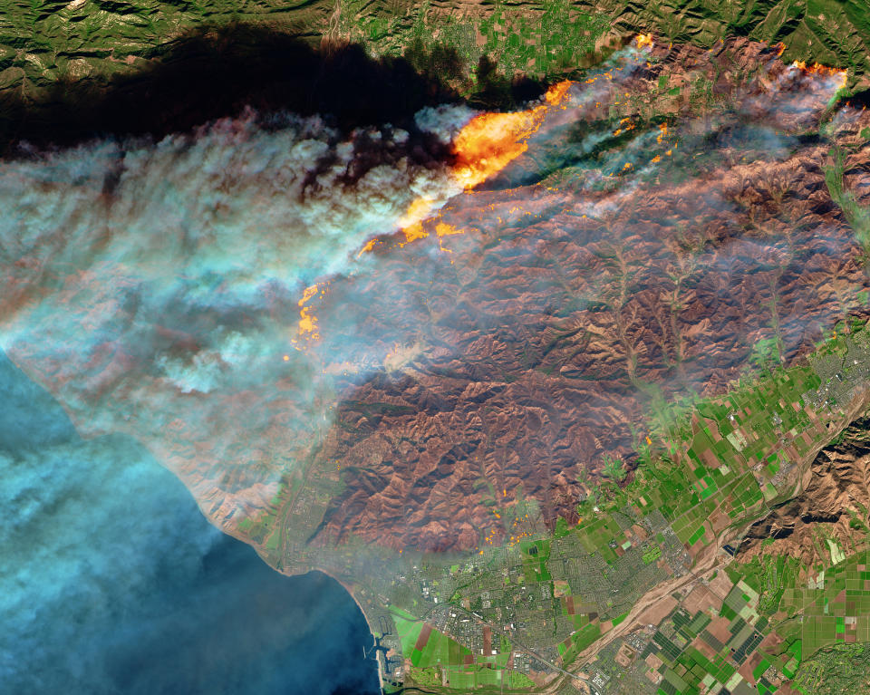
Striking NASA satellite views of the California wildfires


A week of destructive fires in Southern California is ending but danger still looms.
Even as firefighters made progress containing six major wildfires from Santa Barbara to San Diego County and most evacuees were allowed to return home, predicted gusts of up to 50 mph (80 kph) through Sunday posed a threat of flaring up existing blazes or spreading new ones. High fire risk is expected to last into January.
Overall, the fires have destroyed nearly 800 homes and other buildings, killed dozens of horses and forced more than 200,000 people to flee flames that have burned over 270 square miles since Monday, Dec. 4. (AP)
Here’s a look at NASA photos taken from the International Space Station and from NASA Armstrong Flight Research Center’s ER-2 aircraft.
See more news-related photo galleries and follow us on Yahoo News Photo Twitter and Tumblr.
