StormTracker 6 monitoring potential for severe storms

LANSING, Mich. (WLNS) — The StormTracker 6 Weather Team is tracking the chance for severe weather across Mid-Michigan tonight into early Wednesday morning.
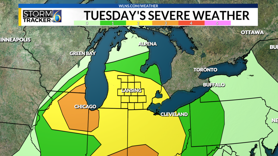
A few showers will be possible this evening, with the main line of storms looking to move into the area between 9 o’clock and exit by 2 am Wednesday.

These storms do have the potential of being severe, bringing damaging winds (with gusts of 60+ mph) and the chance for large hail (up to an inch in diameter) to Mid-Michigan. We also cannot rule out the chance of an isolated tornado in the area. With the timing of these storms occurring overnight, be sure you have multiple ways to receive severe weather alerts


After the chance for severe weather leaves the area, a strong cold front will move through Mid-Michigan, causing a rapid drop in temperatures.
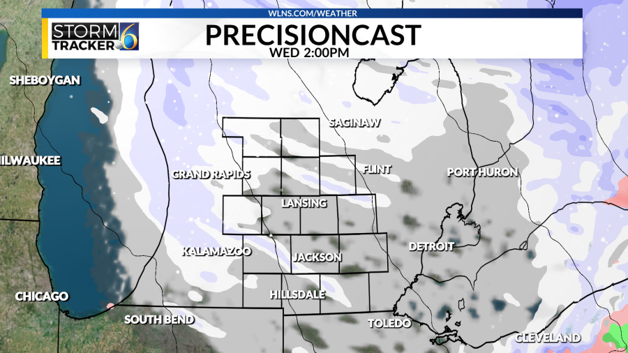
As a result, we could see a flash freeze in the area, with any residual moisture on the roads from tonight’s storms potentially freezing by Wednesday afternoon. This cold front will also cause winds to remain gusty throughout the day.
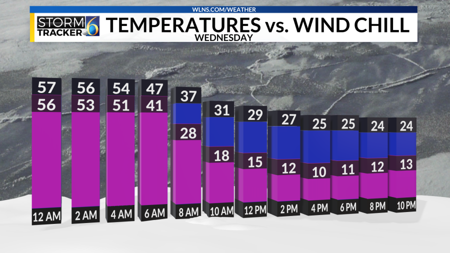
A Wind Advisory will be in place for Mid-Michigan from 7 am to 7 pm on Wednesday, with the chance for gusts near 50 miles per hour. These breezy conditions will cause wind chill temperatures to fall into the low teens by Wednesday afternoon, which could be a 40-degree drop within 12 hours.
For the latest news, weather, sports, and streaming video, head to WLNS 6 News.

