Storms update:Tornado Watch underway
EDITOR'S NOTE: As thunderstorms hit the area, this story will be updated.
Lake City Elementary School is being released at 11 a.m. Wednesday because of a large water main break in the town of Rocky Top/Lake City. According to Anderson County Schools (Tenn.) information, people should pick up their child using the car ride lane. Do not come to the front office or go into the bus lane. The water main break is expected to leave the school without water for three or more hours.
The water main problem has since been fixed, according to a Facebook post by the Rocky Top government.
Weather warnings - Tornado Watch added
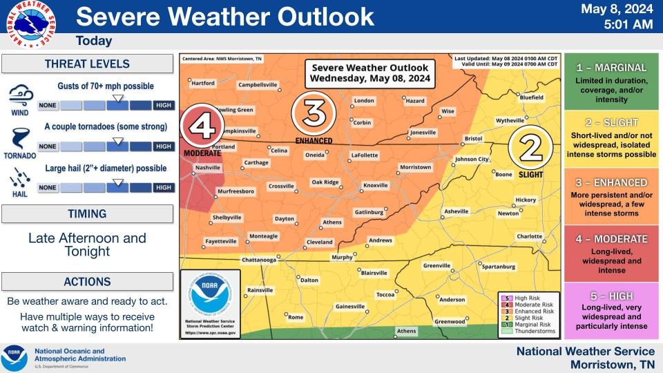
Oak Ridge and the surrounding area is under a Hazardous Weather Outlook, a Flood Watch, a Severe Thunderstorm Watch, and now a Tornado Watch from the National Weather Service.
"An outbreak of severe weather is increasingly likely across much of the Mid-South, including into our area from late this afternoon through tonight. All severe hazards are possible, including widespread damaging winds, very large hail to golf ball size or larger, and tornadoes, some of which could be strong. The tornado threat is highest along and west of Interstate 75. In addition to the severe hazards, heavy rainfall is likely, due to many rounds of showers and storms. Scattered to possibly numerous instances of flooding are likely with the greatest threat along and west of Interstate 75. This threat will be most amplified from the evening until early Thursday morning," the Hazardous Weather Outlook reads.
The Tornado Watch is through midnight Thursday.
This article originally appeared on Oakridger: Storms update:Tornado Watch underway

