Storm Track 3 Forecast: Unsettled Friday night, severe storms early next week
A cold front is cutting across the state with a higher chance of new storm develop ahead of it through this evening.

Areas mainly along and East of the Turnpike stand a chance of a hit or miss shower or storm. A more robust storm could be capable of producing marginally severe hail and gusty winds. This should exit early tonight.
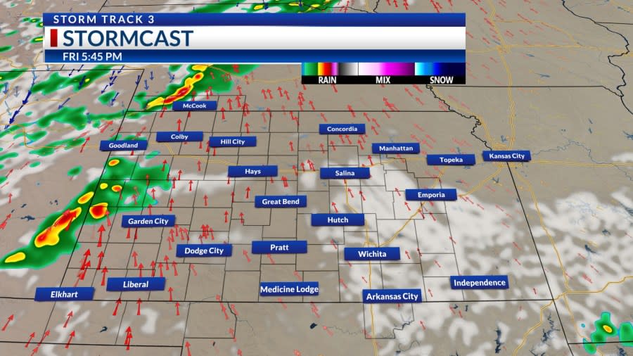
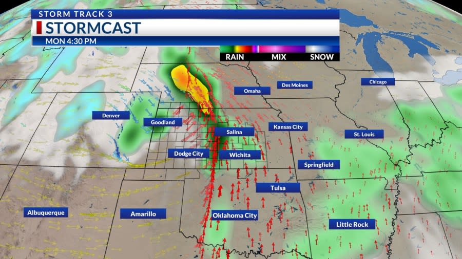
We will then look to another system arriving Friday night. Most of Friday will be dry until after 7 PM. Storms will enter Northwest Kansas first.
This complex of heavy rain and thunder will track all across the state. Most stand a chance of picking up at least some rainfall. Some may benefit more than others.
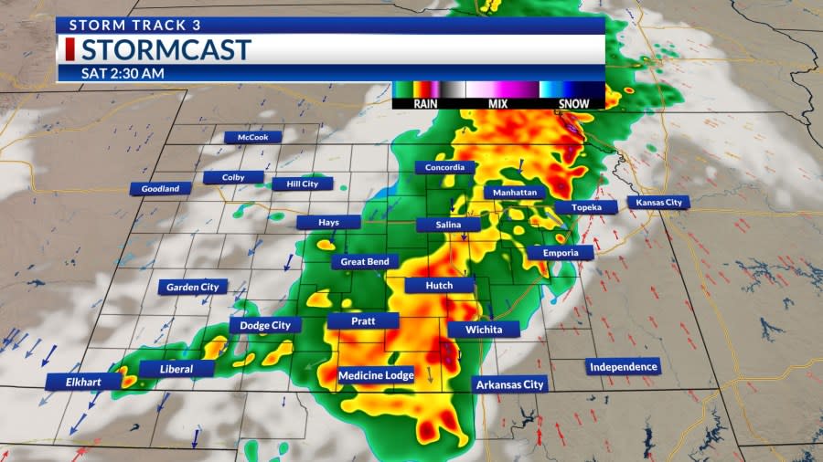
There is also enough instability available to produce some marginally severe hail and damaging winds. Any activity exits the first half of Saturday.
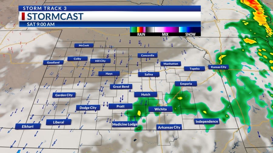
Additional showers and storms will fester near the Kansas/Oklahoma state line late Saturday. There could be some leftovers on Sunday before we anticipate an even strong system. By Monday, the atmosphere will become primed for another round of severe weather.
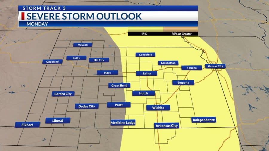
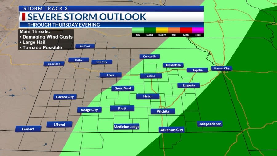
All hazards are possible from large hail to damaging winds and a tornado or two. Greatest risk is from near I-135 and points to the east. We will need to fine-tune the details of this convection or storms as we get closer to Monday afternoon and evening.
Temperatures next week look pleasant behind the front. There may be a few small waves later next week that could pop a shower or a storm, but widespread severe weather is not expected after Monday.
KSN Storm Track 3 Forecast from Chief Meteorologist Lisa Teachman:
Wichita:
Tonight: Partly cloudy. 10% chance of showers and storms. Lo: 52 Wind: NE 8-18
Tomorrow: Partly cloudy. 10% chance of showers and storms. Hi: 74 Wind: NE/SE 8-18
Tomorrow Night: Partly to mostly cloudy, breezy. 60% chance of showers and storms. Lo: 56 Wind: SE/N 10-20
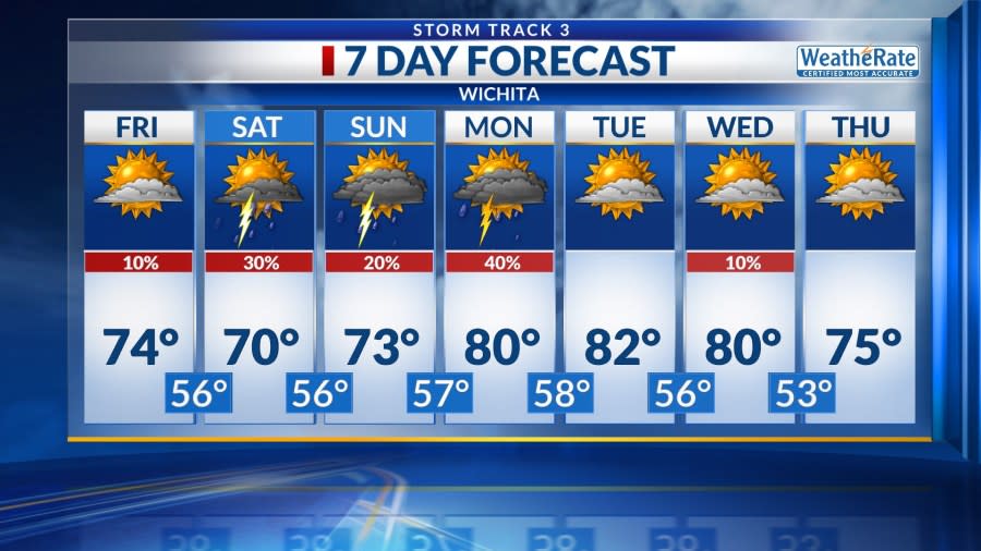
Wichita Weekly
Sat: Hi: 70 Lo: 56 Mostly to partly cloudy, breezy. 30% chance of showers and storms.
Sun: Hi: 73 Lo: 57 Mostly cloudy. 20% chance of showers and storms.
Mon: Hi: 80 Lo: 58 Mostly to partly cloudy, windy. 40% chance of showers and storms.
Tue: Hi: 82 Lo: 56 Partly cloudy, breezy.
Wed: Hi: 80 Lo: 53 Partly cloudy, windy. 10% chance of showers and storms.
Thu: Hi: 75 Lo: 52 Partly cloudy, breezy.
–Chief Meteorologist Lisa Teachman
For the latest news, weather, sports, and streaming video, head to KSN-TV.

