Storm reports and photos: Tornadoes and large hail hit parts of Kansas

WICHITA, Kan. (KSNW) — The KSN Storm Track 3 Weather team tracked the latest round of storms on Tuesday across eastern and southeastern Kansas. The storms brought tornadoes and large hail to the area.
KSN Chief Meteorologist Lisa Teachman, Meteorologist Lucy Doll and Meteorologist Jack Boston tracked the storms from the KSN News 3 Weather Center. KSN Meteorologist Jackey Maney was in KSN Storm Tracker 3, chasing weather in the area of the tornado watch. Storm Tracker Tyler Kurtz was in the Wichita area, and Storm Tracker Jacob Honeycutt was in the Emporia area.Kurtz shared the following video just before 4 p.m. Monday:
Storm reports:
10:04 p.m.
Tornado- 5 WNW Sedan – Chautauqua
9:47 p.m.
Structure fire in Newkirk, secondary to lightning direct strike to natural gas line
9:12 p.m.
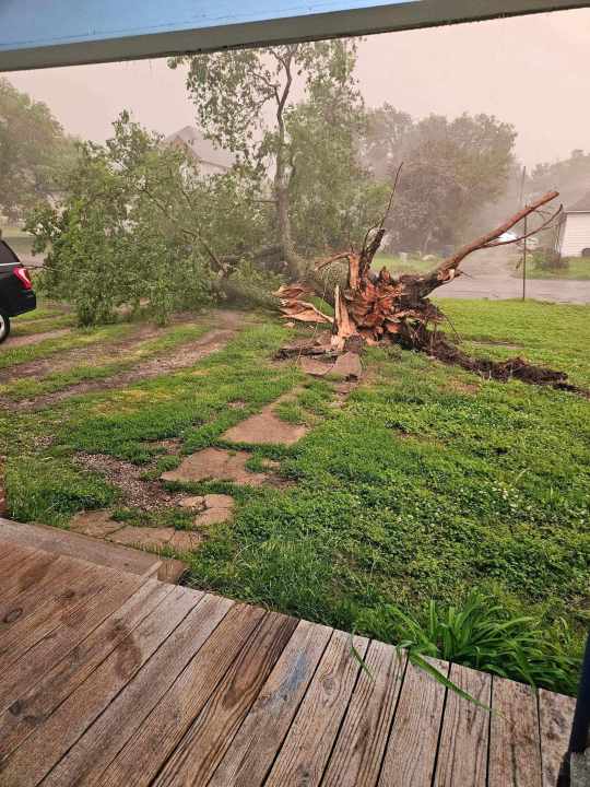
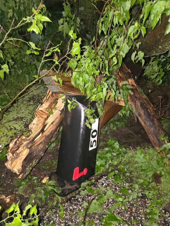
70 MPH winds – Sedan. Limbs and trees are down.
8:49 p.m.
60 MPH wind gusts – 7 N Arkansas City – Cowley County
70 MPH wind gusts – 7 Winfield – Cowley County
7:52 p.m.
Funnel cloud NW of Burden
7:33 p.m.
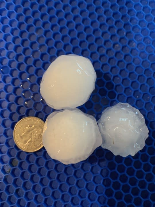
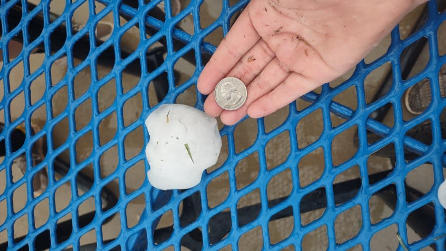
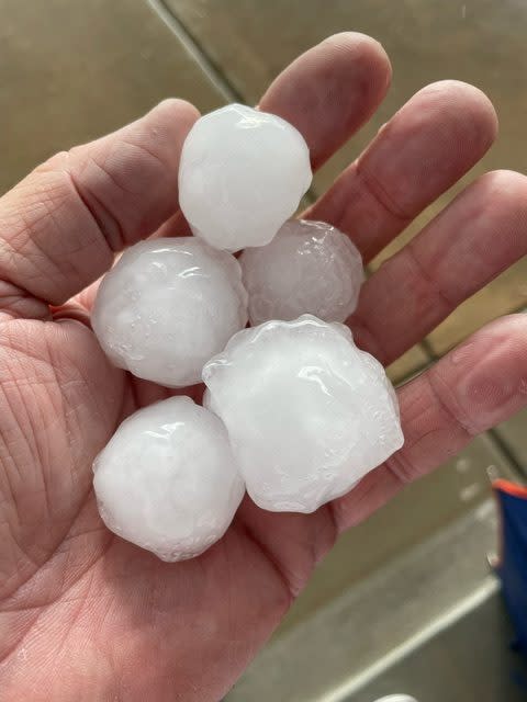
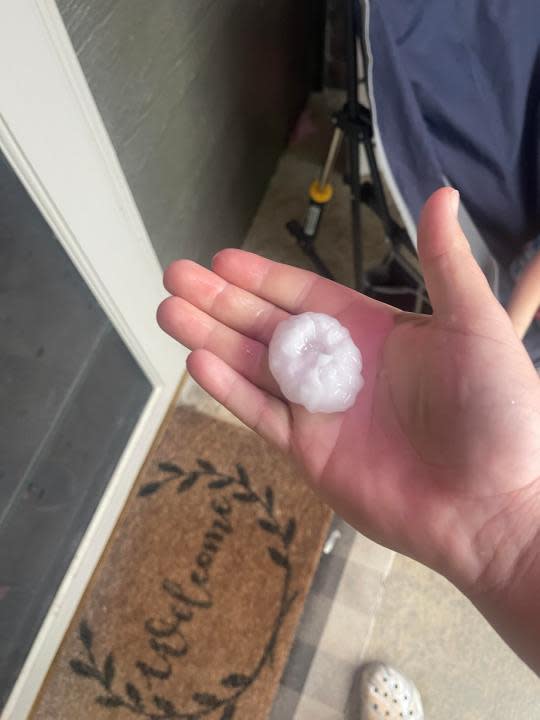
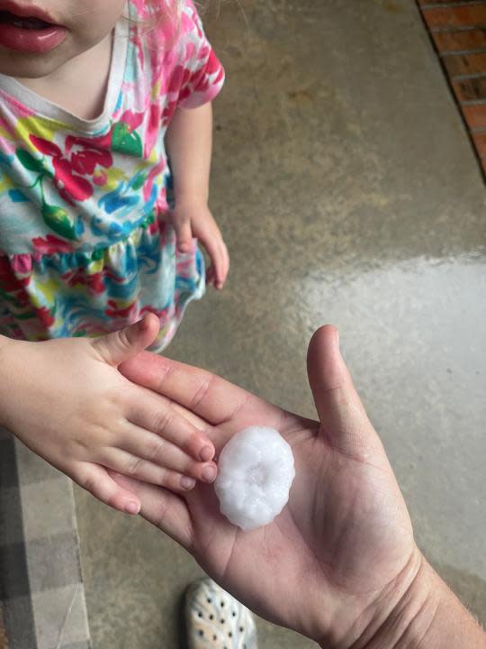
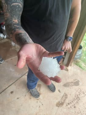
Baseball-sized hail – Anthony – Harper County
Golf ball-sized hail – Harper – Harper County
7:30 p.m.
60 MPH gust – 1 ENE Derby – Sedgwick County
Ping pong ball-sized hail – Anthony – Harper County
7:22 p.m.
Funnel cloud – 5 SSE Udall – Cowley County
Golf ball-sized hail – Andover – Butler County
Quarter-sized hail – Clearwater – Sedgwick County
Quarter-sized hail – Andover – Butler County
65 MPH Gusts – 1 WSW El Dorado – Butler County
Quarter-sized hail – 1 WSW El Dorado – Butler County
7:18 p.m.
Golf ball-sized hail – Harper – Harper county
Quarter-sized hail – 7 NE Winfield – Cowley County
Quarter-sized hail – 2 E Harper – Harper County
Quarter-sized hail – Conway Springs – Sumner County
Ping pong ball-sized hail – Anthony – Harper County
7:07 p.m.
Quarter-sized hail – 3 ESE Benton – Butler County
Tree limbs down – Towanda – Butler County
6:39 p.m.
Irrigation pivot blew onto the roadway at 60th and Emma Creek – 3 NNW Sedgwick – Harvey County
Quarter-sized hail – Wichita – Sedgwick County
Funnel cloud – 3 NW Augusta – Butler County
Golf ball-sized hail – Norwich – Kingman County
Quarter-sized hail – 1 WSW El Dorado – Butler County
Power poles down – 1 WSE El Dorado – Butler County
Quarter-sized hail – 1 WNW Benton – Butler County
Ping-pong-sized hail – Park City – Sedgwick County
6:11 p.m.
Power poles down at 125th Street and Meridian – 3 E Sedgwick – Sedgwick County
Ping-pong-sized hail – Park City – Sedgwick County
Quarter-sized hail – Douglass – Butler County
6:03 p.m.
Golf ball-sized hail – 3 N Kechi – Sedgwick County
6:02 p.m.
Funnel cloud – 3 W Valley Center – Sedgwick County
6:01 p.m.
Quarter-sized hail – 2 W Whitewater – Harvey County
Quarter-sized hail – 5 WSW Newton – Harvey County
Quarter-sized hail – Colwich – Sedgwick County
5:36 p.m.
Golf ball-sized hail – 2 S Newton – Harvey County
5:35 p.m.
Half-dollar-sized hail – 4 S Mt Vernon – Kingman County
5:17 p.m.
Quarter-sized hail – Mount Hope – Sedgwick County
Quarter-sized hail – 4 Nw Burdick – Morris County
5:07 p.m.
Quarter-sized hail – White City – Morris County
5:06 p.m.
Landspout – 4 ESE Burton – Harvey County
4:59 p.m.
Quarter-sized hail – 5 NW Halstead – Harvey County
4:58 p.m.
Landspout reported northwest of 101 Street and Interstate 135 – Harvey County
Trained spotter reports rotation 308 W. Grand Ave. – Marion County
Possible funnel Kansas Highway 96 and West Mount Hope – Sedgwick County
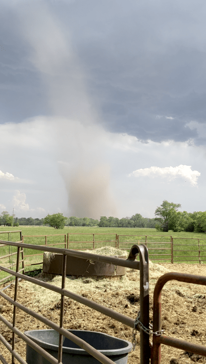
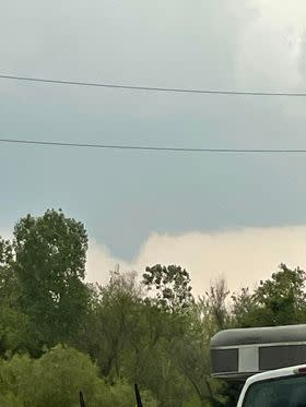
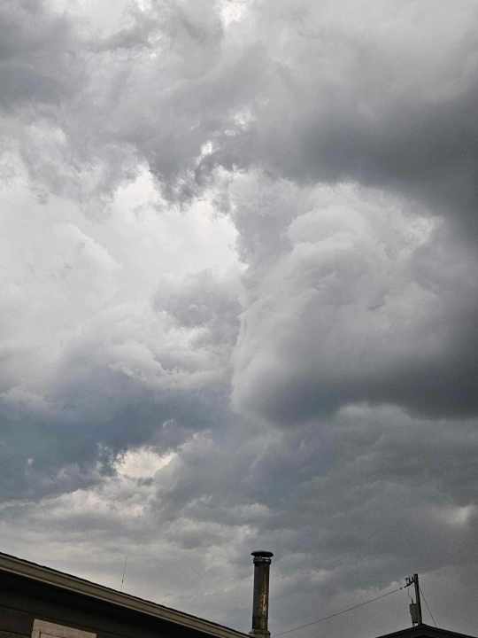
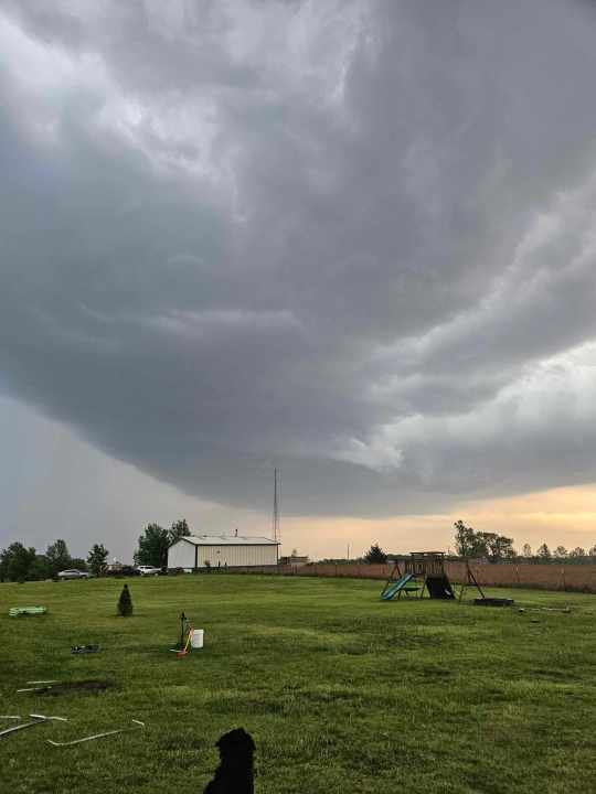
Weather photos:
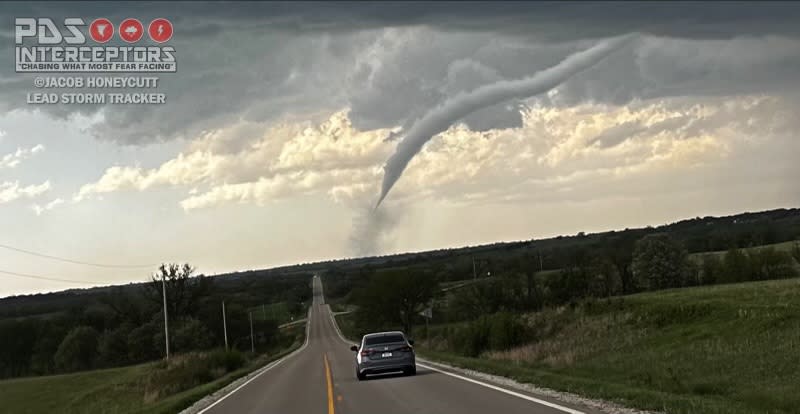
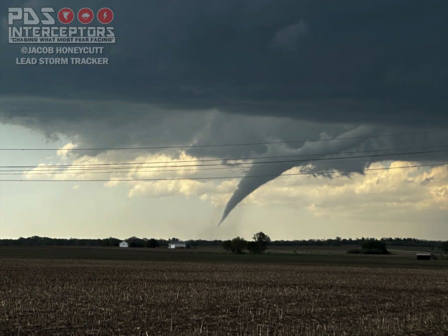
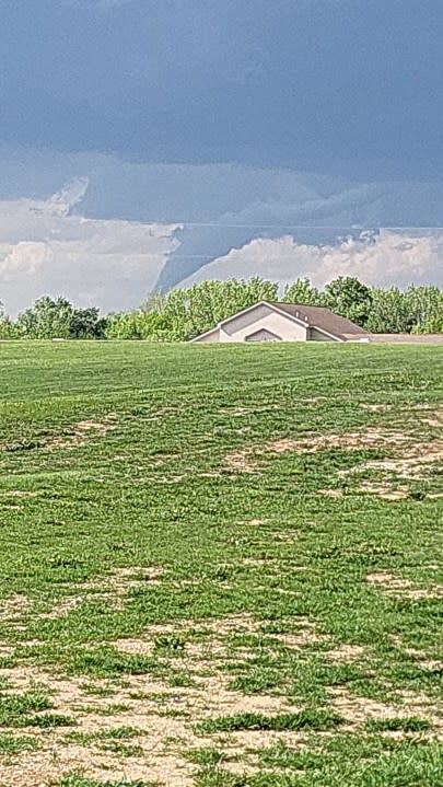
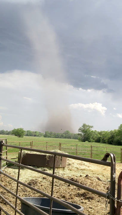
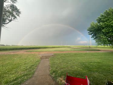
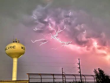
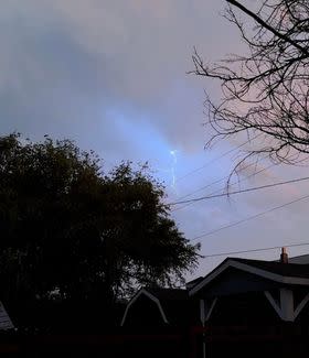
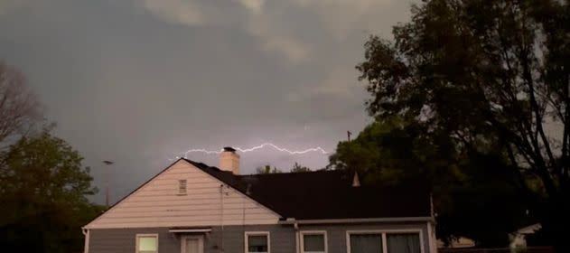
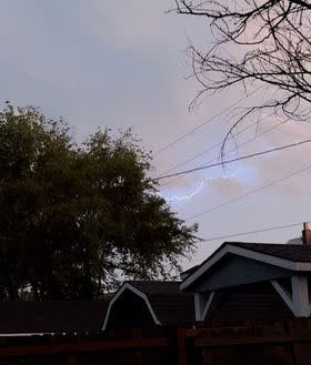
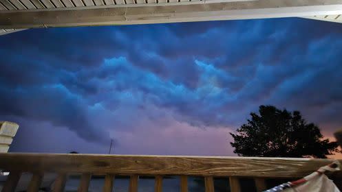
Tornado seen in Westmoreland on April 30, 2024 (Courtesy: Storm Tracker Jacob Honeycutt) Tornado seen in Westmoreland on April 30, 2024 (Courtesy: Storm Tracker Jacob Honeycutt) Tornado seen in Wamego on April 30, 2024 around 5:30 p.m. (Courtesy: Malachi Weimer) Landspout seen southeast of Hutchinson on April 30, 2024 before 5 p.m. (Courtesy: Steven Chambers) Landspout seen southeast of Hutchinson on April 30, 2024 before 5 p.m. (Courtesy: Steven Chambers) Funnel photo from Carrie Dixson nw of Udall on 4-30 Cloud photos from Jeff Whitfield in Udall on 4-30 Cloud photos from Jeff Whitfield in Udall on 4-30 Rainbow photo from Devan Merrifield in Anthony on 4-30 Lightning photo from Aaron Blake in Mulvane on 4-30 Lightning photos from Jayde Shively in Augusta on 4-30 Lightning photos from Jayde Shively in Augusta on 4-30 Lightning photos from Jayde Shively in Augusta on 4-30 Purple cloud photo from Amy Jarboe in Rural Chautauqua County on 4-30
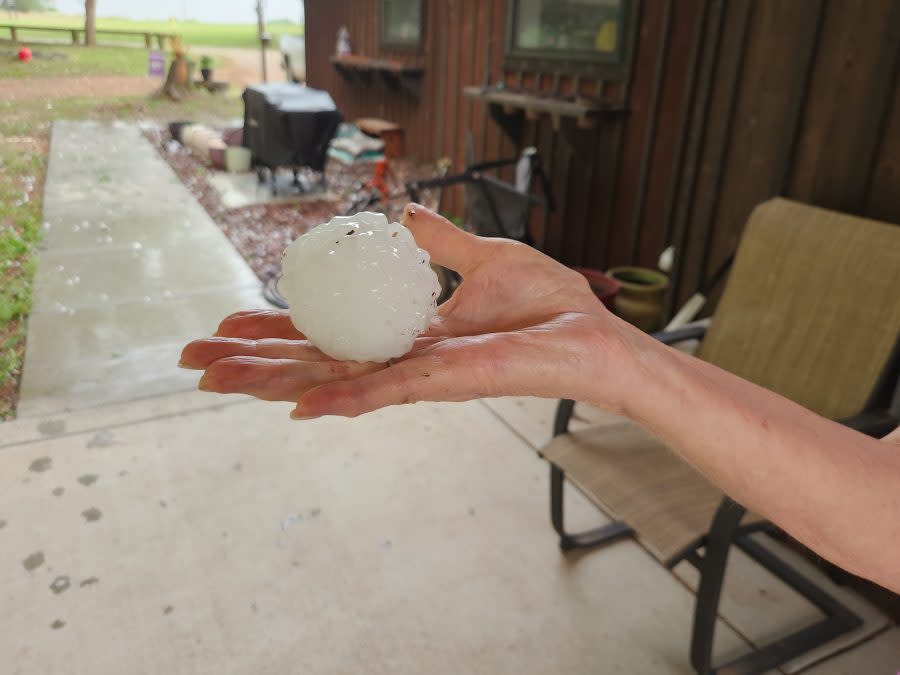
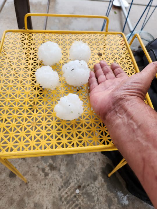
Anthony hail at 7:44 p.m. on April 30, 2024 (Courtesy: Chet Barber) Anthony hail at 7:44 p.m. on April 30, 2024 (Courtesy: Chet Barber) Kechi hail on April 30, 2024 (Courtesy: Angela LeSage) Harper hail on April 30, 2024 (Courtesy: Ashley Hostetler) Harper hail on April 30, 2024 (Courtesy: Ashley Hostetler) Clearwater hail on April 30, 2024 (Courtesy: Kamdyn Johnson) Harper County hail at 7:05 p.m. on April 30, 2024 (Courtesy: Nicole Hacker) Bel Aire hail at 6:15 p.m. on April 30, 2024 (Courtesy: Gary Dietz) Park City hail at 6:25 p.m. on April 30, 2024 (Courtesy: Jeff Stone) Valley Center hail at 5:40 p.m. on April 30, 2024 (Courteys: Chase Lumley) Valley Center hail at 5:40 p.m. on April 30, 2024 (Courteys: Chase Lumley) Hailstone photo courtesy Jack E. Skinner in Clearwater on 4-30. Hail photo from Devan Merrifield in Anthony on 4-30


Storm damage photos from Jamin Dodson in Wellington on 4-30 Storm damage photos from Jamin Dodson in Wellington on 4-30 Storm damage photos from Jamin Dodson in Wellington on 4-30 Storm damage photos from Jamin Dodson in Wellington on 4-30

Upload your photos:
TRACKING SEVERE WEATHER
In the event of expected severe weather, KSN’s live stream replay will be shown without delay.
Severe Weather Preparedness: Interactive map shows tornado shelters in the U.S.
Interactive Radar (Control yourself)
CURRENT WEATHER WARNINGS AND WATCHES
FREE APPS
KSN STORM TRACKER 3 WEATHER APP
SOCIAL MEDIA
For the latest news, weather, sports, and streaming video, head to KSN-TV.

