Storm reports: Tornado confirmed in northwest Kansas Thursday

WICHITA, Kan. (KSNW) — The KSN Storm Track 3 Team has confirmed a tornado east of Highway 27 in Bird City Thursday.
KSN Chief Meteorologist Lisa Teachman is tracking the weather from the KSN News 3 Weather Center. KSN Meteorologist Jack Many is in KSN Storm Tracker 3 chasing the weather in northwest Kansas.
A tornado watch that was issued for northwest Kansas has been extended into western Kansas until 12 a.m. Friday.

Severe weather expected Thursday, Saturday too
Storm reports:
The Storm Track 3 Team is also tracking tornados, wind gust speeds, and the size of hailstones falling across the state.
7:18 p.m.
Quarter-sized hail – Leoti – Wichita County
Hen egg-sized hail – 1 E Page City – Logan County
7:11 p.m.
Quarter-sized hail – 1 N Colby – Thomas County
Half dollar-sized hail – Tribune – Greeley County
Golf ball-sized hail – 1 SW Russell Springs – Logan County
7:05 p.m.
70 MPH wind gusts – 9 SSE Sharon Springs – Wallace County
7:03 p.m.
60 MPH wind gusts – 8 N Marienthal – Wichita County
Golf ball-sized hail – 4 N Syracuse – Hamilton County
6:58 p.m.
Quarter-sized hail – 3 S McCook – Red Willow County NE
Golf ball-sized hail – 3 W Mingo – Thomas County
Ping pong ball-sized hail – 2 S Brewster – Thomas County
Rainfall of 1.50″ – 3 S McCook – Red Willow County NE
Hen egg-sized hail – 10 N Syracuse – Hamilton County
Golf ball-sized hail – 3 N Syracuse – Hamilton County
6:50 p.m.
Quarter-sized hail – 1 E Wallace – Wallace County
6:44 p.m.
Quarter-sized hail – Sharon Springs – Wallace County
60 MPH Wind gusts – Sharon Springs – Wallace County
6:40 p.m.
Ping pong ball-sized hail – 13 NNE Selkirik – Wichita County
6:36 p.m.
Ping pong ball-sized hail – Page City – Logan County
6:30 p.m.
Quarter-sized hail – 10 S Bird City – Cheyenne County
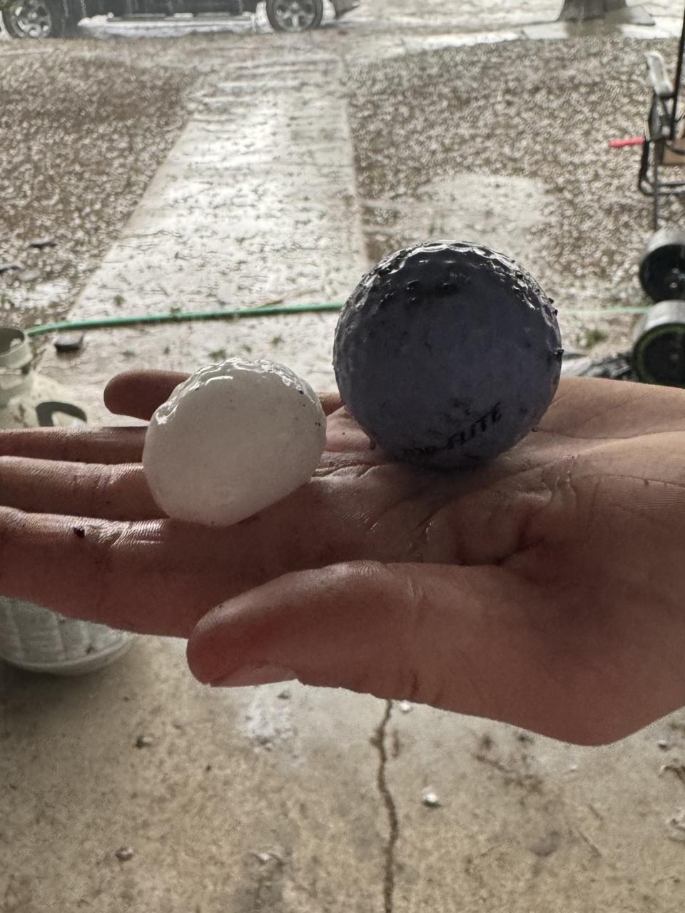
Tennis ball-sized hail – 3 N Russell Springs – Logan County
6:25 p.m.
Golf ball-sized hail – Russell Springs – Logan County
Quarter-sized hail – 2 S Brewster – Thomas County
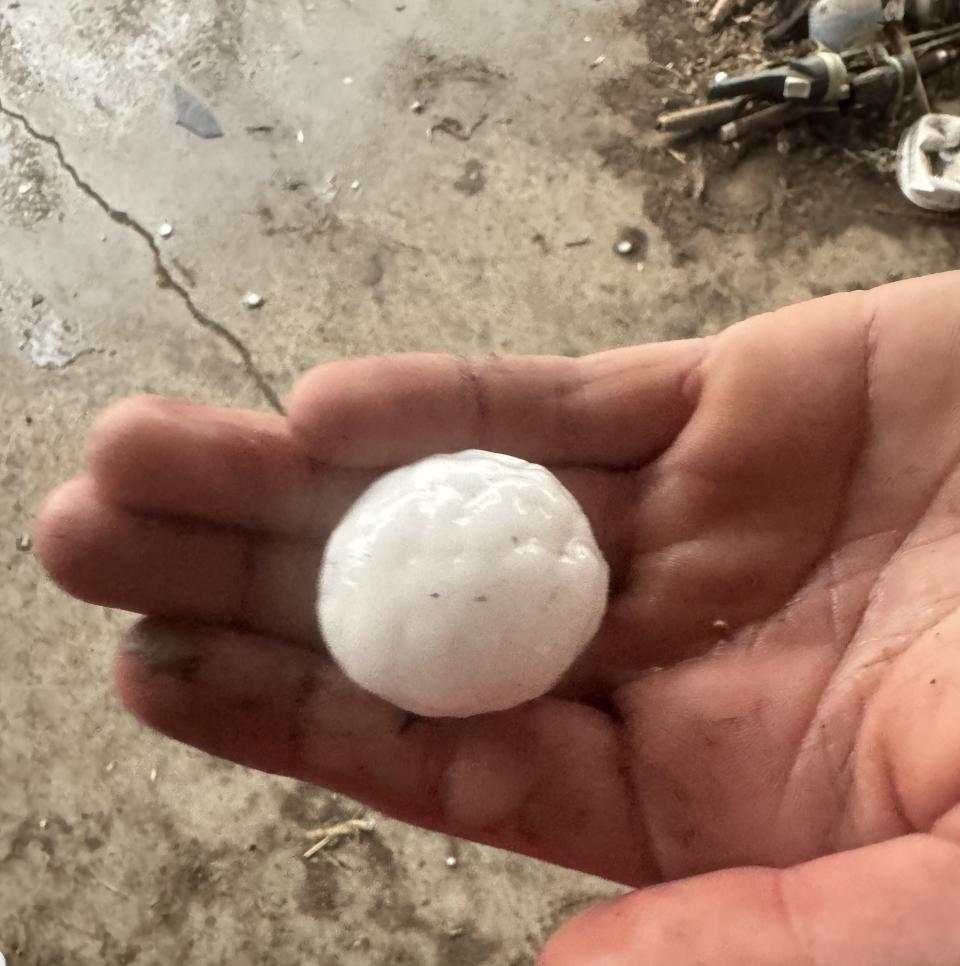
Half dollar-sized hail – Tribune – Greely County
6:16 p.m.
Half dollar-sized hail – Tribune – Greeley County
Quarter-sized hail – Leoti – Wichita County
Golf ball-sized hail – 11 N Leoti – Wichita County
Quarter-sized hail – 7 WSW Syracuse – Hamilton County
6:09 p.m.
Hen egg-sized hail (2″) – 9 N Colby – Thomas County
6:06 p.m.
Golf ball-sized hail – 5 S Russell Springs – Logan County
Baseball-sized hail – 2 SSE Russell Springs – Logan County
5:59 p.m.
Quarter-sized hail – SSW Russell Springs – Logan County
From Twitter: Baseball-sized hail – Russell Springs – Logan County
5:51 p.m.
Quarter-sized hail – Colby – Thomas County
Quarter-sized hail – 10 NNW Ludell – Rawlins County
Ping pong ball-sized hail – Ludell – Rawlins County
5:43 p.m.
Ping pong ball-sized hail – Colby – Thomas County
5:36 p.m.
Golf ball-sized hail – 7 W Richfield – Morton County
5:23 p.m.
Funnel cloud – 2 S Oakley – Logan County
5:21 p.m.
Quarter-sized hail – 14 NNE Saint Francis – Cheyenne County
Quarter-sized hail – 6 N Parks – Dundy County NE
Tornado east of HWY 27 – 10 SSW Bird City – Cheyenne County
Funnel cloud – 12 SSE Wheeler – Cheyenne County
Short-lived rope tornado with a duration of 5 min – 12 SSE Wheeler – Cheyenne County
Quarter-sized hail – 14 SSE Bird City – Cheyenne County
Ping pong ball-sized hail – 2 NNW Blakeman – Rawlins County
1:44 p.m.
Quarter-sized hail – 5 SSE Milford – Geary County
Quarter-sized hail – 4 ESE Council Grove – Morris County
KSN will provide more information as it becomes available on-air and online.
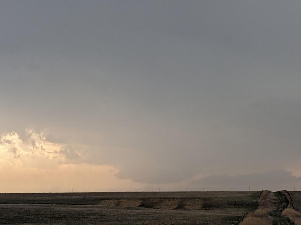
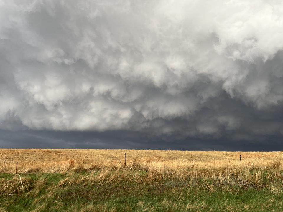
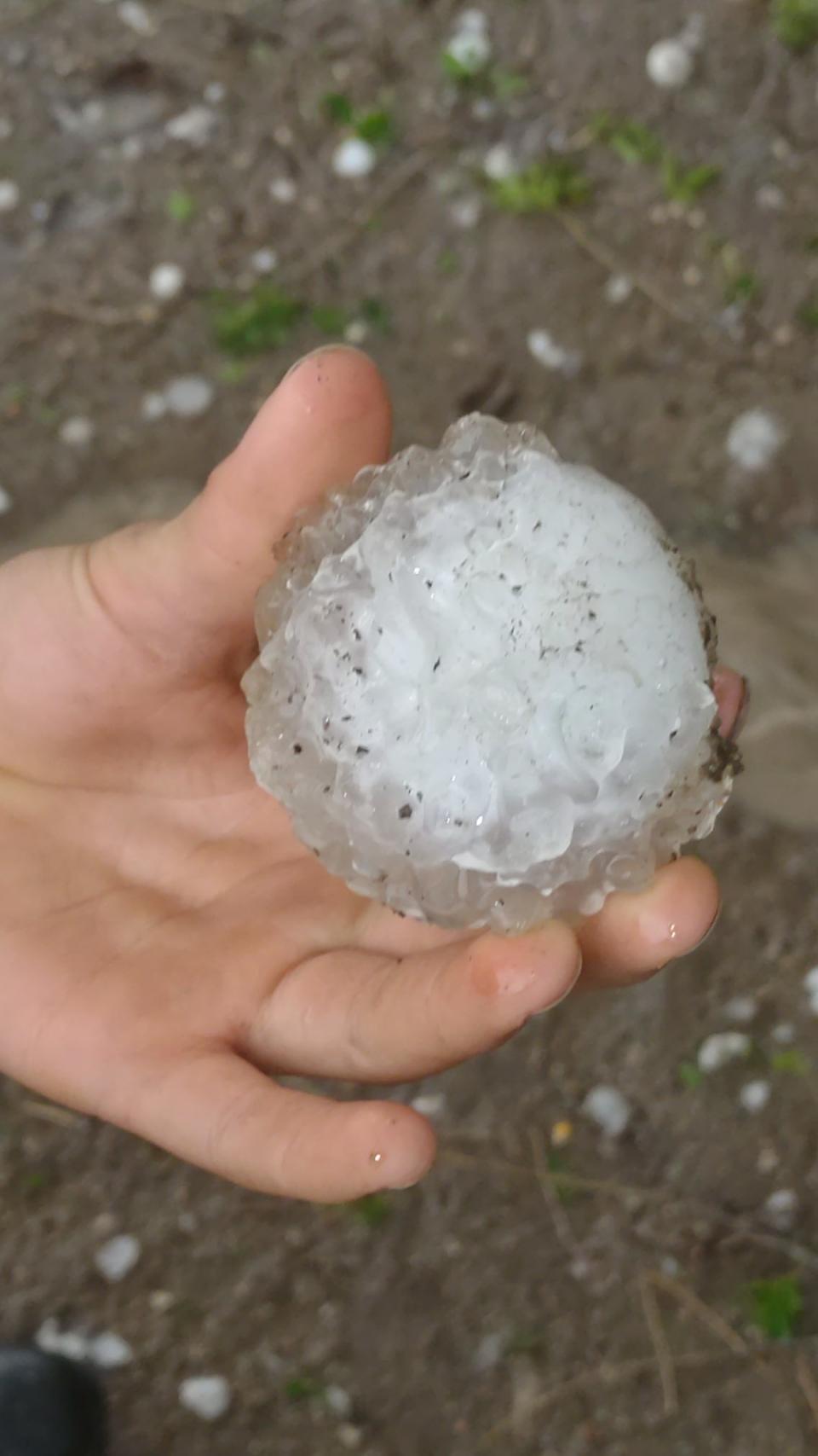
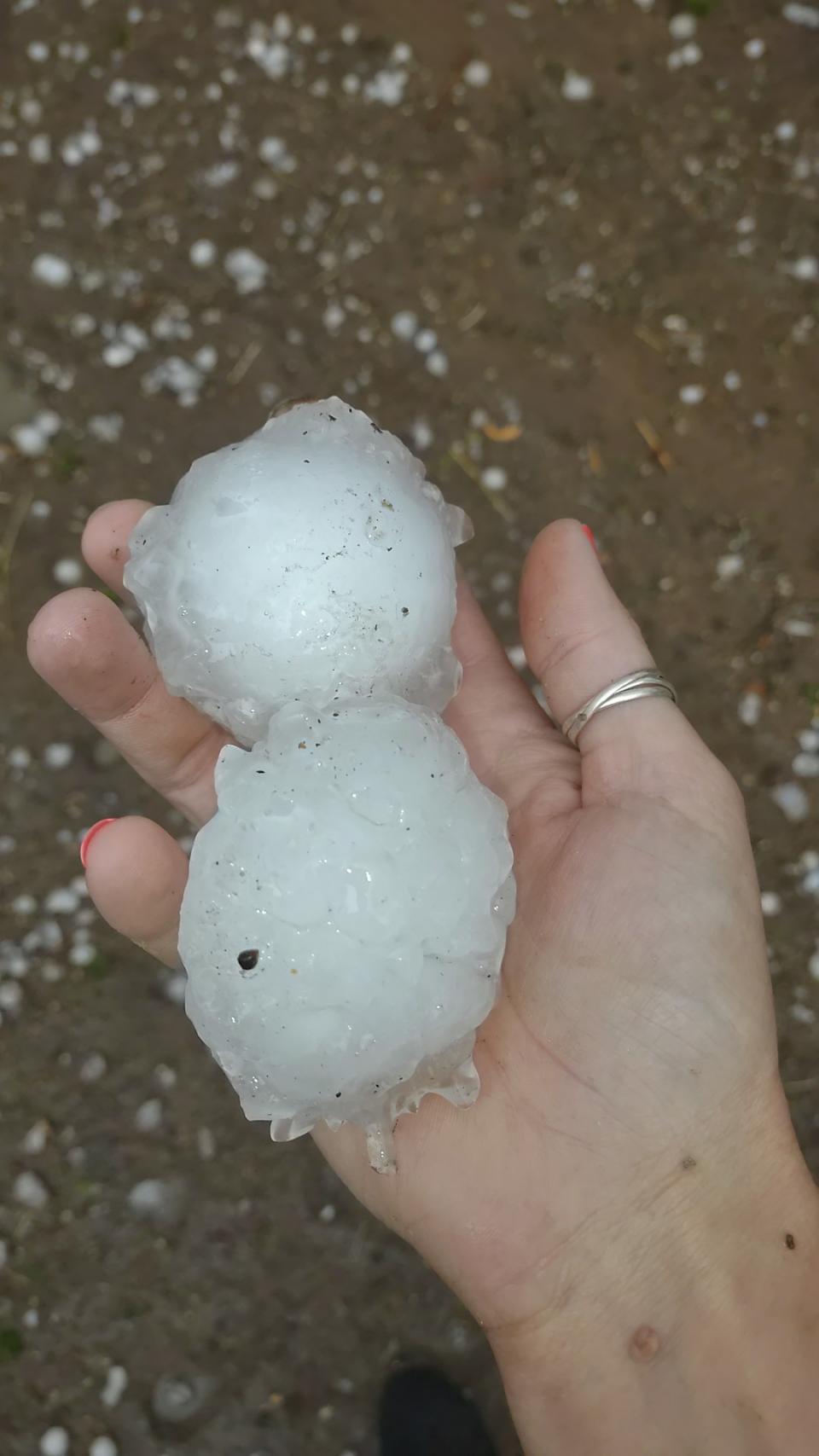
Wall cloud photo from the storm when it was in Logan County from Storm Tracker Lisa Dimmitt. It did produce a funnel. April 25, 2024/ Hail photos from Adriana Evans in Tribune Thursday Hail photos from Adriana Evans in Tribune Thursday Storm shot from Storm Tracker Tyler Kurtz near Brewster Thursday, April 25. Hail photos from Emily Kemp in Russell Springs on April 25, 2024 Hail photos from Emily Kemp in Russell Springs on April 25, 2024 Hail photos from Emily Kemp in Russell Springs on April 25, 2024

Have a weather photo? Click here to upload it to our community gallery.
Tracking Severe Weather:
RADARS:
Interactive Radar (Control yourself)
CURRENT WEATHER WARNINGS AND WATCHES
WATCHING THE KANSAS SKIES:
Free apps
KSN Storm Track 3 Weather App:
Google Download
KSN News App:
Social Media:
Keeping You Safe:
For the latest news, weather, sports, and streaming video, head to KSN-TV.

