Storm reports: Parts of Kansas under severe thunderstorm watch

WICHITA, Kan. (KSNW) — KSN Storm Track 3 Chief Meteorologist Lisa Teachman and the Storm Track 3 weather team are tracking rain, severe storms and snow into Thursday evening. KSN Storm Track 3 Meteorologist Jack Maney is tracking the storms Thursday in Storm Tracker 3.
The Storm Prediction Center has issued a Severe Thunderstorm Watch in several Kansas counties until 9 p.m. Thursday.
Kansas counties include:
Allen
Butler
Chautauqua
Cowley
Elk
Greenwood
Harper
Labette
Montgomery
Neosho
Sedgwick
Sumner
Wilson
Woodson

The NWS has included counties in Oklahoma as well:
Alfalfa
Craig
Grant
Kay
Nowata
Osage
Washington
Chief Meteorologist Lisa Teachman says that “thunderstorm development will ramp up over the next few hours, especially where the Severe Thunderstorm Watch is in effect.” KSN will provide more information as it becomes available on-air and online at ksn.com.
Showers, storms, and even some snow through Friday
The Storm Track 3 Team is also tracking snowfall reports for the KSN viewing area.
Friday, 9:a.m.
McDonald – Rawlins County – 2.8″
3 NNW Ruleton – Sherman County – 0.5″
Friday 8:30 a.m.
Haigler – Dundy County (Nebraska) – 7″
One mile south of Atwood – Rawlins County – 1.3″
Six miles north-northwest of Beardsley – Rawlins County – 2.3″
8:39 p.m.
Haigler in Dundy County, Nebraska, now up to 6” of snow!
1” of sleet 13N of Edson in Sherman County.
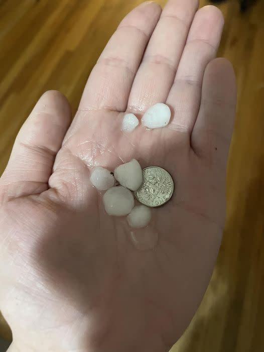
Quarter size hail in Benton.
5:18 p.m.
(Updated) Haigler, Nebraska (Dundy Co.) – 5.0″
2:06 p.m.
1 WNW Goodland (Sherman Co.) – 0.25″ (Pea-sized hail/graupel)
Haigler, Nebraska (Dundy Co.) – 1.0″
2 NNW Blakeman (Rawlins Co.) – 0.3″ (Sleet covered the ground in 15 minutes)
Saint Francis (Cheyenne Co.) – 2.5″
Several KSN viewers have sent in weather photos:
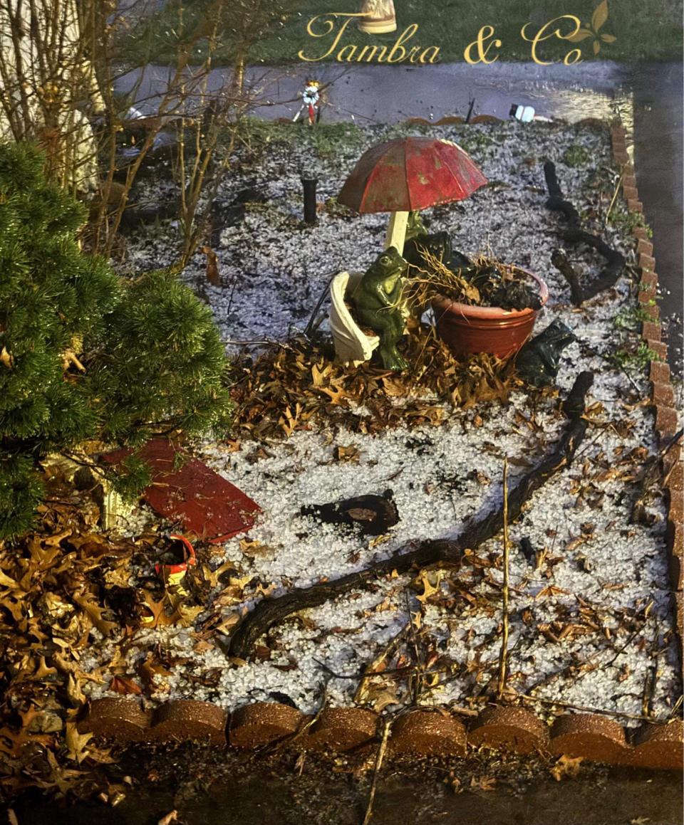
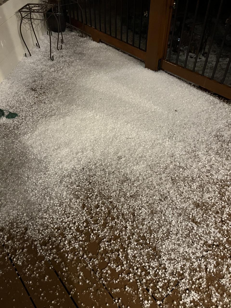
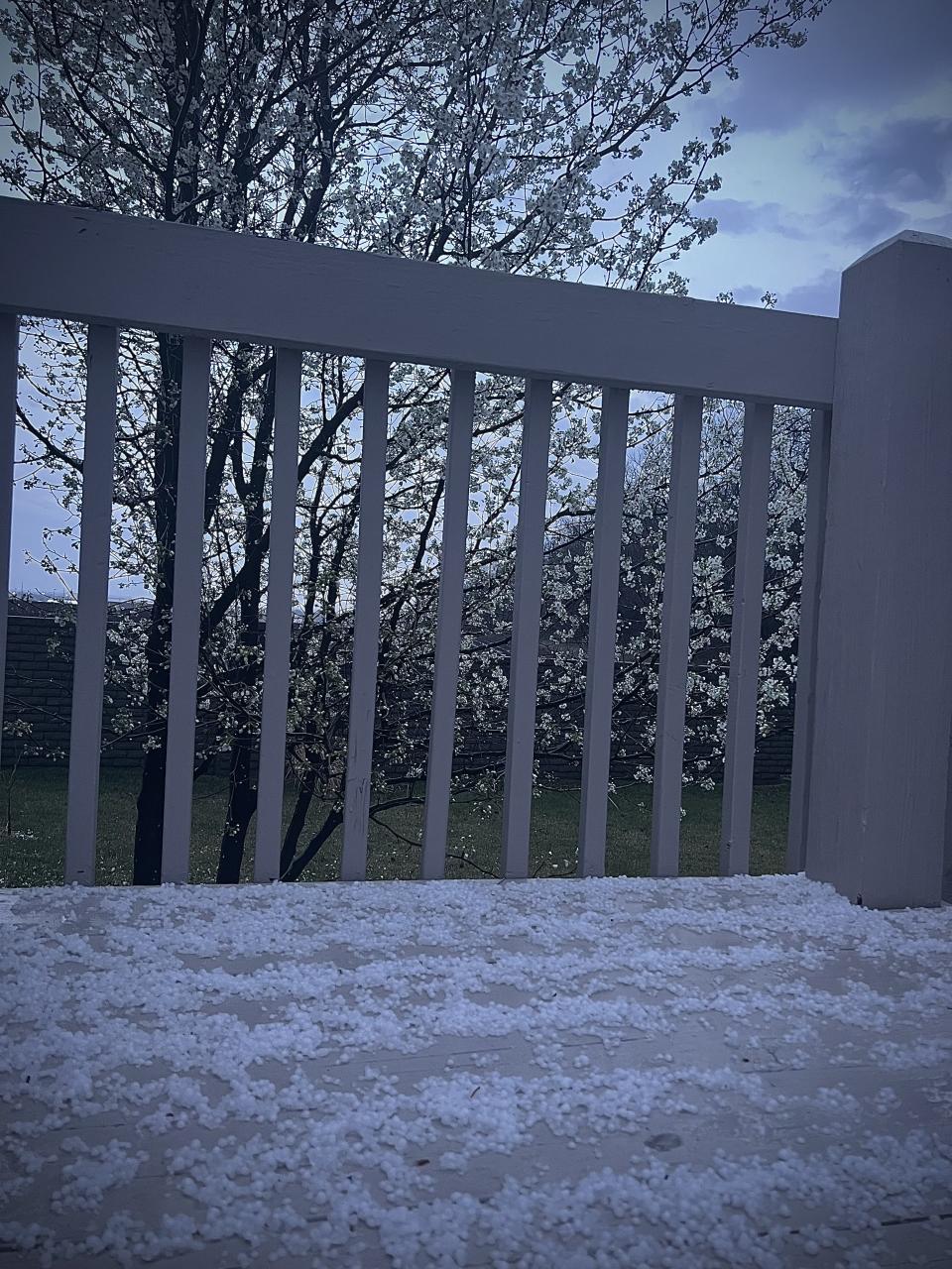
Tambra Hiser sent in this hail photo from Wichita around 8 p.m. Amanda Weber sent in these photos of hail that fell around 8:15 p.m. near Benton. Amanda Weber sent in these photos of hail that fell around 8:15 p.m. near Benton. Jackson’s first experience with hail! It fell in east Wichita around 7 p.m. KSN Meteorolgist captured this photo of pea to dime sized hail in east Wichita around 7 p.m. Xenophon Smith shared this photo of small hail from this morning in Derby.


Tracking Severe Weather:
RADARS:
Interactive Radar (Control yourself)
CURRENT WEATHER WARNINGS AND WATCHES
WATCHING THE KANSAS SKIES:
Free apps
KSN Storm Track 3 Weather App:
Google Download
KSN News App:
Social Media:
Keeping You Safe:
For the latest news, weather, sports, and streaming video, head to KSN-TV.

