South Carolina updates coastal hurricane evacuation zones as season nears
- Oops!Something went wrong.Please try again later.
NORTH CHARLESTON, S.C. (WCBD) – South Carolina’s emergency management leaders are refreshing the state’s coastal evacuation zones ahead of hurricane season.
State and local emergency management officials joined Governor Henry McMaster and law enforcement in North Charleston on Thursday morning to unveil the new evacuation zones. It’s the first major change to the zones in roughly 10 years.
Very active Atlantic hurricane season expected
Officials said the update better reflects the “evolving landscape of potential hazards” and population distribution across the region. Storm surge risk, flooding susceptibility, and best routes to ensure an effective evacuation effort were top factors in planning the new zones.
“With the new zones, we’ve actually shrunk the entire evacuation area by about 250 square miles. Main thing that we want to do is we want to ensure that people are out of harm’s way, that we’re not putting them at risk, but at the same time, we want to make sure that we don’t evacuate people that don’t need to be evacuated,” explained Kim Stenson, the director of the South Carolina Emergency Management Division.
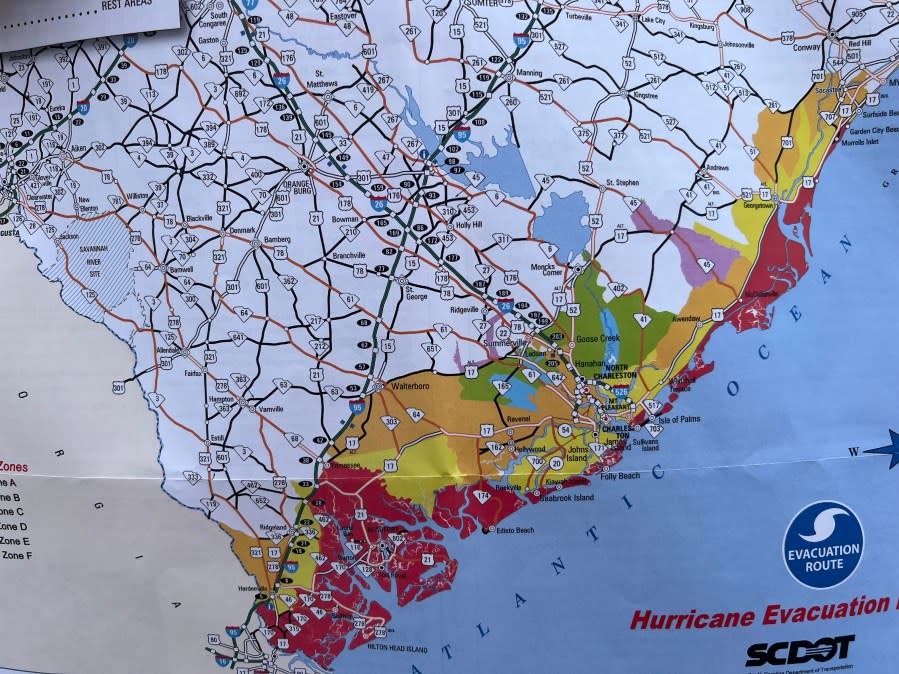
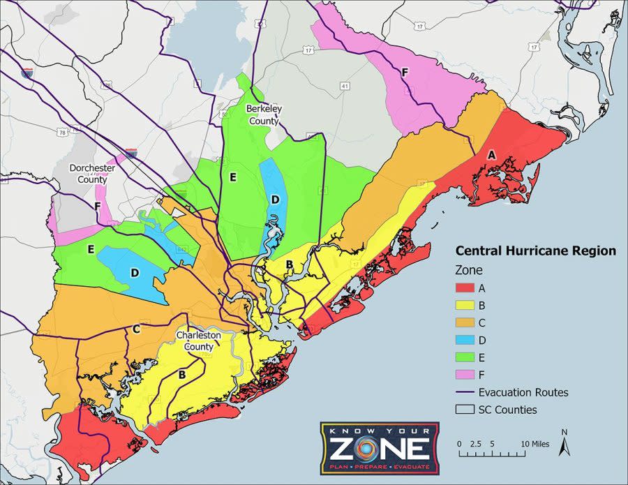
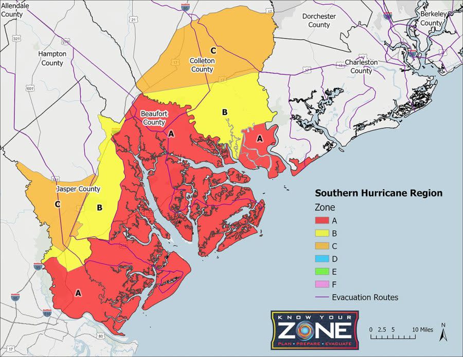
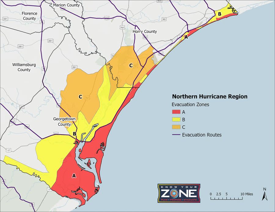
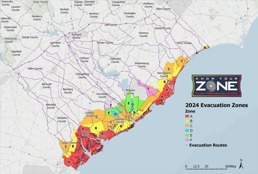
Evacuation zones are categorized ‘A’ through ‘F’ with areas in red designated as the highest risk.
Areas along the immediate coast, including the barrier islands, are listed in Zone A. West Ashley, the peninsula, Mount Pleasant and Daniel Island are in Zone B. Portions of North Charleston and areas of Wando and the Francis Marion National Forest along US 17 are in Zone C.
Central region evacuation zones | Map courtesy SC Emergency Management Division Southern region evacuation zones | Map courtesy SC Emergency Management Division Northern region evacuation zones | Map courtesy SC Emergency Management Division Coastal evacuation zones | Map courtesy SC Emergency Management Division
State and local officials will announce evacuations by the designated zone based on the severity of approaching storms.
“You have to have a plan on what you ‘gon do if it happens. Because the time to plan is now. The time to plan is not when it’s coming ‘cause it is too late,” Governor McMaster said.
Officials with the South Carolina Department of Transportation said they’ve recently reviewed all 35 evacuation routes which included checking cameras and message boards. A lane reversal exercise will take place on June 5 along I-26.
“We’re going to be prepared for hurricane season, we encourage residents to be ready for hurricane season. That means having a plan, knowing your evacuation routes, which way you would go if an evacuation order comes,” SCDOT Secretary of Transportation Justin Powell said during the news conference.
Know your zone, prepare your home, and remember your route are the three points leaders in the Palmetto State want residents and visitors to keep in mind as we approach what they said is expected to be a very active hurricane season. Hard copies of the 2024 South Carolina Hurricane Guide can be found at Walgreens, welcome centers across the interstate, and coastal DMV offices.
Hurricane season begins on June 1 and runs through November 30.
For the latest news, weather, sports, and streaming video, head to Queen City News.

