Beware a burst of late-April snow for parts of B.C., Alberta
Cooler air and moisture arriving in Western Canada will bring accumulating snows to parts of the region as we round out April and head into May.
An upper-level trough swinging in from the Gulf of Alaska will bring chilly and snowy conditions to parts of the West to start the week, lingering over southern Alberta on Tuesday.
DON'T MISS: How the tropics help produce big springtime snows on the Prairies
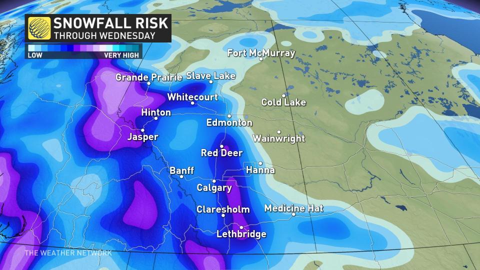
While total accumulations are up in the air at this point, it’s clear that snow will likely cause travel problems for sections of Alberta by mid-week, including Calgary.
With unusually low freezing levels for late April, the snow will also pose some travel issues for some higher elevations across British Columbia.
Monday evening to Tuesday morning: Temperature divide sees wet snow on backside
A deepening low-pressure system over the western Prairies will allow wraparound wet snow to fall across portions of Alberta.
MUST SEE: Bear-tracking study celebrates citizen science in Alberta's grizzly country
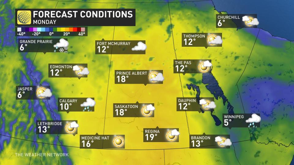
Rising temperatures ahead of that low-pressure system will push daytime highs close to 20°C for some communities in Saskatchewan.
Folks next door in Alberta can expect localized snowfall accumulations and slower travel conditions. Forecasters have lower confidence in total accumulations and where the axis of the heaviest snow will fall, as temperatures will be hovering a couple degrees above the freezing mark.
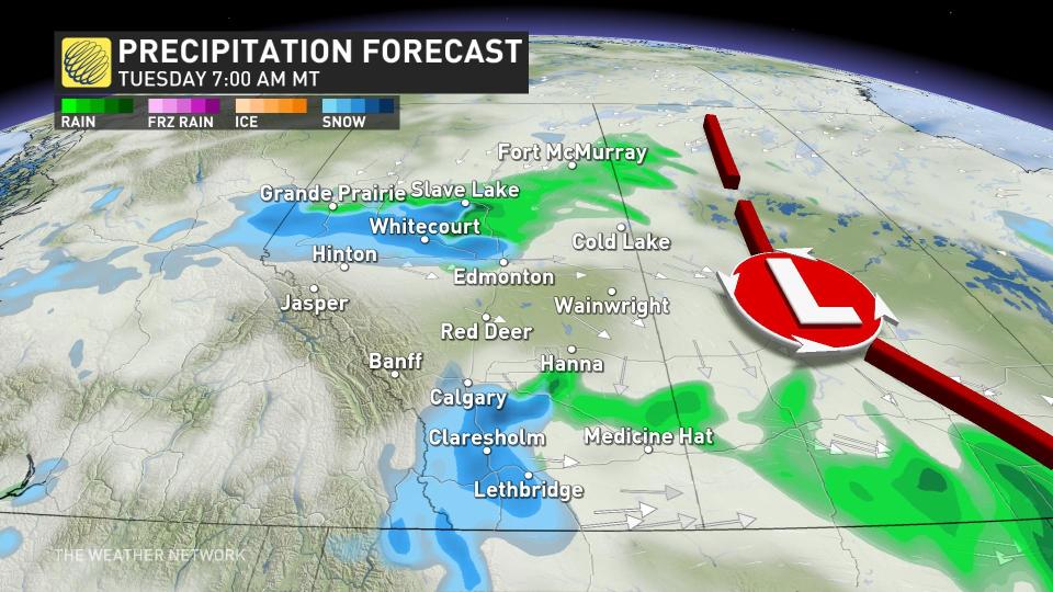
Tuesday night to Wednesday: Highest chance of accumulations for Calgary
The centre of low pressure will remain stalled across Saskatchewan, locking in the chilly north flow over Alberta. This will enhance the risk for localized heavy, wet snow across central and southern portions of the province.
As a result, the greatest threat for accumulating snowfall in the Calgary area develops Tuesday night as cold air wraps in behind the low.
CANADA'S WILDFIRES: Visit The Weather Network's wildfire hub to keep up with the latest on the active start to wildfire season across Canada
Combined with heavy precipitation rates, it’s likely that Calgary will experience bursts of wet snowfall through Wednesday.
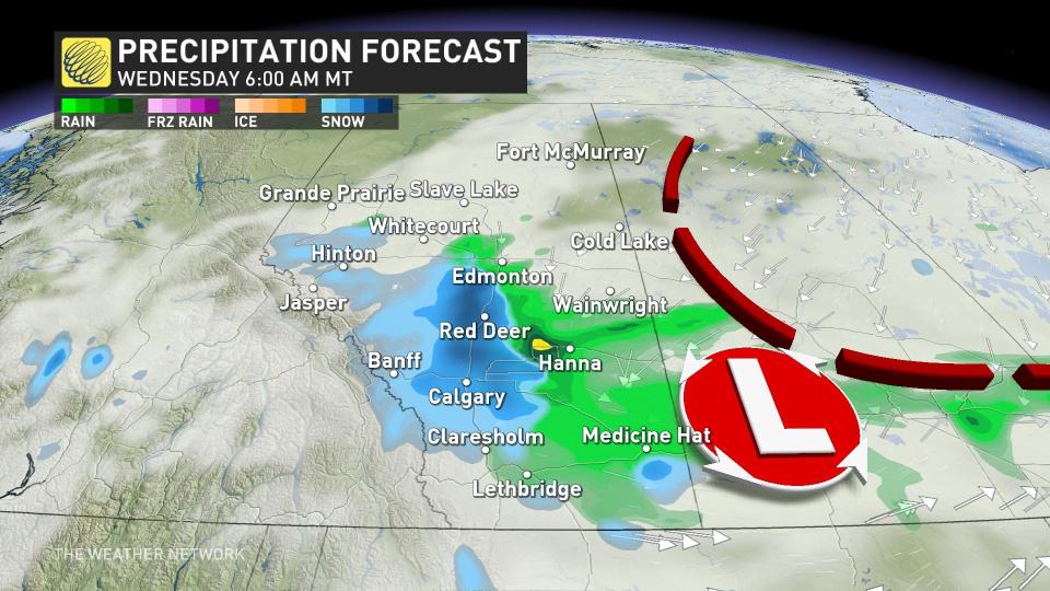
By Wednesday evening, the snowfall threat will have diminished across Alberta with the stubborn departure of the low-pressure system.
Be sure to check back for the latest weather updates across B.C. and Alberta.

