SLO County temperatures are warming up and could hit the 90s this week
The rains of this rainfall season (July 1, 2023, through June 30, 2024) appear to have ended. However, the waters of the Equatorial Pacific off the coast of Ecuador are cooling as the Earth heads toward a La Niña condition.
This condition, which usually produces more hurricanes and a stronger North American monsoon, could significantly impact outdoor activities, agriculture and tourism in our regions. When it occurs, we often experience higher relative humidity levels and plenty of virga — visible streaks of rain that fall from a cloud but evaporate before reaching the ground later in the summer.
In other words, it changes our dry and comfortable climate to a humid, subtropical and sticky one reminiscent of Florida. This condition can also bring rain and thunderstorms to a typically dry time of the year.
Sure, it may not be as glamorous as its Asian counterpart. Nevertheless, it can produce large amounts of rain in northern Mexico, much of Texas, New Mexico and southern Arizona. In rare occurrences, it can also produce heavy rain in Southern and Central California.
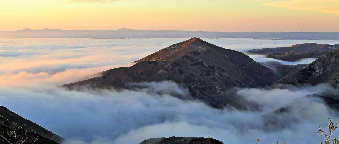
So far, this spring has been relatively fog-free along the coastline, primarily due to the night and morning Santa Lucia (northeasterly) winds and the northwesterly gales in the afternoon.
This condition will change this week as a thermal trough over the Central Valley of California strengthens while the eastern Pacific high will move 1,500 miles to the west of the Central Coast, which will produce persistent moderate to fresh (13 to 24 mph) northwesterly winds during the afternoon decreasing during the night and morning, allowing the marine layer “May gray” to develop in the coastal regions with pockets of fog and mist during the overnight becoming partially clear turn the afternoon. A few of the beaches may remain overcast for most of the day.
Over this period, temperatures will gradually warm, potentially reaching the low 90s in the inland valleys (Paso Robles) by Friday and the following weekend. The coastal valleys (San Luis Obispo) will reach the high 70s, while the beaches will remain in the 60s as the temperature gradients between the inland valleys and the beaches increase.
Surf report
A 3- to 5-foot northwesterly (290-degree deep-water) swell (with an 8- to 12-second period) is expected through Friday.
Combined with this northwesterly sea and swell, will be 1- to 3-foot southern hemisphere (220-degree deep-water) swell (with a 14- to 14-second period) on Saturday through Friday.
Seawater temperatures will decrease to 50 to 52 degrees through Sunday, gradually warming through the week.
On this date in Weather History (May 12):
1934: A dust storm darkened skies from Oklahoma to the Atlantic coast. (David Ludlum)
This week’s temperatures
LOWS AND HIGHS, PASO ROBLES
SUN | MON | TUE | WED | THU | FRI | SAT | SUN |
51, 86 | 53, 82 | 47, 80 | 48, 82 | 50, 82 | 51, 89 | 52, 90 | 53, 91 |
LOWS AND HIGHS, SAN LUIS OBISPO AND COASTAL VALLEYS
SUN | MON | TUE | WED | THU | FRI | SAT | SUN |
51, 75 | 55, 73 | 51, 70 | 51, 72 | 53, 73 | 53, 78 | 54, 78 | 54, 79 |
John Lindsey is a retired PG&E marine meteorologist. Email him at JohnLindseyLosOsos@gmail.com or follow him on Twitter @PGE_John.

