Showers and a few storms arrive this evening
The Latest Northeast Wisconsin Forecast from Storm Team 5…
We are back to full sunshine today for most of the daylight hours as a weak area of high pressure slides through Wisconsin. While temperatures are starting off on the cooler side, the abundances of sunshine and a S/SW wind will bring temperatures into the mid and upper 60s, cooler however lakeside.
Now I mentioned most of the daylight hours will be dry. That’s because a quick moving area of low pressure with a cold front will bring scattered non severe storms late afternoon and early evening. The time window will be 6pm out in our western counties, should arrive by about 8pm in the Fox Valley, and exit over Lake Michigan around 10pm.
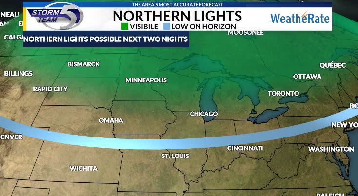
With these thunderstorms, do expect gusty winds and heavier downpours, but severe weather is not expected. Once the front passes, clearing to partly cloudy skies will move in and that posses great news for those wanting to try and get a glimpse of the northern lights. A strong solar storm is arriving tonight and will be at its peak tonight.
Tomorrow will feature a mixture of sun and clouds and in some of those clouds could be a sprinkle or two but most should remain dry. A northeast wind will keep us cooler then today with highs in the mid 60s.
Sunday is Mothers Day and it will be quite warm and muggy in some spots as well. Highs will reach the mid 70s for most with a few 80s possible. Another storm system will bring a few afternoon showers and thunderstorms. Thankfully it wont be raining all day long for any plans you may have. Monday features a mix of sun and clouds and a few isolated showers.


