Weather updates: Area schools announce delayed start for Wednesday
Schools in New Hanover, Brunswick and Pender counties are operating on a two-hour delay Wednesday morning.
"As the storm passes, there is a concern of trees and other debris falling onto roads overnight," according to a post on the Brunswick County school district's Facebook page. This can be dangerous for buses heading out in the morning before sunrise due to poor visibility. Employees from the District’s Maintenance and Transportation Departments must conduct inspections of schools, school access roads, and bus routes around the county."
Likewise, a news release from Pender County Schools said: "Pender County Schools will operate on a 2-hour delay for students and staff on Wednesday, January 10th. This is to allow time for staff to assess road safety, and facility conditions as the storm passes."
In New Hanover, a Facebook post noted that "Pre-K students at elementary school sites will follow the elementary school schedule. Pre-K students at stand-alone sites- Johnson, Howe, CRECC, and Mosley will not attend tomorrow. Staff will still report."
In addition, Brunswick Community College and all campus locations will open at 10 a.m. on Wednesday. Classes will move to remote where possible. This includes the Dinah E. Gore Sports & Aquatics Complex and the Odell Williamson Auditorium.
8 p.m. Update: Wind gusts top 70 mph
The Wilmington International Airport (ILM) recorded a wind gust of 73 mph twice -- at 7:29 p.m. and 7:33 p.m.
A tornado watch remains in effect for the Cape Fear region until 9 p.m. And a wind advisory remains in effect until 6 a.m. Wednesday.
6 p.m. Update: Tornado warnings popping up
Multiple tornado warnings have been issued for portions of the Cape Fear region over the past several hours. The warnings have centered mostly around Bald Head Island, Kure Beach and Carolina Beach.
As of 6 p.m., no confirmed tornadoes had been reported.
Meanwhile, a severe thunderstorm warning is in effect for northeastern New Hanover County and eastern Pender County until 6:30 p.m.
And a tornado watch remains in effect for the entire region until 9 p.m.
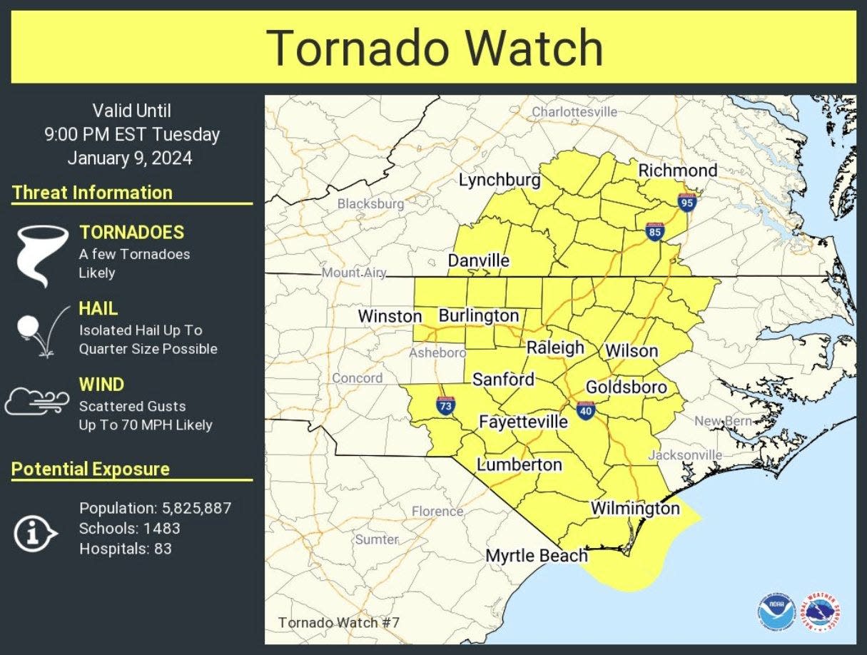
3 p.m. Update: Tornado watch issued for Wilmington area
With dangerous storms and severe weather moving across the Cape Fear region, the area is under a tornado watch until 9 p.m. Tuesday, according to the National Weather Service in Wilmington.
The coastal area is also under a high wind warning, a storm warning, a coastal flood advisory and a high surf advisory.
As of 3 p.m. Tuesday, the Wilmington area had already experienced intermittent bands of heavy rain and gusty winds throughout the day. The most severe and threatening impacts from the storm system are expected by 10 p.m. Tuesday.
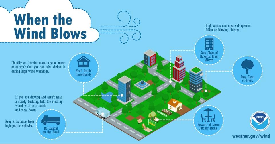
8 a.m. Update: What to expect as severe weather approaches
Wind: Strong wind gusts could break tree limbs and make high-profile vehicles difficult to control, especially on elevated roadways. Isolated power outages are possible. Gusts up to 55 mph are expected inland with gusts higher than that along the immediate coast.
More: Entire Blue Ridge Parkway in WNC, major roads in Smokies closed due to severe weather
Coastal flooding: Minor coastal flooding could lead to shallow saltwater inundation along beaches, tidal creeks and rivers. Coastal flooding along the lower Cape Fear River during high tides may continue into Wednesday.
Rain: Heavy rainfall of 1 to 2 inches with locally higher amounts could produce flash flooding.
Tornadoes: Enhanced (level 3 of 5) risk of severe thunderstorms with damaging winds and isolated but possibly strong tornadoes. The greatest potential for severe weather will be with the main squall line, sweeping west to east Tuesday afternoon and evening. Isolated severe storms are possible ahead of the main squall line.
This article originally appeared on Wilmington StarNews: Severe weather, storms in Wilmington, NC: What you can expect

