Severe weather shuts down Lexington roads. Here’s the list, plus how to stay updated
Multiple roads in Lexington are blocked or closed due to debris from Tuesday morning’s severe thunderstorm, according to the Lexington Traffic Management Center.
There were many reports of downed trees or power lines in various parts of Fayette County. Shortly before 11 a.m. the traffic management center reported the following roads were blocked due to storm debris:
Alexandria Road in area of Old Frankfort Pike
Fontaine Road near Desha Road
Alexandria Drive near Our Native Lane
Area of Romany Road near Hart Road
Parkers Mill Road near Traveller Road.
Fontaine Road and Squires Road will be closed for a while due to storm cleanup, according to Lexington Emergency Management Director Rob Larkin.
Where can I find updated road closures?
Residents can stay updates on the latest road closures in Lexington by checking the traffic management center’s website or by following the traffic management center on X at @lexwrecks.
Is the highway still shut down?
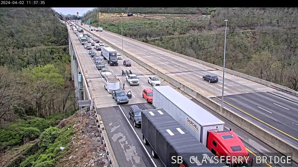
A section of I-75 in Lexington was blocked off due to downed wires and storm debris in the road, according to the traffic management center. The interstate fully reopened around 11:45 a.m.
The Kentucky Transportation Cabinet’s interactive traffic map shows heavy traffic in the northbound lanes from mile-marker 99 to the Athens Boonesboro exit at mile-marker 104.
There also was heavy traffic reported in the southbound lanes from the Winchester Road exit to the Athens Boonesboro exit.
Is more severe weather coming Tuesday?
Tuesday morning’s severe storm has departed the area but more severe weather is expected through the afternoon and evening.
In the NWS forecast discussion at 11:10 a.m., meteorologists said a storm is developing in southern Illinois and traveling east. Hazards with the storm include large hail, damaging winds and possible tornadoes.
There is an active tornado watch for Adair, Allen, Barren, Calloway, Casey, Christian, Clinton, Cumberland, Green, Hart, Lincoln, Logan, Metcalfe, Monroe, Russell, Simpson, Taylor, Todd, Trigg and Warren counties. The watch will be in effect until at least 3 p.m. central time.
The tornado watch for Central Kentucky expired before noon.
“We still have an incoming cold front this afternoon, and plenty of time for the atmosphere to reload to support dangerous storms. Damaging winds, large hail and fast-moving, possibly strong tornadoes will all be possible,” the NWS said in the forecast discussion. “Anyone in southern Indiana or central Kentucky will need to stay weather aware for the rest of today.”
Who has power? See latest storm outages from Kentucky Utilities, Blue Grass Energy

