Severe weather rolls through region overnight into Memorial Day
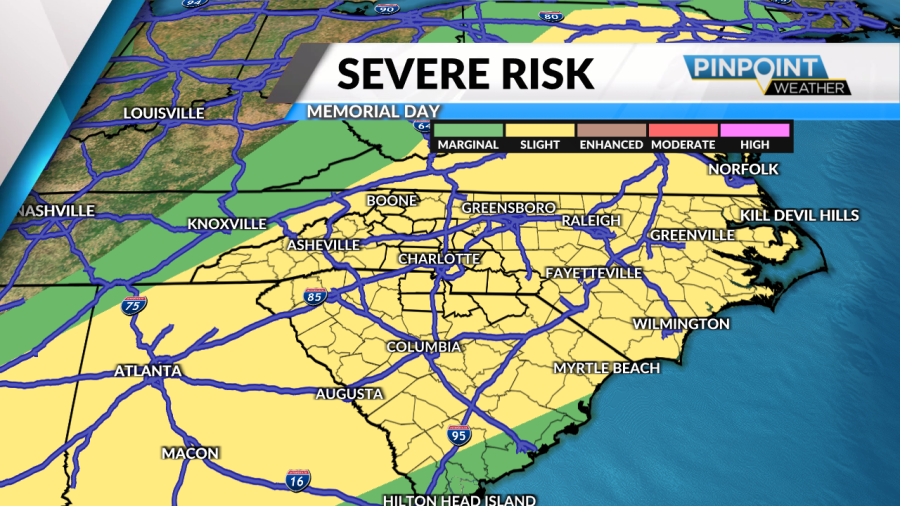
(PINPOINT WEATHER) — More rounds of stormy weather are expected in parts of the region into Memorial Day on Monday as a cold front continues its approach from the west.

Starting with tonight, showers and a few stronger storms could linger in spots before the next round comes on Monday morning. It will be a Pinpoint Weather Alert Memorial Day, meaning it’s a day you’ll want to stay extra weather-aware for possible severe weather. After morning rain and storms move east of the mountains, sunshine returns for a good part of the day. However, that daytime heating combined with the incoming cold front could lead to more lines or a complex of storms to get going by late afternoon and evening. Damaging wind gusts and hail are the primary threats, but a brief tornado can’t be totally ruled out.

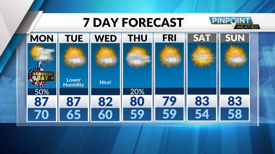
The weather behind the front starting Tuesday will feel nice! Humidity levels drop and temps get a bit cooler. After Memorial Day, it looks like we’ll be mostly shower and storm-free for a while, too.
Tonight: Lingering showers, t’storm. Low 70.
Memorial Day: Periods of showers and storms. High 87.
Copyright 2024 Nexstar Media, Inc. All rights reserved. This material may not be published, broadcast, rewritten, or redistributed.
For the latest news, weather, sports, and streaming video, head to Queen City News.

