Severe weather is possible this weekend in central and eastern NC. Here’s the forecast.
A low–pressure system that will move out of the Mississippi Valley on Friday could bring heavy rain and maybe severe storms to North Carolina this weekend.
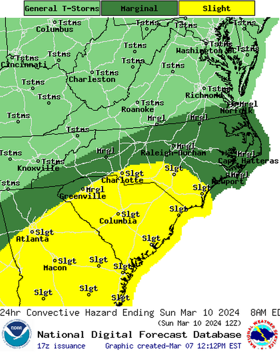
Some forecasting models indicate the possibility of damaging wind gusts and a slight chance of tornadoes, the National Weather Service says.
The forecast for Raleigh, Durham and Chapel Hill
After bringing rain to the western part of the state during the day Friday, the low-pressure system will roll into central North Carolina late Friday into Saturday.
The National Weather Service says that through Saturday afternoon, Raleigh, Durham and Chapel Hill could see up to an inch of rain, with some thunderstorms possible.
Forecasters have issued a hazardous weather outlook for Saturday that includes Wake, Durham and Orange counties, as well as Chatham, Johnston, Person, Granville, Vance, Warren, Halifax, Forsyth, Guilford, Alamance, Nash, Edgecombe, Davidson, Randolph, Wayne and Wilson counties.
The risk level is marginal, forecasters say — Level 1 of 5 — with the main hazard being isolated damaging wind gusts.
High temperatures Saturday are expected to be in the low 60s, with prevailing winds of 9 mph to 17 mph and gusts up to 26 mph.
The chance of rainfall decreases through Saturday night but additional showers are possible.
Sunday and Monday should be dry but breezy and cool and, “This could create some fire weather concerns, especially on Monday,” the weather service says.
If you live in an area where it’s legal to burn yard debris, put that off for a few days to prevent accidental wildfires.
Tuesday and Wednesday will feel more like spring: sunny and warmer, with highs in the 70s.
A greater risk to the south
Higher rainfall amounts — and a higher risk of severe storms — are expected south and east of the Triangle.
The National Weather Service has issued a hazardous weather outlook for Harnett, Lee, Moore, Montgomery, Stanly, Anson, Richmond, Scotland, Hoke, Cumberland and Sampson counties.
According to forecasters, there’s a slight risk — Level 2 out of 5 — of severe thunderstorms Saturday that could bring damaging wind gusts.
Isolated tornadoes are possible in that area, the weather service says.
Where will the heaviest rainfall be?
Jacksonville, Wilmington, Morehead City and other areas in southeastern North Carolina and along the coast could get between 1 and 2 inches of rain on Saturday, enough to cause minor flooding in low-lying areas.
Sunday will bring mostly sunny skies and temperatures in the low to mid-60s on and near the coast.

