South Dakota counties removed from tornado watch as storms move through

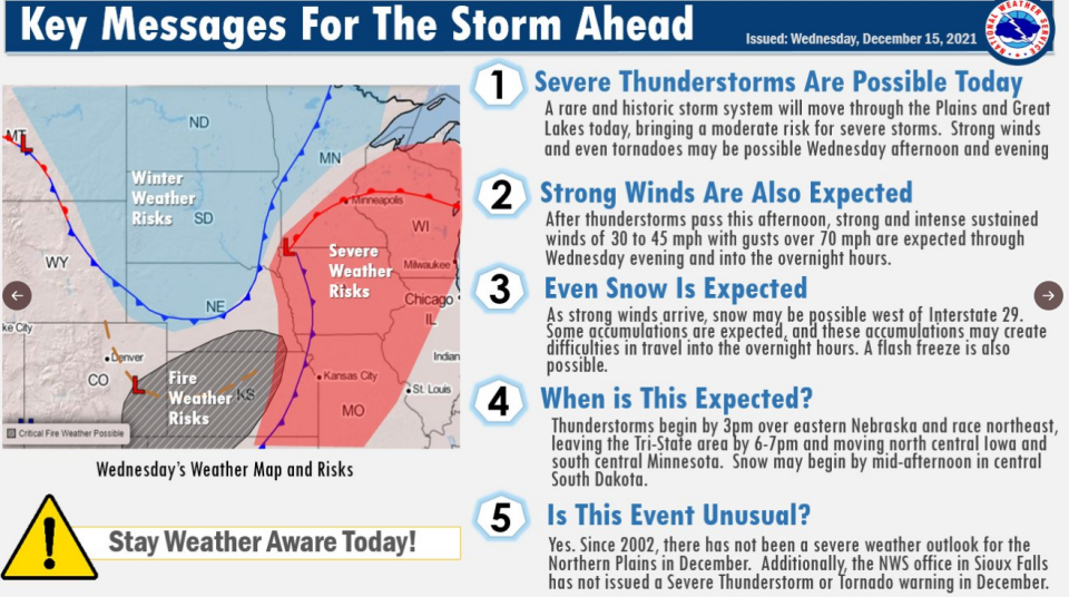
Storms that threatened tornadoes and brought heavy winds hit southeastern South Dakota early Wednesday afternoon with no damage or tornados reported as of 5:30 p.m., according to the National Weather Service.
Tornado watches that were issued for Lincoln County as well as Union County have been removed, according to the NWS. Tornado watches continue through 8 p.m. in Iowa.
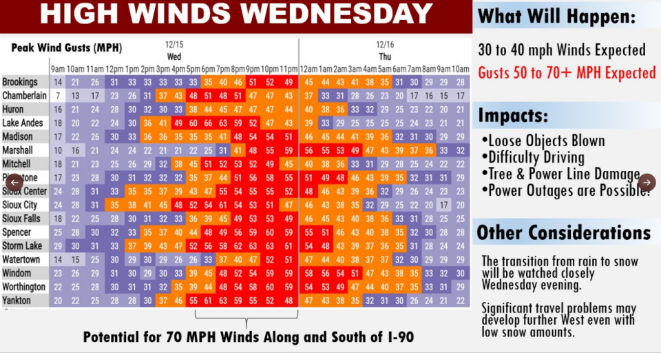
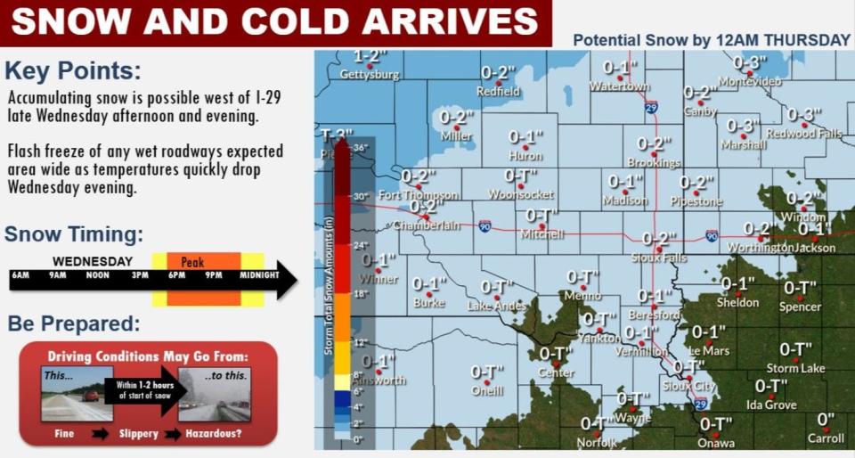
Rain will continue to fall into late Wednesday evening when the temperature is expected to drop and snow will begin before 11 p.m., according to the NWS. Wind gusts as high as 60 miles per hour are possible in the area.
Story continues below:
Several tornadoes reported in Iowa
Tornadoes were reported in Salix, Bronson and Lawton, Philip Schumacher, a meteorologist with the NWS said.
Various damage was recorded in Lawton, Kingsley, Bronson and Ida County, including Battle Creek and Ida Creek, Schumacher said. Damage was also reported in Dakota County, Nebraska.
The NWS plans to send out storm surveyors Thursday to see how bad the damage was and if either it was caused by high winds or tornadoes, Schumacher said.
How much rain and snow could Sioux Falls get?
The NWS expects between a tenth and a quarter inch of rain in Sioux Falls, but that could be higher if thunderstorms hit the region. The chance of precipitation is around 60%.
As for snow, the NWS predicts there could be anywhere from less than half an inch to 2 inches. Most of eastern South Dakota could also receive a small amount of snow.
More: Rapid City attorney to guide impeachment investigation into Attorney General Jason Ravnsborg
Could there be power outages in South Dakota?
Because of high winds, it is possible there could be damage to trees and powerlines, according to the NWS.
The NWS recommends staying away from downed powerlines and securing any holiday decorations that are outside.
Xcel Energy says it is staging extra workers in the area to fix any power issues that come up.
Sioux Falls weather: Rolling storm damage reports in South Dakota
What's the weather look like for the rest of the week?
Wednesday: Mostly cloudy throughout the day and breezy. High near 51. Slight chance of rain before 4 p.m., then chance of showers and thunderstorms between 4 p.m. and 5 p.m..
Wednesday night: Showers likely before 10 p.m. and a chance of snow between 10 p.m. and 1 a.m.. Mostly cloudy with a low near 21. Windy with gusts near 55 mph.
Thursday: Sunny with a high near 32. Breezy with gusts as high as 35 mph.
Thursday night: Increasing clouds with lows near 26. Breezy.
Friday: Mostly cloudy with a high near 32.
Friday night: Mostly cloudy with a low near 9.
Follow Annie Todd on Twitter @AnnieTodd96. Reach out to her with tips, questions and other community news at atodd@argusleader.com or give her a call at 605-215-3757.
This article originally appeared on Sioux Falls Argus Leader: South Dakota counties removed from tornado watch as storms move out
