Severe storms with strong winds, hail and flooding possible for Kentucky
Scattered strong to severe storms are possible for most of Kentucky on Wednesday, according to the National Weather Service.
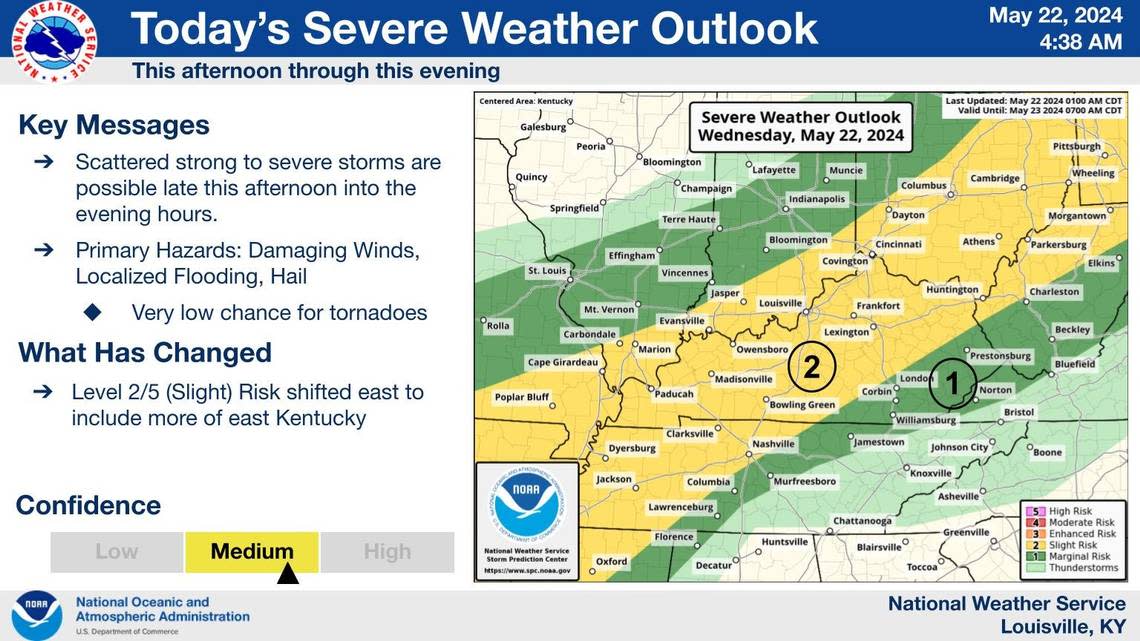
The NWS’ severe weather outlook puts most of Kentucky, including Lexington, in the slight risk zone for severe weather. Slight risk implies, “organized severe thunderstorms are expected, but usually in low coverage with varying levels of intensity,” the NWS said.
The storms are expected to arrive late Wednesday afternoon into the evening hours. The NWS said damaging winds, hail and localized flooding are the main hazards with the storms.
There is a low risk of tornadoes with the storms, according to the NWS.
It’s unknown on where the storms will be at their strongest but meteorologists in the NWS forecast discussion guessed south-central Kentucky may be the most at-risk for severe weather. NWS meteorologists added the severe weather threat should diminish in the overnight hours but the possibility of flooding still exists, especially in southern Kentucky.
A cold front mixed with troughs of low pressure boundaries will create chances for showers and storms through Tuesday, according to the NWS. The main hazards are expected to be gusty to damaging winds, lightning and heavy downbursts of rain.
Sunday appears to be the most likely day for strong to severe weather. The NWS said forecasters will likely determine the chances of severe weather on a day-to-day basis.
Two-four inches of rain in certain spots of Kentucky are possible with this stormy pattern, according to the NWS.
Parts of Kentucky are under marginal risk for severe weather Thursday and Friday, according to the NWS’ severe weather outlook.
️Strong to severe storms are expected to develop this afternoon through the evening hours.
Main threats are damaging wind, hail, and localized flooding.
Stay weather aware this evening. #kywx #inwx pic.twitter.com/opH0RKijcj— NWS Louisville (@NWSLouisville) May 22, 2024

