Severe storms bring large hail, tornado warning to Central Texas Thursday: NWS
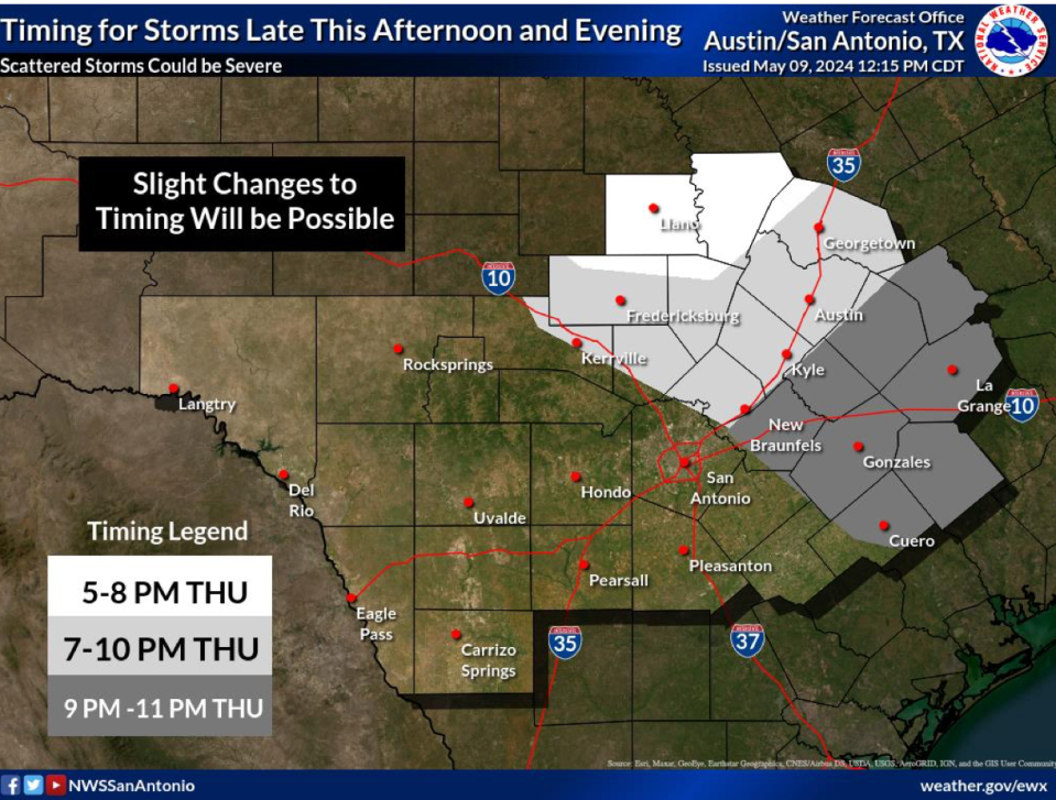
Severe weather is heading to the Central Texas region Thursday evening, according to the National Weather Service. The storm activity will range from the Hill Country into the Interstate 35 corridor and coastal plains, the agency said.
More: Baseball-size hail hits Central Texas during severe storms. Here's what it looks like
Travis, Williamson and parts of Hays counties have a 5 to 9% chance of seeing tornado activity, though very large hail and damaging winds are the primary threats. The storm is predicted to roll into the area at about 7 p.m. and exit Central Texas by 10 p.m. Thursday, before continuing southeast, according to meteorologist Jason Runyen. He said up to half an inch of rain could be possible in some areas.
More: Hail no! Tips on how to prevent the next hail storm from damaging your car
Tornado watch and tornado warnings issued for parts of Central Texas
The National Weather Service issued a tornado warning for San Marcos, Kyle, and Redwood, Texas, until 8:45 p.m. CT.
Tornado Warning including San Marcos TX, Kyle TX and Redwood TX until 8:45 PM CDT pic.twitter.com/L3wsYYEnGQ
— NWS Tornado (@NWStornado) May 10, 2024
The National Weather Service also issued tornado watches in multiple North and West Texas counties. The watch is in effect until 9 p.m. Thursday for the following counties:
Bosque
Coleman
Coryell
Ellis
Hill
Kimble
Mcculloch
Mills
Runnels
Taylor
Brown
Comanche
Dallas
Erath
Hood
Lampasas
Mclennan
Palo Pinto
San Saba
Stephens
Callahan
Concho
Eastland
Hamilton
Johnson
Mason
Menard
Parker
Shackelford
Tarrant
Tornado watch and tornado warning: What's the difference?
Tornado watch: Tornadoes are possible and residents should be alert.
Tornado warning: Tornadoes have been spotted or indicated on weather radar, and residents should seek shelter immediately.
This article originally appeared on Austin American-Statesman: Severe storms bring large hail, tornado warning to Central Texas: NWS

