A Secret Waterway Helped Egyptians Build the Pyramids, Scientists Discover
"Hearst Magazines and Yahoo may earn commission or revenue on some items through these links."
Fresh research on an ancient—and now lost—branch of the Nile River shows how Egyptians could have constructed pyramids.
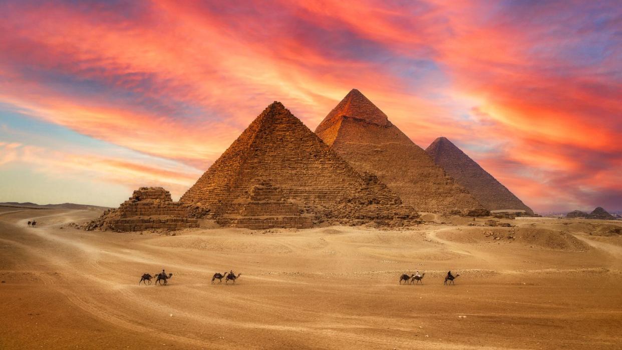
The largest pyramid field is now clustered along a narrow desert strip, but an extinct Nile branch likely once fed the area.
The Ahramat Branch allowed for easier construction of Old and Middle Kingdom pyramids.
Just how did a stand of 31 pyramids with such robust construction materials get built on a strip of desert in Egypt? It turns out that desert strip once had a powerful, 39-mile branch of the Nile River flowing right by it—perfect for ancient people to ferry materials down.
In a new study published in the journal Communications Earth & Environment, researchers used radar satellite imagery and geophysical data with deep soil coring to investigate the subsurface and sedimentology in the Nile Valley near the pyramids. The team found a “major extinct Nile branch,” which they named the Ahramat Branch (meaning “pyramids” in Arabic) once ran right along where the pyramids now sit.
“The Ahramat Branch played a role in the monuments’ construction and that it was simultaneously active and used as a transportation waterway for workmen and building materials to the pyramids’ sites,” the authors wrote. “The size and longitudinal continuity of the Ahramat Branch and its proximity to all the pyramids in the study area implies a functional waterway of great significance.”
The long-lost branch—which varied in width between 656 and 2,296 feet—was large enough to carry a significant volume of Nile discharge over 4,000 years ago during the periods of the Old and Middle Kingdoms. That means the river was functioning during the time of pyramid construction. The pyramids in question include the Great Pyramid of Giza and the Khafre, Cheops, and Mykerinos pyramids, along with a mix of other prominent constructions.
The study notes that the pyramids from the Middle Kingdom were built farther east than that from the Old Kingdom, and on lower altitudes compared to the floodplain. “This paradox might be explained by the fact that the Ahramat Branch migrated eastward sightly away from the Western Desert escarpment, prior to the construction of the Middle Kingdom pyramids,” they wrote, “resulting in the pyramids being built eastward so that they could be near the waterway.”
By using radar, the team was able to look deep below the sand surface and search for features in the land that gave clues to buried rivers. Once in the field, the team drilled sediment cores to confirm the river’s former location. The scientists believe that shortly after the construction of the pyramids, a major draught led to the branch getting inundated with sand.
According to the new data, the Giza pyramids were built on a plateau maybe just half a mile from the bank of the river. Eman Ghoneim, lead author from the University of North Carolina Wilmington, told AFP, that a “ceremonial raised walkway” likely ran alongside the river at the Valley Temps, serving as a river harbor.
Not only would the river have allowed the movement of heavy stones and construction materials, but also the workers needed to build the site. Suzanne Onstine of the University of Memphis told the AFP the river harbors could also have served as a key location for funeral entourages of pharaohs to gather before moving the bodies within the temples.
“Our finding has filled a much-needed knowledge gap related to the dominant waterscape in ancient Egypt,” the authors wrote, “which could help inform and educate a wide array of global audiences about how earlier inhabitants were living and in what ways shift in their landscape drove human activity in such an iconic region.”
You Might Also Like

