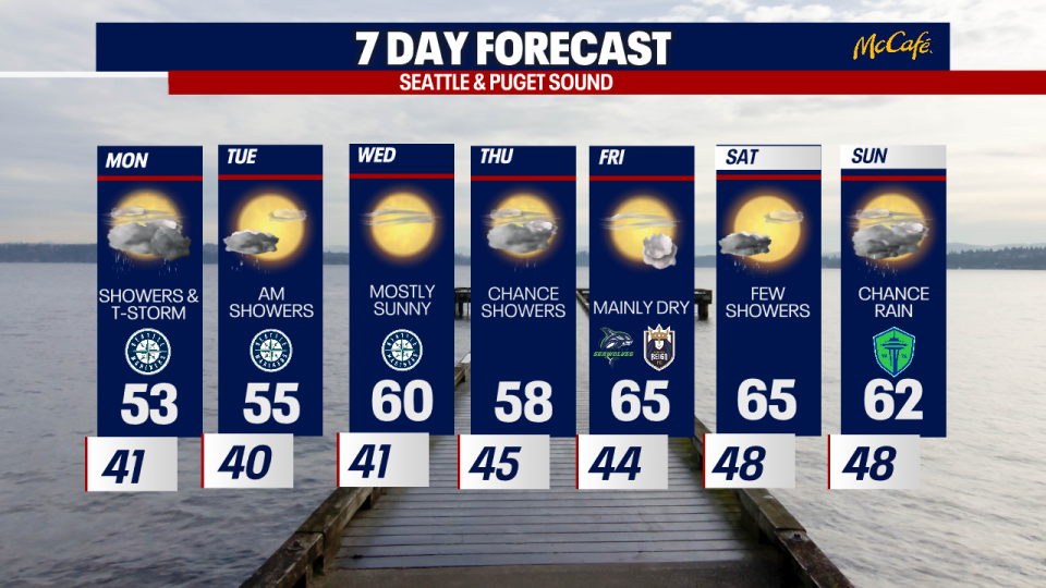
Seattle Weather: Showers, cooler and chance of t-storms
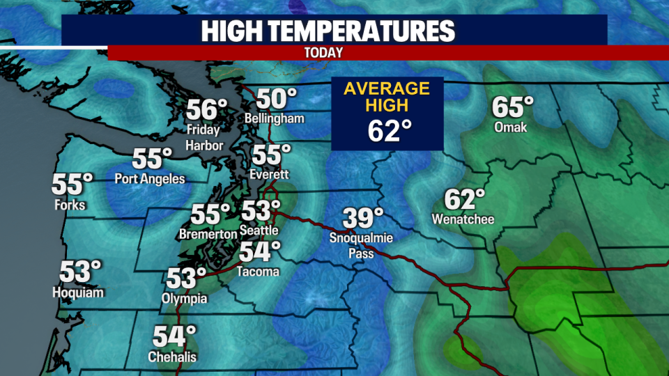
Cooler temperatures on Sunday afternoon with scattered showers and sunbreaks. Highs were well below average.
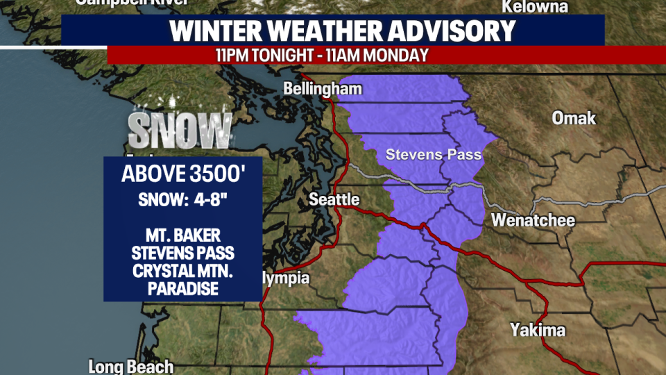
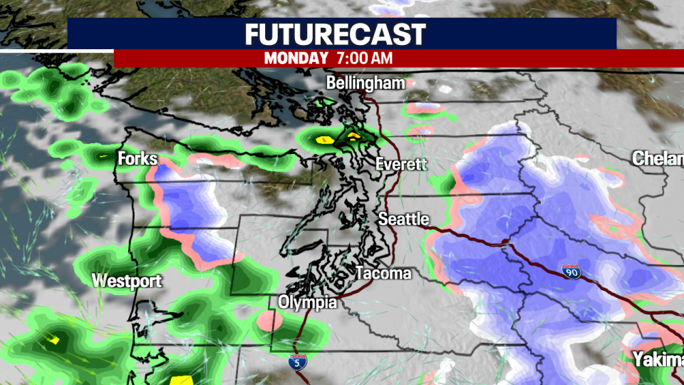
Tonight we will see cooler air moving in, dropping snow levels and snow showers to the Cascades. A Winter Weather Advisory in effect from 11pm tonight through 11am Monday morning for the Cascades above 3500'. Snow totals 4-8".
A few showers around this evening into the overnight hours, also a possible rumble of thunder.
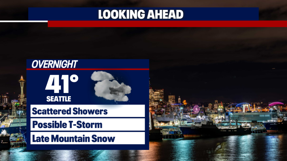
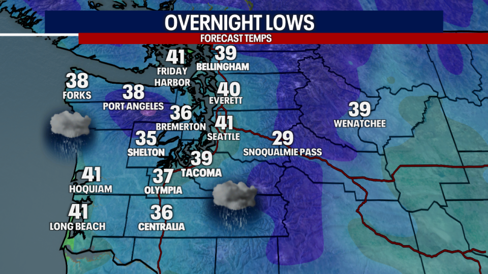
Temperatures will cool again overnight, dropping into the 30s to low 40s.
Scattered showers to start our Monday with mostly cloudy skies. Morning snow will continue in the Cascades until midday.
Showers and sunbreaks last into the afternoon, but it will be sunnier Monday than over the weekend.
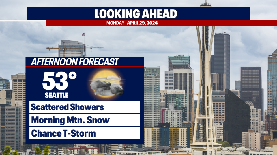
Highs will be similar to Sunday with temperatures staying in the low to mid 50s.
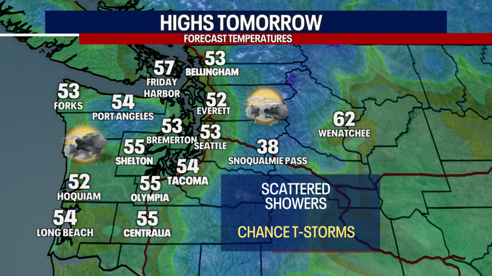
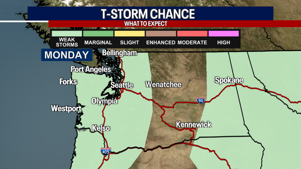
The Storm Prediction Center has included Western Washington in the "weak storms" category for Monday. Watch for thunderstorms that could produce gusty winds and small hail.
Showers will taper Tuesday morning with more sunbreaks into the afternoon. A weak ridge of high pressure will bring a warmer and drier midweek. A few showers around Thursday with highs in the 50s.