Severe weather sweeps through Tampa Bay area

TAMPA, Fla. (WFLA) — The severe thunderstorm warning issued for Hillsborough, Pinellas and Manatee counties has expired
The tornado watch was cancelled for Hernando and Citrus counties.
Stay up to date on the latest from News Channel 8 on-air and on the go with the free WFLA News Channel 8 mobile app and the Max Defender 8 weather app.
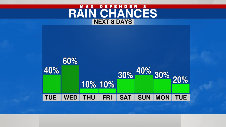
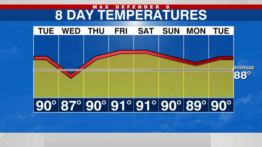
It’s a warm and gusty day with highs near 90. Scattered storms arrive from the Gulf of Mexico this afternoon. Rain chances increase to 40%. A tornado watch has been issued for Hernando and Citrus counties.
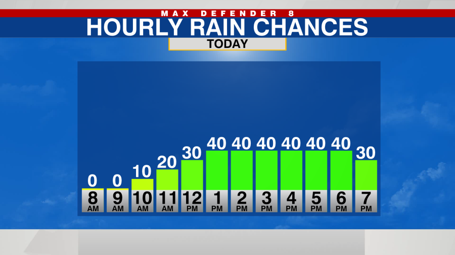
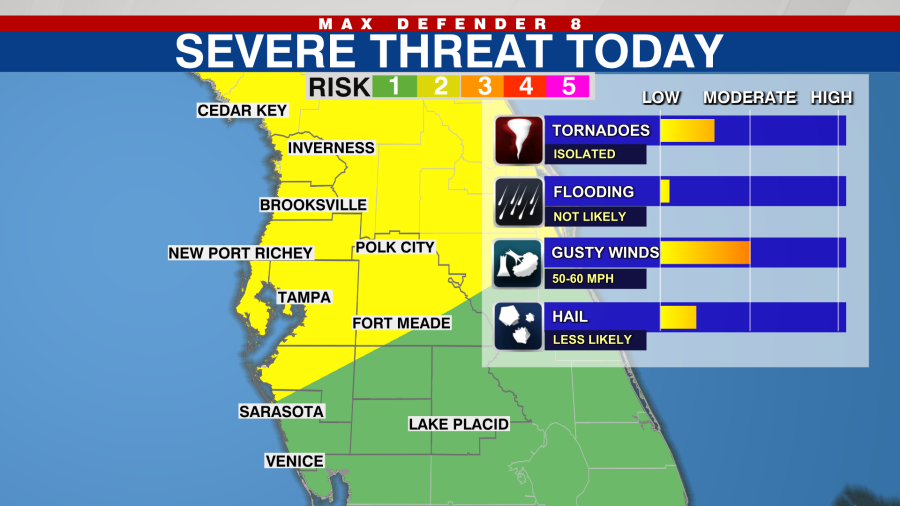
Some of the storms may be strong to severe. Most of us are in a 2 out of 5 on the severe level threat (yellow). Watch for damaging wind gusts, isolated tornadoes and small chance of hail.
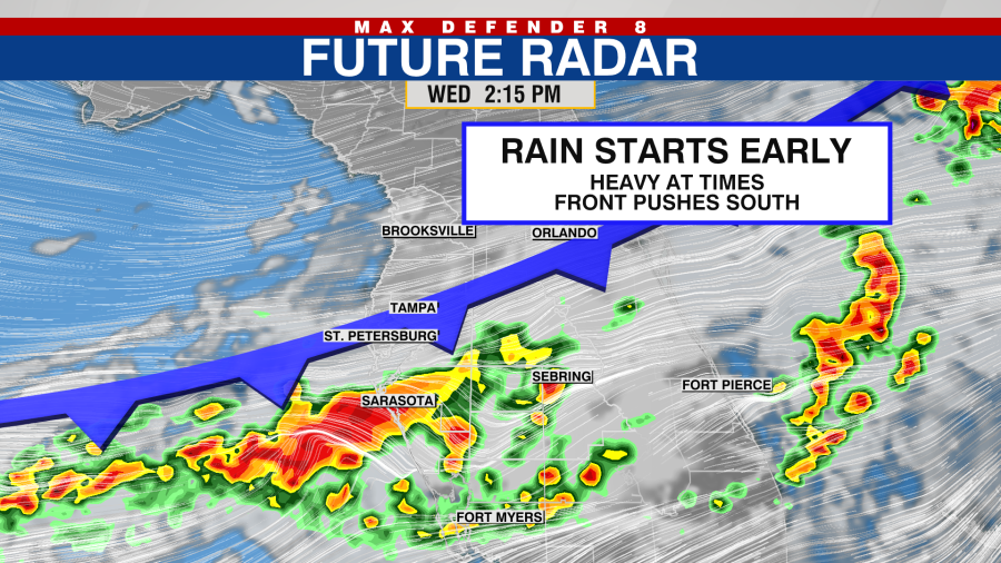
A cold front passes through tomorrow, so the downpours start earlier in the day. The severe threat is not quite as high with Wednesday’s storms, but the rain coverage should be higher.
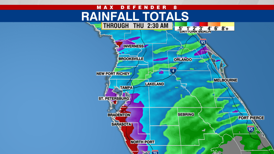
Between today and tomorrow, many of us may get anywhere from a half inch of rain to 2-3 inches in isolated spots. We do need the rain.
Drier air arrives for the end of the week with just 10% rain chances Thursday and Friday. Spotty downpours return for the weekend and early next week.
We don’t get a break from the heat. Highs remain near 90 degrees.
Thanks for signing up!
Watch for us in your inbox.
Subscribe Now
Daily Weather Forecast
For the latest news, weather, sports, and streaming video, head to WFLA.

