Satellite photos reveal the devastation of Guatemala's Fuego volcano

Hotel La Reunión Golf Resort and Residences sits in the shadow of Guatemala's Volcán de Fuego, at about five miles away. Prior to the June 3 eruption, it was a verdant land, with well-manicured lawns.
Two days later, harrowing avalanches of scorching volcanic ash, rocky debris, and gas — called pyroclastic flows — smothered La Reunión and the surrounding land. Satellite images taken before and after the eruption reveal the devastation, which was not caused by lava flows, but by these speeding chaotic avalanches.
SEE ALSO: Why Guatemala's volcano erupted in deadly avalanches, but Hawaii's hasn't
Fuego, an explosive volcano, erupts like this "intermittently," Stanley Mertzman, a volcanologist at Franklin and Marshall College, said over email. For anyone studying this mountain, he recommends that "your life insurance is paid up," and if the mountain erupts, "to stay out of the valleys."
It's good then, that La Reunión evacuated early before some of these pyroclastic flows traveled down the steep flanks of Fuego, moving down low-lying channels and blanketing the land below in gray-brown volcanic soot.
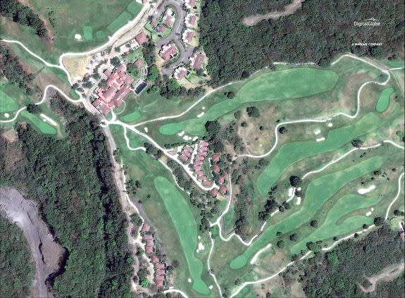
Image: ©2018 DIGITALGLOBE, A MAXAR COMPANY

Image: ©2018 DigitalGlobe, a Maxar company
In a statement the resort released on social media, La Reunión notes that it heeded evacuation warnings before the hot debris flows — which Mertzman said can range from 400 to over 1,000 degrees Fahrenheit — pummeled the area.
Not everyone around the volcano, however, was able to evacuate in time. As of June 6, the Guatemalan government reported 75 deaths due to Fuego's activity.
Similar to La Reunión, the village of San Miguel Los Lotes has been buried in Fuego's sand-like, volcanic debris.
"You can actually see gases emanating from the cooling warm mass," noted Mertzman.
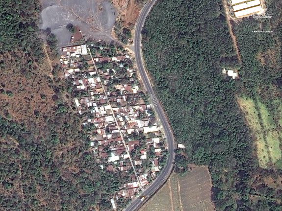
Image: ©2018 DIGITALGLOBE, A MAXAR COMPANY

Image: ©2018 DIGITALGLOBE, A MAXAR COMPANY
Images from the ground show devastation.
Many homes, cars, bodies, and animals — if not buried completely — have been coated in Fuego's grey soot.
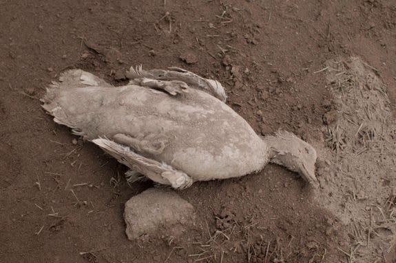
Image: Luis Soto/AP/REX/Shutterstock
Volcano scientists keep an index of how explosive each volcano in the world is. The ranking ranges from 0 to 6, with 6 being the most explosive.
On a global scale, Fuego is decently explosive, falling between 3 and 4, said Mertzman.
As a counter example, Hawaii's Kilauea, which typically oozes lava and rarely kills people, falls somewhere between 0 and 1, he said.
WATCH: Ever wonder how the universe might end?