These Before and After Satellite Images Show the Scale of the Destruction From the Guatemala Volcano
Before and after satellite images show the horrifying scale of the destruction left in the wake of the Guatemala volcano eruption.
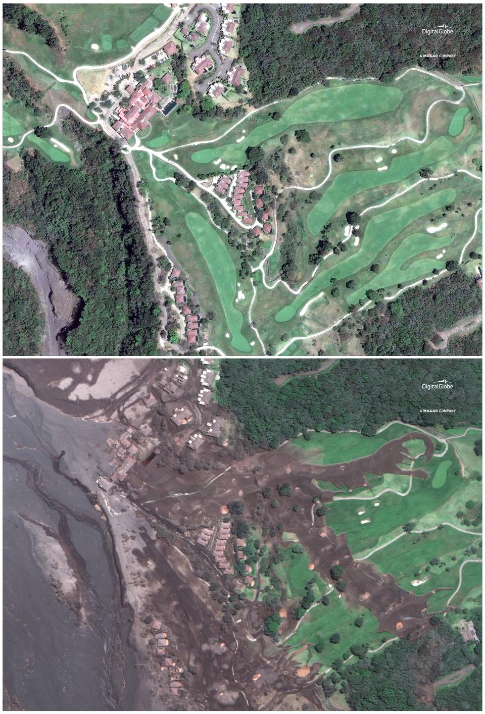
The pictures, from satellite imagery company Digital Globe, show the world-famous La Reunion Golf Resort on April 7, 2017 and on Wednesday – days after the eruption of Volcan de Fuego, Spanish for “volcano of fire.”
The once lush, green resort appears completely blanketed by lava and grey ash. The golf course, which is four miles from the volcano, was the host of the Latinoamerica PGA tour since 2014 and kicked off the 2018 Guatemala Stella Artois Open in March. The resort was immediately evacuated following Sunday’s eruption.
Guatemalan authorities have confirmed 99 people died, but only 28 have been identified, due in part to the volcanic flow leaving bodies un-recognizable. Some 197 are still missing.
According to Guatemalan disaster management agency CONRED, 1.7 million Guatemalans have been affected by Sunday’s volcanic eruption. Officials said more pyroclastic flow is expected in the upcoming days.

