Satellite images show Hurricane Matthew's devastating mark on Haiti
Hurricane Matthew left a trail of devastation across Haiti earlier this month after the Category 4 storm flattened houses, flooded streets and killed hundreds of people.
New satellite images from NASA's Earth Observatory and DigitalGlobe show the extent of the hurricane's destruction across Haiti's hard-hit southern coast.
Green swaths become barren brown patches, marking the places where extreme winds, landslides, erosion and storm surge stripped trees of their foliage and leveled entire neighborhoods.
SEE ALSO: Carolinas still drying out from Hurricane Matthew
Matthew made landfall in Haiti on Oct. 4, killing at least 473 people, according to national emergency officials cited by the Associated Press.

Image: NASA Earth Observatory image by Jesse Allen, using Landsat data from the U.S. Geological Survey.
Other death toll estimates are higher: A Reuters tally of numbers from local officials suggests 1,000 people were killed in the nation of 10 million.
NASA's Operational Land Imager on Landsat 8 captured images of Haiti before and after the storm in Les Cayes, on Haiti's Tiburon Coast. The seaport town of 86,000 people was among the most densely populated areas slammed by Matthew.
Satellite images also show the storm's effects on Nan Fort and to the east near the Cavaillon River. Those areas did not take a direct hit from Matthew but still took in damaging levels of sediment after the storm.
Greener images show Haiti's coast on Sept. 26, a week before the storm ripped across the island. The browner images show the same areas on Oct. 12, eight days after Matthew made landfall.
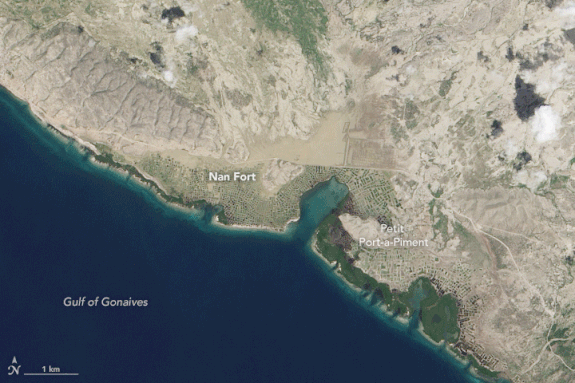
Image: NASA Earth Observatory image by Jesse Allen, using Landsat data from the U.S. Geological Survey
The most obvious changes are the loss of vegetation, Alexandra Morel, an ecosystem scientist at the University of Oxford, told NASA.
"When I look at these images, I see what seems to be seriously denuded hillsides, which I assume are from crops and fallows being washed away," she told the space agency.
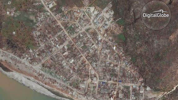
DigitalGlobe, a commercial vendor of satellite and geospatial content, also released a set of before-and-after photos from Haiti showing destroyed buildings, missing rooftops and trees ripped from the ground.
The post-Matthew images were captured on DigitalGlobe's WorldView-2 satellite on Oct. 9 and show six Haitian towns along the western side of the island's southern peninsula: Les Anglais, Port-à-Piment, Les Cayes, Chardonnieres, Coteau, and Jeremie.

Image: ©DigitalGlobe 2016
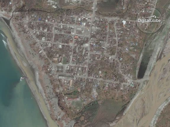
Image: ©DigitalGlobe 2016
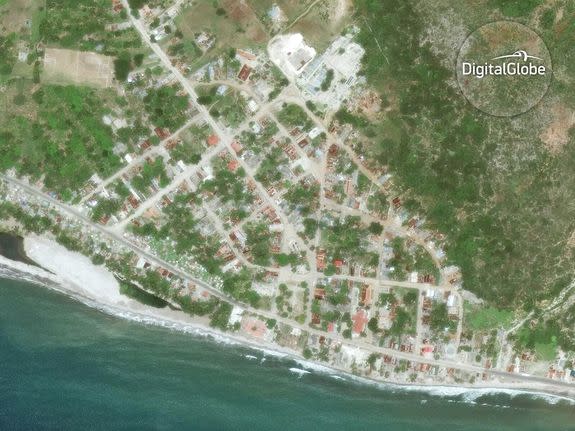
Image: ©DigitalGlobe 2016

Image: ©DigitalGlobe 2016
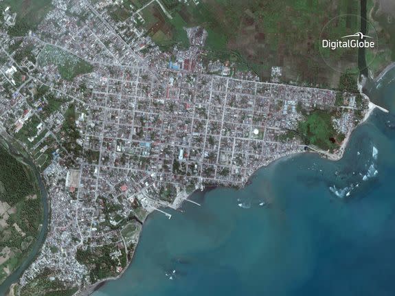
Image: ©DigitalGlobe 2016

Image: ©DigitalGlobe 2016

Image: ©DigitalGlobe 2016
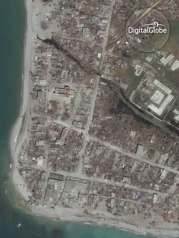
Image: ©DigitalGlobe 2016

Image: ©DigitalGlobe 2016

Image: ©DigitalGlobe 2016
