Risk of severe storms with strong winds, heavy rain Thursday afternoon in Beaufort County
Ahead of a cold front, local meteorologists say thunderstorms, with the potential to bring strong winds, large hail and heavy rains, have the highest likelihood of happening in the Lowcountry on Thursday.
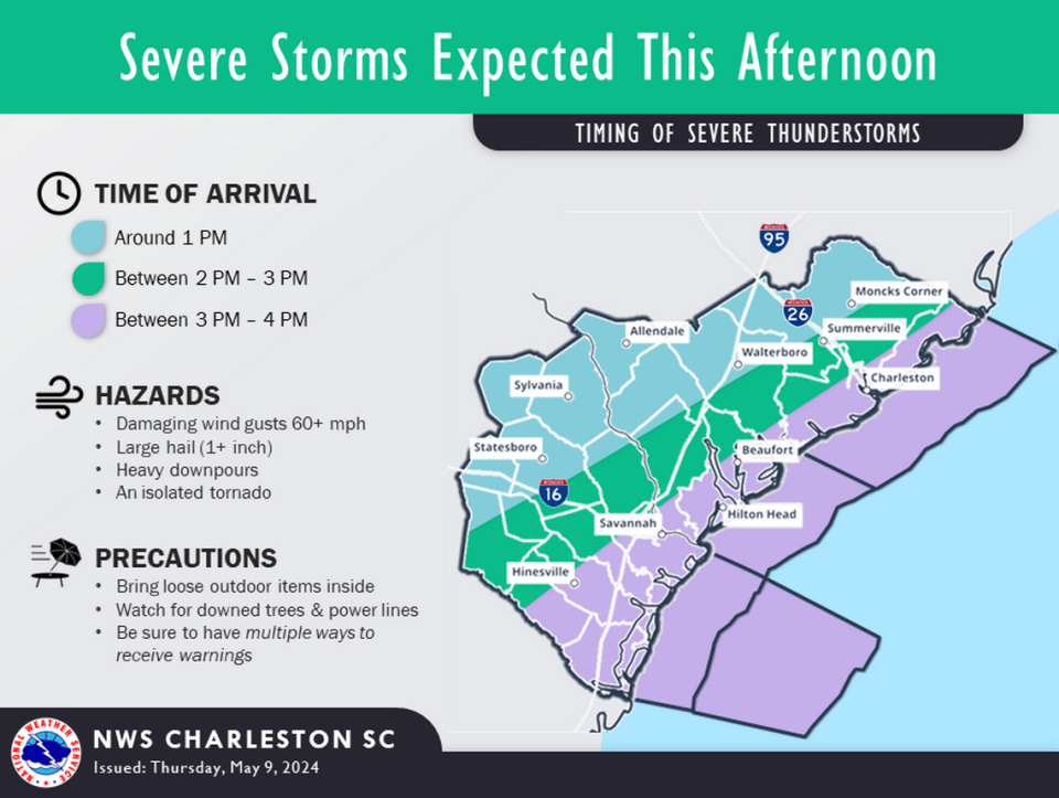
A “thunderstorm complex” coming from west of southeast South Carolina will move into Beaufort County between 3 and 4 p.m. Thursday, according to the National Weather Service’s Charleston Office. A second round of possible severe storms could move through Friday morning and into the afternoon.
Severe storms blowing through have the potential to stir up wind gusts up to damaging 60 mph, heavy downpours and hail up to an inch, the NWS said. Isolated tornadoes cannot be ruled out.
Strong wind gusts can down tree limbs, result in power outages and make travel — especially on bridges and overpasses — difficult.
The service’s Storm Prediction Center highlighted Beaufort County at an “enhanced risk” for numerous severe storms possibly developing. An “enhanced risk” means scattered and severe thunderstorms are more “persistent and/or widespread,” with a few being intense, according to the National Oceanic and Atmospheric Administration.
Local meteorologists urged people to bring in loose outdoor items and watch for downed trees and power lines.

