Recent storms pushed California's yearly rainfall, snowpack even higher — and more could be coming
After recent storms dumped even more rainfall on Southern California and blasted snow across the central and northern Sierra Nevada, the latest hydrological data shows the state in its best position yet for a drought-free summer.
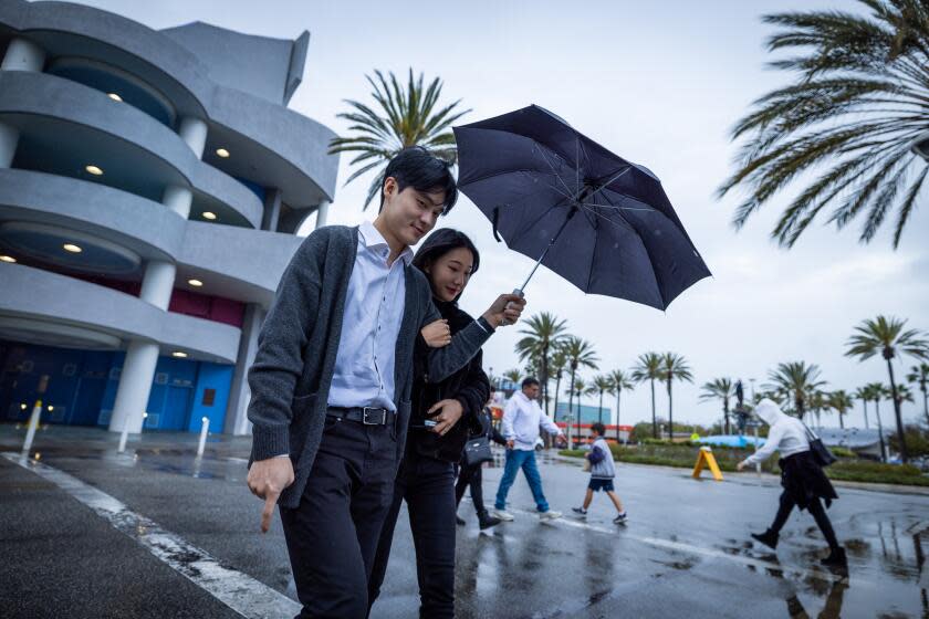
Following a February of wet, winter storms — many aimed at California's southwest region — Wednesday's low pressure system didn't set any rain records by itself, but it did bring the latest in a series of heavy downpours to the Southland. Much of the region received about a half-inch to one inch of rain, though some areas saw significantly more, according to the weather service.
In the San Gabriel Valley and nearby areas of Los Angeles County, continued heavy rains in the late afternoon prompted the National Weather Service to issue a flash flood warning.
The cities and areas near San Dimas, Glendora, Pomona, West Covina, La Verne, Claremont, Covina, Azusa and Walnut were expected to receive somewhere between half an inch and one inch of rain within 30 minutes, increasing the risk of flooding in small streams, highways, underpasses and other areas with poor drainage.
Some of the highest rainfall totals from Wednesday's storm included 1.99 inches at the Topanga Fire Station, 1.55 inches in Thousand Oaks, 1.51 inches in Bel-Air, 1.4 inches in Oxnard, 1.37 inches in Northridge and 1.3 inches in Lake Cuyamaca.
Those amounts further boosted year-to-date rainfall counts. Downtown Los Angeles received 0.72 inches from Wednesday's storm, bringing its total rainfall to 18.99 inches since Oct. 1 — the beginning of the water year. The average for this point in the year is 11.37 inches, according to the National Weather Service.
"We're about 7.5 inches above average for this time of year," said Kristan Lund, a National Weather Service meteorologist in Oxnard.
California's South Coast region has recorded 16.79 inches from Oct. 1 through March 6, according to the latest state data — which is 127% of average for this time of year. That makes the South Coast region — which stretches from Ventura County to the Mexican border — the hydrological region with the state's highest percent-of-average, thus far.
Read more: Tracking California’s water supplies
Statewide, rainfall totals hit 18.5 inches Wednesday, up a few tenths of an inch from the day before, according to California Water Watch. That's about 109% of the average.
But even with such high numbers this year, 2024 is still tracking behind 2023's rainfall totals. Last year, downtown L.A. was at 20.04 inches for this date, compared to 18.99 inches so far this year, and the South Coast region was at 22.06 inches, compared to 16.79 inches this year.
Still, experts say the continued rainfall and recent snowstorms have helped push out any worries of drought, even after a relatively dry November and December.
The Inland Empire and Orange and San Diego counties also got measurable rain from this latest storm. In Riverside, about 0.8 inches fell Wednesday, pushing its water year total up to 10.22 inches, well above its average of 7.48 inches for this time of year. San Diego International Airport got almost half an inch of rain Wednesday, which brought its yearly total to 10.31 inches, almost 3 inches above normal for this date.
Wednesday's storm also brought snow — about 1 to 4 inches — to the Southern California mountains, with some snow flurries still lingering Thursday, according to the National Weather Service. L.A. County's Mt. Wilson recorded 2 inches, while San Bernardino County's Snow Valley saw 4 inches, Barton Flats got 3 inches and Green Valley Lake reported 2 inches of snow.
While snowfall in those areas doesn't directly affect the snowpack in the Sierra, the tailwinds of the recent blizzard there — plus additional snow from a smaller storm early this week — continued to bolster the snow drifts that are key to the state's water supply.
The statewide snowpack this week swelled to 96% of its average for April 1, typically when it's at its deepest — up more than 20 percentage points from a week prior, according to the California Department of Water Resources.
And though the beginning of April often marks the end of California's heaviest snow, there's still plenty of opportunity for the snowpack to further build, said Andrew Schwartz, lead scientist at UC Berkeley's Central Sierra Snow Laboratory.
"California, in general, sees snow storms occur through April and the beginning of May," Schwartz said. "So, there's still plenty of time for snow to come in this season. Right now, it's looking like we'll have a couple of chances at decent snowfall early next week."
And the same could be true in Southern California.
While the next few days are expected to remain dry, there's a chance that a new system could bring more precipitation next week, Lund said, adding that forecasts remain unclear, on both the probability of such a storm and its timing.
“Right now it looks dry through the next week or so, but with this system that could change," Lund said.
This last storm saturated the soil, which increased concerns for flooding and mudslides.
“Since we kind of had a little bit of a break before this past weekend and this past storm ... we had time for land to recover a little bit," Lund said. But "things could still be unstable if we continue to get storms."
This story originally appeared in Los Angeles Times.

