Get ready: NOAA meteorologists agree it could be ‘extraordinary’ hurricane season
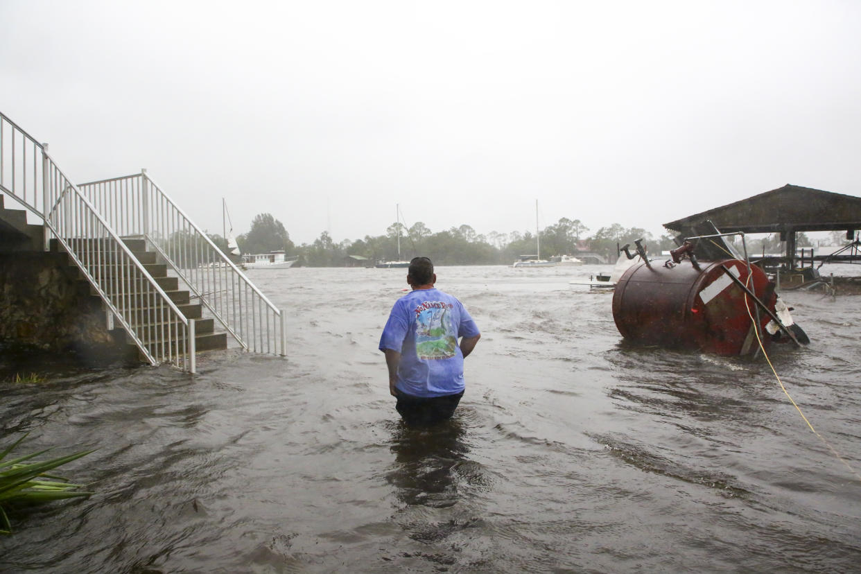
With the Atlantic Ocean heating to levels normally seen in August, federal meteorologists on Thursday issued their most aggressive preseason hurricane forecast in history.
Storm experts at the National Oceanic and Atmospheric Administration are calling for an “above average” 2024 Atlantic hurricane season with up to 25 named storms, of which as many as 13 could spin into hurricanes and up to seven could muscle to major hurricane status with a Category 3 strength or higher.
It’s not just the warmer-than-usual Atlantic temperatures that forecasters are watching. They also cite an emerging La Niña weather pattern, known to be more friendly to hurricane formation than its counterpart, El Niño, as a main reason this year’s storm season could be busy.
Forecasters predict an 85% probability of an above-average season — the most confidence the agency has had in a storm outlook.
“The key this year, as in any year, is to get prepared and stay prepared,” said Rick Spinrad, the head of the agency. He noted the start of what could be an “extraordinary” season is June 1, just days away.
The federal forecast comes on the heels of some of the most ambitious hurricane season outlooks ever produced by renowned climate schools. Last month, Colorado State University issued an early outlook that calls for 11 hurricanes — the most that university has ever predicted.
A few weeks later, the University of Pennsylvania revealed an aggressive forecast of their own: Experts there anticipate a record 33 named storms. Those predictions also pointed to warming Atlantic temperatures and an emerging La Niña weather pattern.
“The ocean is already in the heart of hurricane season. It’s three months ahead of pace,” said Brian McNoldy, a senior research associate at the University of Miami. “I’m hoping things go back to normal soon, but I’m not going to hold my breath.”
Waters stretching between the Caribbean and the coast of Africa are at record-hot levels, with more than 90% of the region’s sea surface at record or near-record heat, according to Michael Lowry, a hurricane specialist at WPLG-TV. Human-driven climate change and the quickly developing shift to a La Niña are two of the likely several factors for why Atlantic waters are hotter now than at any point on record this early in the season, according to Lowry.
The aggressive forecast didn’t surprise Jeff Masters, a hurricane scientist formerly with the National Oceanic and Atmospheric Administration. Given the record ocean heat and the dissipating El Niño, this season already has all the ingredients for tumultuous weather.
“It’s probably going to be a crazy-active season,” Masters said. Winds will likely help nudge hurricanes to form, and it’s looking like there won’t be as many shearing winds that can tear storms apart, he said.
Rapid intensification, which occurs when a storm’s top wind speeds rise by 35 mph in a single day, is tied closely to ocean temperatures, experts said. Ken Graham, director of the National Weather Service, said the strongest storms over the last century have all been fueled by rapid intensification.
“I worry about that every season,” Graham said.
Colorado State University in early April identified five similar Atlantic hurricane seasons from over the centuries that resemble the start of this year’s season: 1878, 1926, 1998, 2010 and 2020. Records are spotty from the late 19th century going into the early 20th century, but experts at the university said those were all active seasons.
In 2010, most of the United States was largely spared, but it was a relatively busy season. The world saw the most active hurricane season to date in 2020, with 30 named storms, of which 14 became hurricanes, including seven major hurricanes. A record 12 named storms made landfall across the United States that year.
If it does end up being an active season, that doesn’t guarantee that a hurricane will hit where you live — but it does increase the odds, McNoldy said.
For instance: Forecasters at Colorado State University predicted a greater than 50% probability that a named storm will stray within 50 miles of Hillsborough and Pinellas counties this season. The probability for winds or rains brought by a hurricane hover above 25% locally, and there’s an 11% probability for a major hurricane to hit the Tampa Bay area, according to the university.
This week, St. Petersburg Mayor Ken Welch and 12 other Pinellas mayors penned a letter to Washington asking for more storm-hardening funds. The coastal mayors wrote that grants provided by the Federal Emergency Management Agency are “woefully underfunded” and urged the agency to prioritize its resilience programs for local governments.
“We are not seeking a handout but rather a partnership in protecting our communities,” the letter states.
Forecasters are already watching a patch of disturbed weather.
Just two hours before NOAA issued its season outlook, the National Hurricane Center said it was tracking a “large area of cloudiness and showers” east of Cuba. There is just a 10% chance it forms into a tropical system over the next week, forecasters said.
“You hear the same thing every year: ‘It only takes one storm.’ But it’s true,” Masters said. “You should make the same preparations assuming you’re going to get a worst-case storm. Review your evacuation plan, get flood insurance if you can afford it, flood-proof your home.”

