Quebec isn't tracking the state of its flood protection structures. Experts see risks growing
Five years after the major flood in Sainte-Marthe-sur-le-Lac, the Quebec government still doesn't track flood protection structures regularly, experts warn.
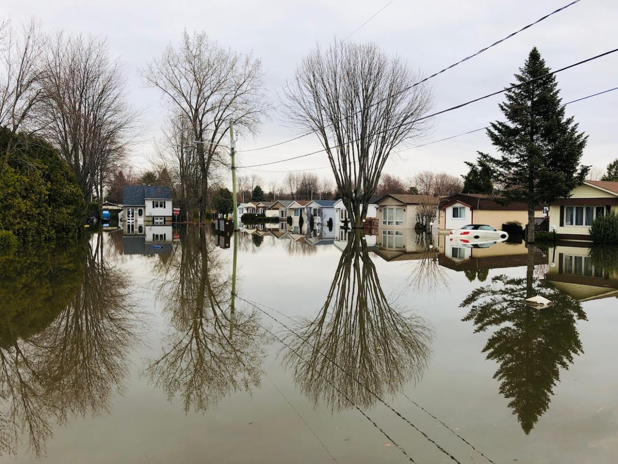
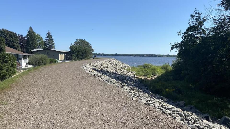
After a natural dike broke in 2019, the Lake of Two Mountains overflowed, forcing the evacuation of more than 6,000 residents in the town about 30 kilometres northwest of Montreal. About 2,500 homes were flooded.
That and the 2017 spring floods prompted the government to task a committee of experts with developing recommendations to manage at-risk areas.
"The rupture of a protective dike in Sainte-Marthe-sur-le-Lac, Que., in the spring of 2019 highlighted the fact that flood protection structures are not monitored or maintained regularly," the committee's report reads.
But so far, Quebec doesn't have an inventory detailing the location and fragility of flood protection structures. And experts say climate change is making the situation all the more worrisome.
"Over the next few years, we will obviously face increasingly severe phenomena, which will generate what we call flash floods," rapid flooding after major precipitation, said Philippe Gachon, a professor of hydroclimatology at the Université du Québec à Montreal (UQAM).
A new map and persistent uncertainties
Under the Environment Quality Act, Quebec plans to set up a public registry for flood protection structures once rules on governance and responsibility for them are established.
Information in the registry would come from municipalities with flood protection structures on their territory, the Environment Ministry said in an email to Radio-Canada.
Since the 2017 flooding, the province has been in a period of transition, says Prof. Pascale Biron, a specialist in fluvial geomorphology at Concordia University.
"There are many initiatives and a lot of government funds that have been put into thoroughly revising how flood zones are mapped," she said.
The Sainte-Marthe-sur-le-Lac dike burst in 2019, causing a major flood. (Philippe-Antoine Saulnier/Radio-Canada)
Quebec is also preparing to publish new maps of areas at risk of flooding, which will take into account flood protection structures, dams, the impact of climate change on waterways and potential hazards, the ministry confirmed.
High-risk areas are currently given a 0- to 20-year flood zone rating. That means each year, homes in those area have a one-in-20 chance of being flooded. But the classification system is poorly understood, said Biron, who advised the government in its work on flood-prone areas.
The new maps would use categories such as high, medium or low risk.
At the moment, little information is known about the future classification of flood risk areas. But experts are calling for territories located behind the dikes to be added to the regions at risk.
In the case of Sainte-Marthe-sur-le-Lac, there was a belief that dikes served as protection, which meant the area wasn't considered a risk zone, Biron said.
"There is a false sense of security, often, that comes with dikes, which makes us think that they will always protect us," Biron said.
Pascale Biron is a professor in the department of geography, planning and environment at Concordia University. (Submitted by Lisa Graves)
The professor champions hydraulic transparency — an approach adopted by France and the Netherlands. It entails identifying potential flood zones with the assumption there are no dikes.
At-risk areas would be included in maps so residents can plan the layout of their house accordingly.
Sainte-Marthe-sur-le-Lac Mayor François Robillard said he expects the municipality to be labelled an at-risk area but not necessarily a flood zone since the criteria for those zones have not been announced.
In Gachon's view, the proposed new maps will be helpful, but they don't paint the full picture.
He says he's disappointed that, so far, the maps will focus on the overflow of waterways and won't consider meteorological phenomena — like major precipitation and ice buildup — which can increase water levels in certain areas.
"We must provide the necessary resources to develop this knowledge, develop the tools, because it is essentially the academic network that develops this knowledge," he said.

