Prolonged Northeast dry stretch to come to an end later this week
The northeastern United States is in the midst of a rare dry spell, though it is expected to come to a soaking end later this week.
"The last time the New York City area had a similar dry stretch was from September to October 2017, when they had 15 consecutive rain-free days," said AccuWeather Meteorologist Brian Thompson.
Since then, even shorter dry spells have been rare - the only six-day stretches occurred in November 2017 and August 2018. Interestingly, that same August, New York City ended up with nearly 200 percent of its normal rainfall for the month anyway.
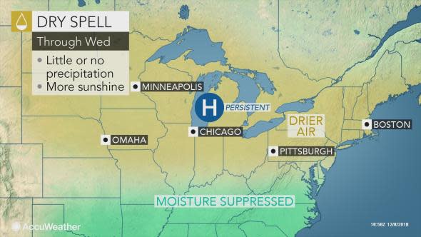
Even as a powerful winter storm moves out of the Southeast this week, high pressure will remain in control of the Midwest and Northeast, maintaining clear, calm weather conditions.
High temperatures will struggle to reach normal levels, instead topping out 5-10 F below average each afternoon.
By the end of the week, another storm gathering strength in the South with set its sights on the northeastern U.S.
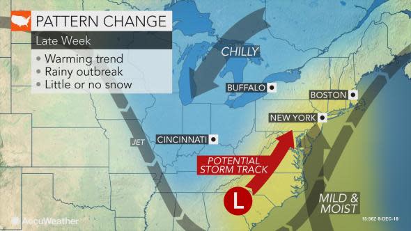
According to Thompson, this system is not expected to bring widespread wintry weather.
"With the cold air moving out toward the end of the week, the next storm moving into the East will bring primarily rain," he said.
"There is the potential for a few inches of rain along portions of the Eastern Seaboard from Friday into Friday night, which can lead to flooding."
Overnight temperatures this week will continue to freeze and harden the ground, increasing the threat of high runoff when the first rounds of rain move into the region.
Street flooding and the associated threats, such as hydroplaning, washouts and road closures, will therefore be more likely. Anyone planning travel through the region can expect delays.
