Drenching rains will disrupt the week for many on the Prairies
This weekend was the calm before the storm for a wide swath of the Prairies as one soaker of a system pushes into the region to start the week.
Several days of heavy rainfall and gusty winds will blanket the southern Prairies as a stubborn and strong low-pressure system meanders near the international border.
Persistent rain and gusty winds could lead to issues throughout the region, including a risk for localized flooding, isolated power outages, and slow travel at the very least.
YOUR MAY OUTLOOK: Spring into summer or a stalling spring ahead, Canada?
Monday sees the start of formidable storm
An upper-level disturbance will spin up a low-pressure system over Montana to start the week.

This storm will strengthen as it approaches the southern Prairies. Forecasters expect the storm to meander over Montana, North Dakota, and Saskatchewan through early Wednesday.
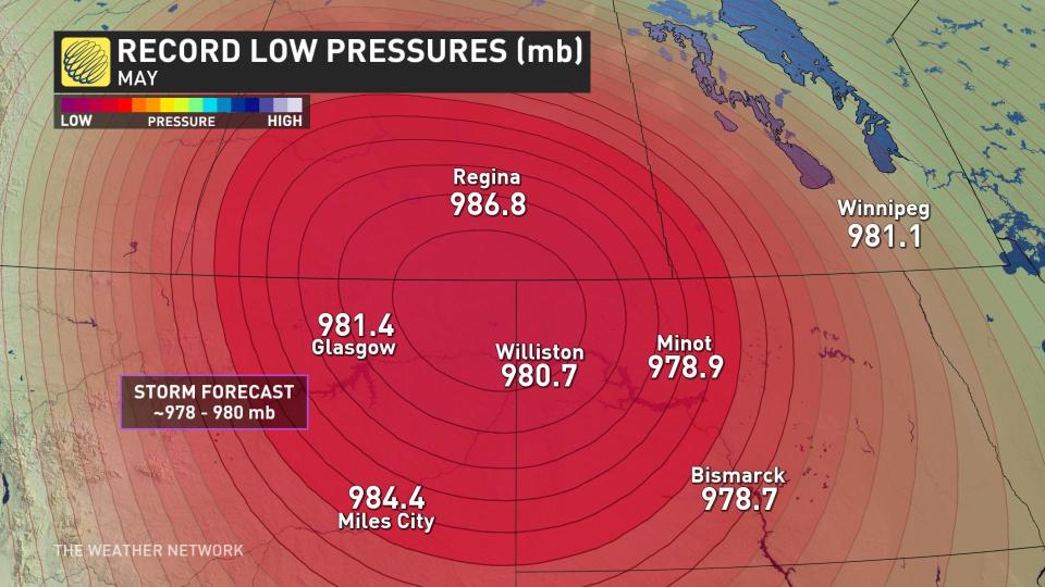
It’s going to be a formidable low-pressure system for this time of year. Its minimum central pressure could easily drop below 980 millibars, which could set records for the lowest pressure ever recorded in this region during the month of May.
This storm’s strength and slow forward motion will combine to produce multiple days of heavy rain and gusty winds throughout the region.
Heaviest rain arrives Tuesday, lingers into Wednesday
We’ll see scattered rain push into southern portions of Alberta and Saskatchewan on Monday morning, with persistent rain covering the region by the evening hours.
Rain will start pushing into southern Manitoba through the overnight hours Monday into early Tuesday.
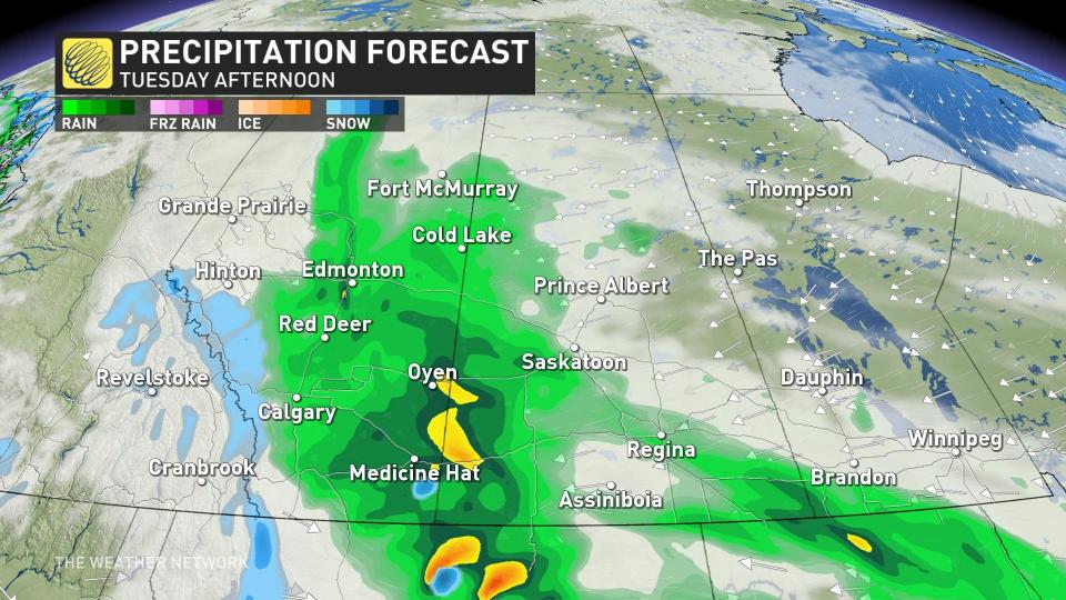
Widespread soaking rains will blanket the southern half of the Prairies through the day Tuesday, with the event’s heaviest rainfall rates affecting portions of eastern Alberta and western Saskatchewan.
Fortunately for farmers, the heaviest rain will fall over the western grasslands, likely avoiding a tough situation as we approach planting season east of Regina.
Persistent heavy rainfall could lead to flooding issues in vulnerable areas. Remember, never try to drive across a flooded roadway. It’s impossible to tell how deep the water is until it’s too late.
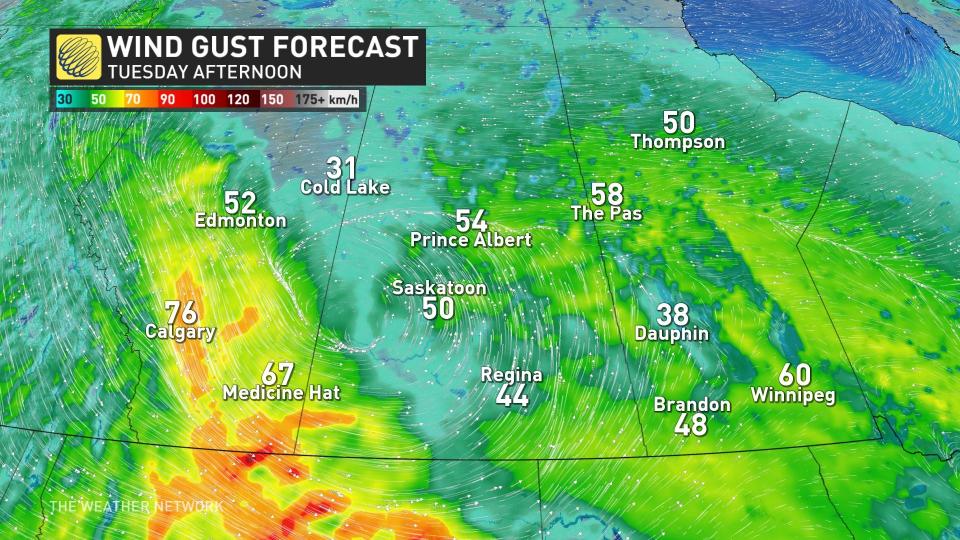
Wind gusts of 50-70 km/h could accompany the heavy rainfall at times. The combination of gusty winds and rain-soaked soil could lead to isolated power outages.
SEE ALSO: May is here, along with all its Canadian weather extremes
Rain will continue into Wednesday as the system finally wraps up its tour of the southern Prairies. Folks across southern Manitoba will see precipitation taper to scattered showers by Wednesday morning, with the rain finally easing for Alberta and Saskatchewan into Wednesday night.
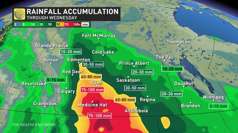
All told, widespread rainfall totals of 30-50 mm are in the forecast throughout the southern half of the Prairies. Locally higher totals of 50-75+ mm are possible in southeastern Alberta.
Stay with The Weather Network for your latest forecast across the Prairies.

