Plethora of wind, rain and snow targets Atlantic Canada with next storm
Spring is well underway, but there is no leaving winter behind for Atlantic Canada this week, unfortunately.
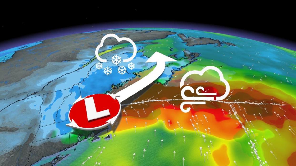
A coastal storm in the works will bring a widespread dose of wintry weather this week, though models are trending more towards greater amounts of rainfall than snowfall at this time. A potential "boom" scenario with snowfall totals is becoming less likely.
DON'T MISS: Everything you need to know for April's spectacular and rare solar eclipse
Special weather statements are in place across the Maritimes, but snowfall warnings may be required as the storm draws closer. Travellers can expect slippery and poor road conditions, so modifying plans to avoid the worst of the impacts is recommended.
As well, blustery winds may cause power outages, so ensure your devices are charged.
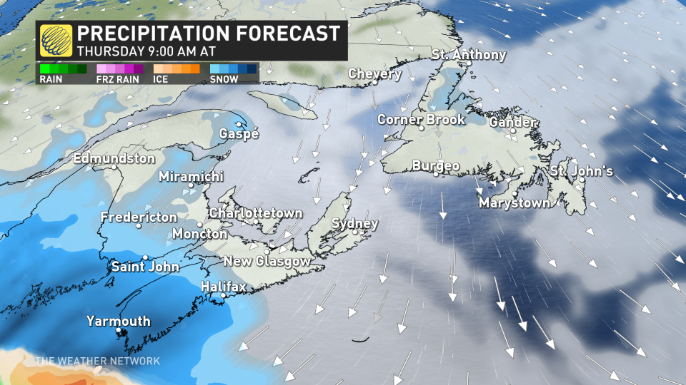
A developing low-pressure system is expected to move into southwestern Nova Scotia Thursday morning, dumping heavy, wet snow over the region before lifting north into the rest of the Maritimes Thursday afternoon and evening.
As well, Nova Scotia’s south coast will see a period of period of rainfall push in late Thursday.
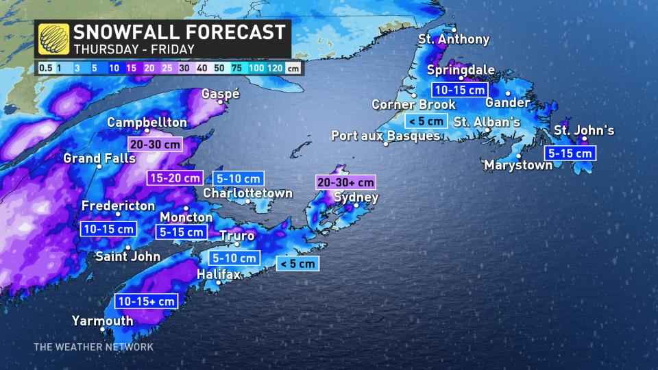
This system will start off strong on Thursday with heavy snowfall and increasingly blustery winds. Gusts could reach 70-80+ km/h throughout southwestern Nova Scotia before easing on Friday.
Folks living in areas of higher elevation can expect to see the most snow from this, as well as folks in northern New Brunswick.
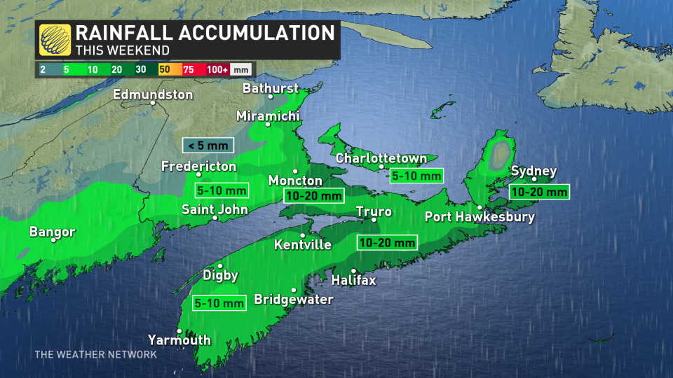
As the winds ease on Friday, a shifting storm track has the potential to let in some milder air and push some rain to Nova Scotia's south coast.
Snow falling overnight Thursday in the Maritimes will begin transitioning to rain on Friday, spreading throughout Nova Scotia, Prince Edward Island, and southern New Brunswick.
Total snowfall accumulations are still very uncertain at this time, however, due to the shifting storm track and milder air pushing in on Friday. The majority of models are remaining fairly conservative in their snow outlooks due to more periods of rain, so the chances of a "boom" scenario -- where snow totals exceed expectations -- are decreasing.
Folks can anticipate wintry travel conditions with this system on Thursday. Gusty winds and heavy snow will reduce visibility when driving, as well as make for some slick roads.
Due to the heavy nature of wet snow, localized power outages are possible as the weight of the snow and high winds puts pressure on power lines.
Conditions will remain chilly and unsettled behind this system as we head into the first weekend of April, with much warmer temperatures likely by the second weekend of the month.
Forecasters will continue to monitor conditions ahead of the total solar eclipse that’ll traverse the region on Monday, April 8.
Stay with The Weather Network for all the latest on conditions across Atlantic Canada.

