Planning to travel? Above-normal hurricane season expected
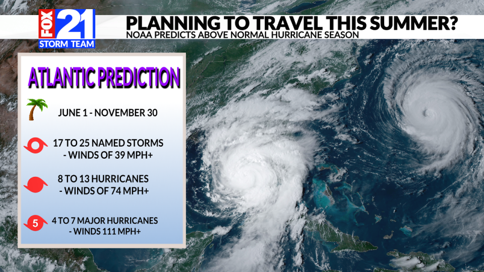
(NATIONAL) — The National Oceanic and Atmospheric Administration (NOAA) released its annual Atlantic hurricane forecast for the 2024 season. The hurricane season itself runs from June 1 to Nov. 30 every year. This time frame is typically the most active for tropical weather due to the warm ocean temperatures – among other factors.
In 2023, the Atlantic hurricane season ranked 4th for the most named storms in a year. The Atlantic Basin had a total of 20 named storms for the year. A storm sytem is given a name from the World Meteorological Organization after its wind speeds reach at least 39 mph. This is typically when clear organization is noted in the storms traversing through the ocean waters.
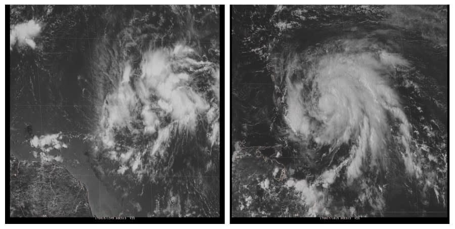
The image above, courtesy of NOAA, is an example of a tropical disturbance becoming more organized. Eventually this disturbance would turn into Hurricane Maria from 2017 (right).
This year, NOAA is predicting an above-normal year for hurricane activity in the Atlantic.
A reminder, the Atlantic Ocean covers roughly one-fifth of the Earth’s surface. It includes areas like the Gulf of Mexico and the Caribbean Sea. Keep this in mind if you’re traveling anywhere along the Gulf or the tropical islands. States like Florida, Alabama, Mississippi, Louisiana, and Texas are particularly vulnerable – especially along the coastlines.
NOAA is officially predicting 17 to 25 named storms, eight to 13 hurricanes, and four to seven major hurricanes for the year. The strength of each is determined by the maximum sustained wind speeds.
Tropical Storm: winds 39+ mph
Hurricane: winds 74+ mph
Major Hurricane: winds 111+ mph
Each hurricane also recieves a different strength rating based off of the Saffir-Simpson scale.
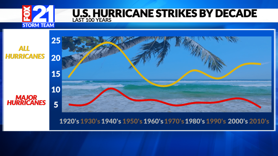
According to NOAA, on average, there are 14 named storms per year, seven hurricanes, and three major hurricanes. Historically speaking, we’ve seen a lot of ups and downs when it comes to the numbers. The last 100 years have varied widely between decades. One of the bigger peaks of hurricane activity occurred in the 1940s, with a bit of a downward trend occurring in the 60’s and 70’s.
This year is forecasted to be very active for a number of reasons. Here are just a couple of them:
We are seeing a strong transistion from El Nino to La Nina
Ocean temperatures are providing abundant heat and storm fuel
La Nina years typically have less wind shear in the upper atmosphere and this is key for keeping storms well organized. Wind shear is often to blame for storm systems falling apart. The excessive heat in the ocean is one of the most important ingredients for fueling hurricanes.
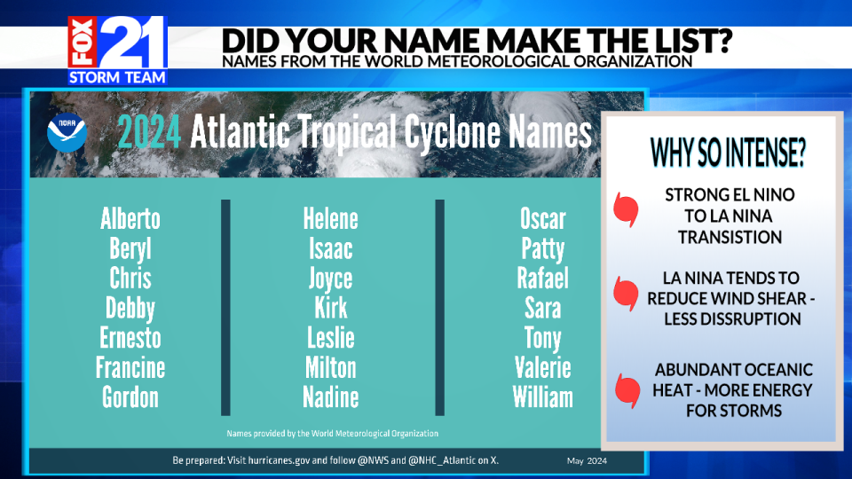
As far as names go, the World Meteorological Organization (WMO) provides the list each year. For 2024, some of the tropical cyclone names include Chris, Francine, Joyce, Kirk, Milton, Valerie, and many more. If you don’t see your name on the list, there’s a chance it will be included in a different season or it may have already been retired. The WMO cycles through the same list of names every six years. See if your name is on that list.
If a hurricane reaches a certain threshold for devistation, it is typically retired. Here is a list of retired hurricane names. The naming convention is completely independent of NOAA.
Another reminder, hurricanes typically have multiple impacts beyond just fast winds. Life-threatening flooding, storm surge, and even tornadoes can all be a part of these high impact storm systems.
Copyright 2024 Nexstar Media, Inc. All rights reserved. This material may not be published, broadcast, rewritten, or redistributed.
For the latest news, weather, sports, and streaming video, head to FOX21 News Colorado.

