Pinpoint Weather: Windy and cool before a warm up

Strong gusty wind is expected to continue through the night and into Monday. A High Wind Warning is in effect for Roanoke County and City and Floyd, Carroll, and Grayson Counties until noon Monday. Damaging 25-35 mph wind with gusts to 60 mph is expected to result in downed trees and power lines. The broader area along and west of the Blue Ridge is under a Wind Advisory for gusts up to 55 mph.

The higher elevations will be susceptible to the faster wind speeds while the foothills and valleys will still be blustery. The following forecast model shows the gust potential for Sunday through Monday afternoon.
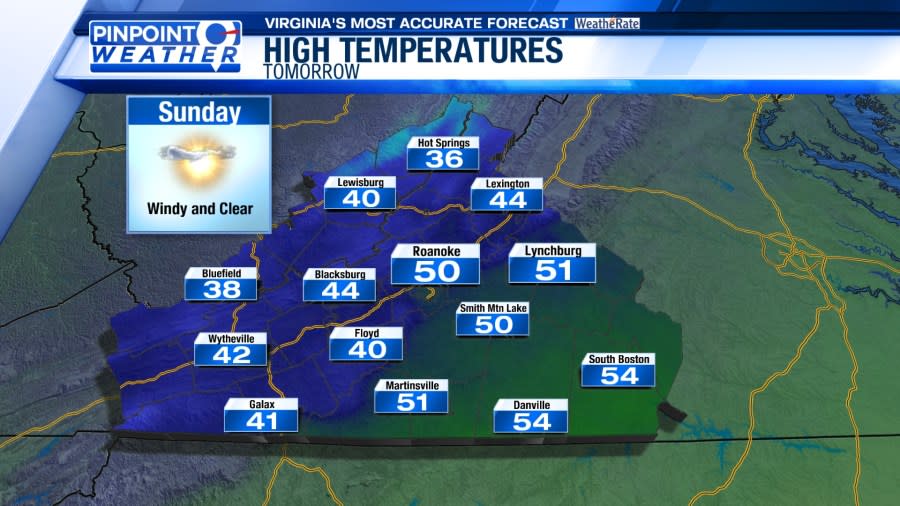
After morning low temperatures in the 30s, Sunday afternoon will be sunny for most areas with temperatures in the 40s to middle 50s.

While most areas will be sunny there is a chance of snow in the Highlands along and north of I-64. For tonight and Sunday, a Winter Weather Advisory is in effect for western Highland County and a Winter Storm Warning is in effect for western Pocahontas County, including Snowshoe.

There is a chance of snow showers and flurries Sunday morning across SWVA and the NRV.
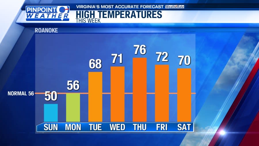
Once we get past the chilly and blustery weather of Sunday and Monday, the rest of the week will be unusually warm.

Breaking news, weather, and sports on your smartphone with the WFXR News app
For the latest news, weather, sports, and streaming video, head to WFXRtv.

