Pinpoint Weather: More storms to come
(WFXR) – The first round of storms will exit the region late Sunday night. A second round will enter from the west during the overnight hours. Heavy rain and gusty winds are possible with this line which will likely move in starting around 3 a.m. A third round of storms is possible Monday afternoon into the evening as a cold front enters the region.
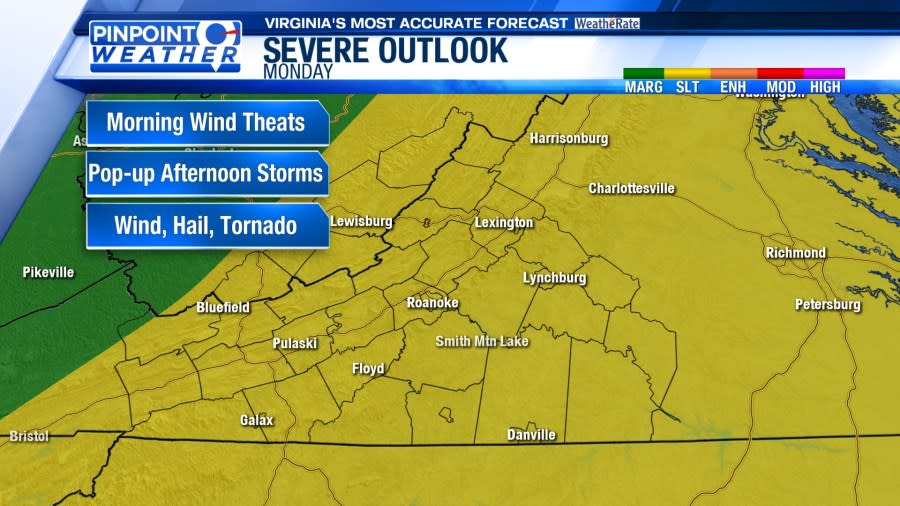
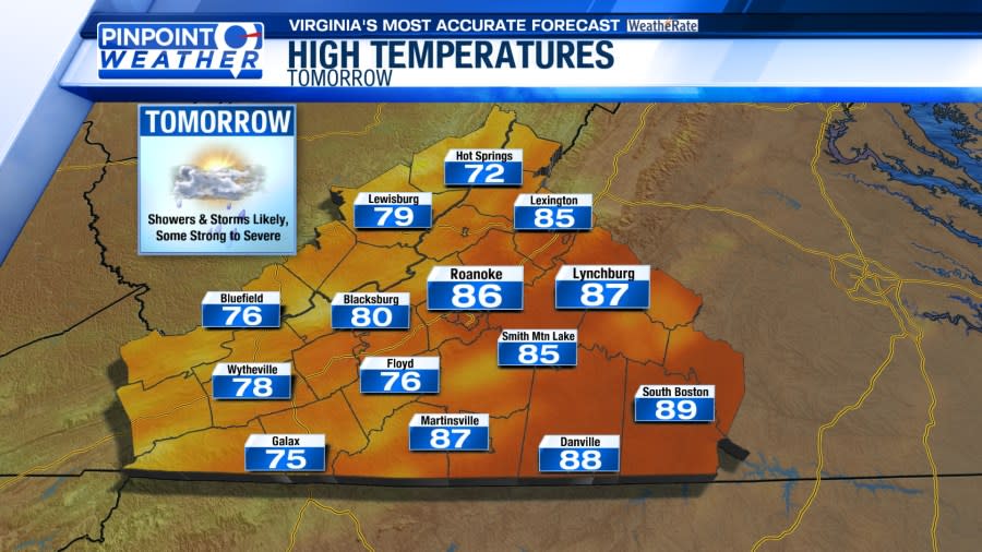
Storms during the day on Monday could be severe. There is a slight, or level two, risk of severe weather. Hail, wind and an isolated tornado are possible as a cold front slides through the region.

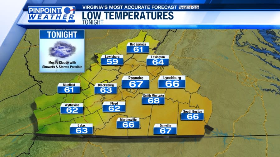
Temperatures will remain warm on Monday with humidity also remaining. Temperatures for many will top out in the 80s after starting in the 60s.

Behind the front, temperatures begin to drop starting on Wednesday. Rain chances are very low beyond Monday. A slight warmup is expected for the weekend.


Copyright 2024 Nexstar Media, Inc. All rights reserved. This material may not be published, broadcast, rewritten, or redistributed.
For the latest news, weather, sports, and streaming video, head to WFXRtv.

